Taking a break for 1 week because of ramadhan and installing gentoo as my main system.
I have a large set of photographs I made while running. They are geotagged, as I took them with my phone camera. The compass direction is completely unreliable, but lat/lon is more trustworthy.
A few quick notes on some changes I made to OSM based on local knowledge.
Changed the point for the Riverside Centre building to reflect that it is now a Builder’s Corner hardware store.
Added a point for the nearby Hole in the Wall Centre
Defined an area for the Somerset Lofts apartment complex and added some details for it.
Ive recently begun contributing street-level imagery on Mapillary and Panoramax in my local area. I figured that my dash cam was already recording anyway, so if it could be of use to anyone, why not share it?
I spent some time today improving the map data in my local area using the iD editor. As a local, I noticed that several roads were untracted
added roads but i got confused while selecting presets- then i realised the more i do mapping, the better i will get with using presets. Each preset serves a unique purpose.
Few weeks ago i spent time mapping my school in my city, i was soo fun- just wish they could use more updated satelite image.
There has been a very interesting question on the OSM US Slack lately.
Changeset: 178729012
Today I contributed to OpenStreetMap by improving map completeness in my local area in Bengaluru, Karnataka.
🔹 What I Worked On
Added a missing café using local knowledge Verified placement to ensure it was mapped at the correct entrance location Added appropriate tags including: amenity=cafe name= ##Bean Stop Café
Checked for duplicate entries before uploading
🔹 Mapping Approach
I focused only on verified, ground-truth information and avoided copying from copyrighted sources. All additions were based on direct familiarity with the area.
🔹 Quality Checks
Ensured the point was not placed on the roadway Confirmed correct spelling and capitalization Reviewed surrounding features for consistency
🔹 Objective
The goal was to improve local POI completeness and contribute accurate, structured data to OpenStreetMap. This is part of my effort to make consistent, quality-focused contributions rather than large, unverified edits.
Changeset: 176210161
In this changeset (176210161), I focused on improving building-level mapping by adding missing building outlines and refining structural details using Bing Maps aerial imagery.
The objective of this session was to enhance spatial accuracy and improve map completeness in the area. I ensured that:
- Building footprints were aligned correctly with satellite imagery
- Proper geometry was maintained
- No duplicate structures were created
- Tagging remained consistent with OSM standards
Working on building details helped strengthen my understanding of:
- Accurate polygon tracing
- Satellite imagery interpretation
- Clean data structuring
- Version control within OSM changesets
Changeset number is 178690672
Today, I worked on improving map data around Yelahanka Taluku, Karnataka. I updated the official name of Sai Vidya Institute of Technology to reflect accurate real-world information and ensured proper tagging consistency.
In addition to correcting the name, I reviewed campus boundary structure, building tagging, and surrounding infrastructure to avoid duplication and maintain data integrity. I verified that the edits align with real-world sources and OSM tagging standards.
My focus during this session was on:
- Accurate name correction
- Structured campus boundary validation
- Road connectivity refinement
- POI accuracy improvement
- Avoiding duplicate objects
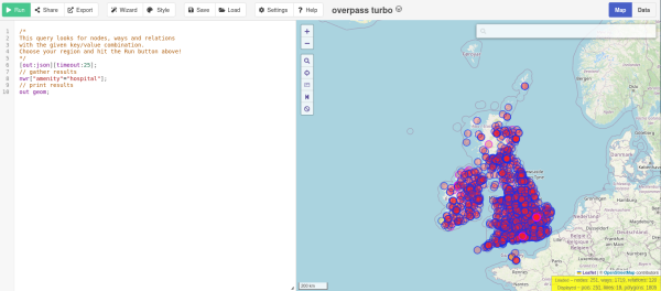
Many people have noticed that publicly available Overpass servers have been suffering from overuse (a typical tragedy of the commons). OSM usage policies generally contain the line OpenStreetMap (OSM) data is free for everyone to use.
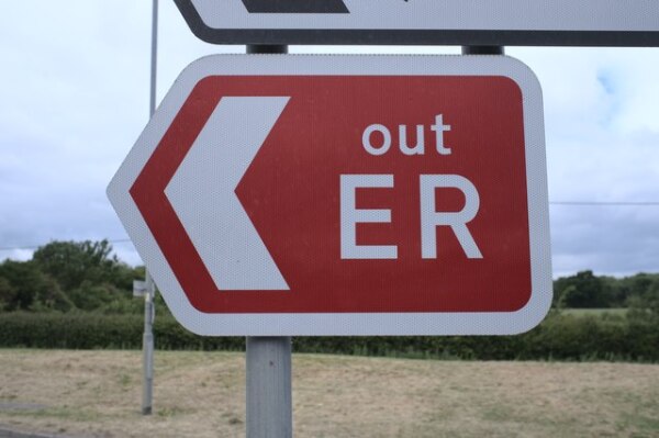
Hello! This is my first Diary Entry and I wanted to dedicate it to the Forum Post that I made about the UKs Only (I Believe) ER OUT routes in the case of any emergencies: mainly flooding in this case.
Safe Routes to School is a program designed to help parents encourage their
children to walk and bike to school safely, while promoting healthy engagement.
In some locations, walking or biking to school is a childs only means of getting to school.
children to walk and bike to school safely, while promoting healthy engagement.
In some locations, walking or biking to school is a childs only means of getting to school.
About 99% of supplements have garbage in them like seed oils, starch, citric acid or other fillers because most people are too ignorant to read the ingredients labels, let alone realize that ultra-processed pseudo-food is harmful for them in the first place.
I wonder if there is some tag for a nutrition supplements store to state that they offer clean supplements with just one ingredient, just like vegetarian tags, except focused on health rather than ethics.
Maybe diet:raw=* could somewhat apply?
I wonder if there is some tag for a nutrition supplements store to state that they offer clean supplements with just one ingredient, just like vegetarian tags, except focused on health rather than ethics.
Maybe diet:raw=* could somewhat apply?

Tagging fillers in supplements?
About 99% of supplements have garbage in them like seed oils, starch, citric acid or other fillers because most people are too ignorant to read the ingredients labels, let alone realize that ultra-processed pseudo-food is harmful for them in the firs…OpenStreetMap
For a while, I was interested in understanding what makes one pedestrian OSM way better than another. I wanted to know if there is some generic way to identify good walking routes from OSM data. I looked at Garmin and Strava heatmaps at first.
I mainly edit OSM based on GPX files from my runs. I use JOSM. I created a simple script to extract a buffered area around my GPX files to make sure I dont accidentally edit parts of OSM I dont intend to. See this Github Gist for the source.
Hello! Im Quincy Morgan. Thank you for considering my candidacy for the board of directors of OpenStreetMap US.
I started mapping in 2021 as I tried to ride every street in Brooklyn, NY on wandrer.earth. I kept finding private streets and other issues on OSM and began fixing them.
The seriousness with which the OpenStreetMap community approaches discussions is a true strength of the project. Over years of debate, the community has formed a highly cohesive tagging system for names.
https://en.wikipedia.org/wiki/Akkadian_Empire
https://en.wikipedia.org/wiki/Ebla#/media/File:Ancient_Near_East_2400BC.svg
https://en.wikipedia.org/wiki/Bell_Beaker_culture
https://en.wikipedia.org/wiki/Ebla
https://en.wikipedia.org/wiki/Ebla#/media/File:Ancient_Near_East_2400BC.svg
https://en.wikipedia.org/wiki/Bell_Beaker_culture
https://en.wikipedia.org/wiki/Ebla

Quick notes for self
https://en.wikipedia.org/wiki/Akkadian_Empire https://en.wikipedia.org/wiki/Ebla#/media/File:Ancient_Near_East_2400BC.svg https://en.wikipedia.org/wiki/Bell_Beaker_culture https://en.wikipedia.org/wiki/EblaOpenStreetMap
Today, I continued my journey as an OpenStreetMap contributor by actively participating in humanitarian mapping through the HOT Tasking Manager. During this session, I focused on mapping basic features such as buildings and road segments using satellite imagery.
This experience helped me better understand the importance of accurate data in supporting humanitarian efforts, including disaster response and community planning. I paid close attention to data quality, proper tagging, and alignment with OpenStreetMap mapping guidelines.
Through this contribution, I strengthened my familiarity with the OSM editing tools and improved my confidence as a mapper. I also gained valuable insight into how collaborative mapping enables volunteers from around the world to support vulnerable communities with reliable geospatial data.
I look forward to continuing my contributions, improving my skills, and participating in more humanitarian mapping projects in the future.
Jovita Fuentes Javellana, age 82, of Acworth, GA, passed away on Thursday, February 7, 2019. She was born on June 24, 1936 in Iloilo, Barotac Nuevo in the Philippines to Angelina Agudo and Nicolas Fuentes. We call her by her name, Betty.
im sooo new plssss what can i benefit from this, i needddd this to help me for the future and stuff idk
Model buildings along the grid, after each grid add accessible parking and crosswalks, levels, addresses, alltheplaces, and wikimaps, then adjust roads and add streetside and zoning. I will later add lanes
add street lamps, check sidewalks, and add street signs and fences
add businesses ect.
survey area to find missing details
add neighborhoods to Evansville, each added once that neighborhood is complete
add neighborhoods to Newburgh, likely no borders only points
add street lamps, check sidewalks, and add street signs and fences
add businesses ect.
survey area to find missing details
add neighborhoods to Evansville, each added once that neighborhood is complete
add neighborhoods to Newburgh, likely no borders only points
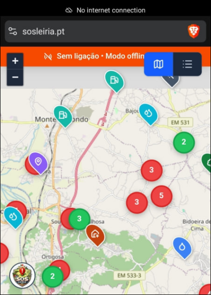
In disasters and other connectivity outages, people on the ground often see road blockages, landslides, bridge damage, or other map-relevant changes before reliable Internet access is restored.
Occasionally, I simply scroll through the map on openstreetsmap.org.
A year ago, I became aware of the area around Sa Pobla, a Spanish town on the Balearic island of Mallorca.
A year ago, I became aware of the area around Sa Pobla, a Spanish town on the Balearic island of Mallorca.
Not everything in the woods needs a map, and not everything needs to be publicly accessible online. Enter the woods, make your own maps, and share them with the friends that are willing to conserve and enjoy the land as they should.
Starting in 2026, I slightly adjusted my daily routine, particularly around my weeklyOSM-related activity. Instead of passively consuming updates, I began actively scanning for news by lurking in several regional OSM online groups.
At SOTM EU I gave a demo of how to use the OSMF vector tiles with custom tiles for detailed information on a feature. In the demo I showed walls, focusing on the material of the walls.
I fell down the rabit hole, learning about OSM, in order to port the map into a video game called Farm Simulator. They suggested I just rip it, and add what I want unsaved before I port, then realized I might as well just contribute to this neat open source database! I actually find it quite satisfying, and hope I’m helping. I’m not sure how long I’ll stick around, but I’m already at the max contribution…
The weather’s not been great around here, so I’m keeping myself busy (and out of harms way) by updating OpenStreetMap – there are lots of missing buildings here and there, and a few missing pathways and trails.
I’ve been focusing on the Ely, Caeru, and St Fagans areas in Cardiff as I’ve a particular interest in their history (see my previous posts). My aim is to add more detail to the woodland areas, especially the locations of hidden historical sites and secluded trails.
There are lots of buildings throughout that also need re-aligning, with the last edit for many being sixteen years prior! I’ll continue to chip away until everything’s up to date – given the horrid weather, I shouldn’t run short on time!

Around the Houses!
The weathers not been great around here, so Im keeping myself busy (and out of harms way) by updating OpenStreetMap there are lots of missing buildings here and there, and a few missing pathways and trails.OpenStreetMap
I’ve been editing and modifying things on OpenStreetMap for about a year now, which is just insane to me!
I had never thought I’d make it to this point. At first, I was trying to modify a village and make it look a little better, but now, I can modify a lot of places.
If I showed my account to myself a year ago, he wouldn’t believe me.
Of course, this is still not my job. I’m still incredibly busy with life, which might make it harder for me to modify things on this platform, but I still enjoy my time here!
Thank you, guys, for reading this! I really appreciate your time here!
Peace.
- Emerucha

I've been on OpenStreetMap for about a year now!
Ive been editing and modifying things on OpenStreetMap for about a year now, which is just insane to me!OpenStreetMap
Things you only find in OSM no 94...
e.g. A place called “FooBar” should show up when you search for “Foo Bar”, or “Foo & Bar’s” should appear for “Foo and Bars”.
Note the space, ampersand, and apostrophe which may affect a search engine but are not pronounced in spoken English.
Is there a tag that the search engines pick up where I can put those variations? I notice that CoMap’s search engine is pretty good, but the search on openstreetmap.org is a little more strict.

Can I add extra keywords to improve search results?
e.g. A place called FooBar should show up when you search for Foo Bar, or Foo & Bars should appear for Foo and Bars.OpenStreetMap
Exactly a year ago I summed up the results in diary of my work on the script, its time to do it again.

![Neighborhood Update: [Wadsa, Desaiganj]](https://soc.citizen4.eu/photo/preview/600/4393988)
![[slice-of-life] [en] Blg. 2: Remembering my Lola Betty](https://soc.citizen4.eu/photo/preview/600/4331636)
