I had the privilege of presenting about weeklyOSM at COSCUP 2025, Taiwans largest open source conference, held on August 9–10, 2025, at the National Taiwan University of Science and Technology (NTUST) in Taipei.
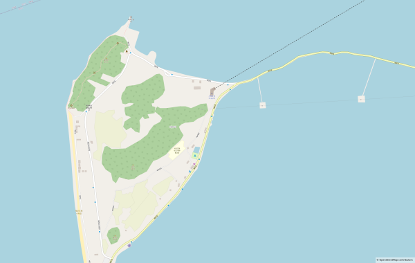
I think people use these diaries for slightly more meaningful posts, but I just want to keep saving my progress somewhere. It took me 5 days to maping this island. I could have done it faster, but I wasnt in a rush.
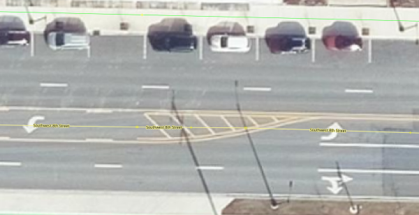
Ive mapped in OSM for many years now, but more of my work and been Bike-Pedestrian related, and Ive only just come back around to mapping streets their widths and their number of lanes as a means to start evaluating crossings in our area.
Five years ago, I started mapping on OpenStreetMap, and I have to say that I have never had problems with my Italian community, especially because opinions are expressed in a detailed and cordial manner, even when they differ.
Since I discovered that there were recommended guidelines in the wiki for managing bounding boxes, I have tried to remind all users—whether beginners or experienced—about them, to make it easier for us locals to verify edits.
Unfortunately, I have encountered non-Italian users who have expressed their disapproval through teasing, humiliation, and everything associated with bullying.
This contrast between the Italian community (where people reason seriously) and the noisy part of the international community (where responses come in the form of provocations) has struck me deeply, leaving me sad and hurt.
At this point, I asked myself whether it really makes sense to continue improving the mapping of the territory where I live if I am surrounded by users who do not respect me…
The answer is yes, because OpenStreetMap is an open system, in need of data and people who try to do their best, also helping “younger” users. The more of us maintain a healthy environment, the healthier the community becomes, and the fewer those who ruin it will be.
Regarding the insults and teasing I have received, I have already taken all possible actions. The most effective measure has been to block, wherever possible, on all known social platforms the people who publicly and privately mocked me.
As a passenger in a moving car, I like to do OSM field mapping, constantly scanning the view outside and noting every detail I can spot. The catch is, I need to do it fast. Too fast to worry about proper tagging or structured data entry.
Eastern Road Travels
I’ve been continuing an anti clock-wise journey around Grenada.
Other Projects
Yeah there have been a month or two when work here stops. Often its just other projects but sometimes it’s a but like my day job.
Progress
I think this period started with Egmont, where I have family, through Calivigny, Fort Jeudy then all the Westerhalls. A lot of coastal details too at times. I did go inland but do not recall how far. Had fun doing the river along La Sagesse Beach Road and all the associated buildings. Loved doing Felix Park Rd. I met Dr G and spent an afternoon with him there. Very nice to meet a local botanist that I could learn from.
So now in August I’m nearing the end of Hope. From then on it’s all North and into 2026.
Good afternoon from sunny, hot, and muggy northeast Florida!
I noticed that on OpenStreetMap we were missing types of surfaces for many important roads in Kosovo.
Hey gang!
I went on a roughly 2-week hiatus because I was visiting my uncle down south. However, I am back and hopefully able to work on OSM more
The first thing I did when I came back was deal with some very old vandalism that was somehow undetected? So I managed to clear all that up and am now remapping it correctly
Anyways, thats enough from me! Goodbye!
NK-Mapper
As in my profile, yes Ive been addicted to https://blacket.org for a while. If anyone joins it and wants to reach out, my username is 76 ingame and my discord username is .i76. (76). Just editing the overnight camp I attend right now. Being bored.

Why I've been inactive as of late
As in my profile, yes Ive been addicted to https://blacket.org for a while. If anyone joins it and wants to reach out, my username is 76 ingame and my discord username is .i76. (76). Just editing the overnight camp I attend right now. Being bored.OpenStreetMap
Another year has passed since my last entry, and its about two years ago that I resided in Bonaire for half a year.
Humanitarian Openstreetmap Team (HOT) is an international team dedicated to humanitarian action and community development through open mapping.
The Geocoding Search is very well done and will be part of my own project’s functionality which I plan to use self host on my machine.
In collaboration with a local team in Grünstadt, Mannheimer Mapathons e.V. completed the mapping of the historic Jewish cemetery in early 2024 after five months of data collection.
I have continued mapping Happy Valley Goose Bay. I noticed that the ESRI world imagery isn’t particularly good. I could do with some more or better data, and I may have to do some drone flights to get it.
I have also started to reach out for data in the surrounding towns.
I have also started to reach out for data in the surrounding towns.

Mapping Happy Valley Goose Bay Another day, another street
I have continued mapping Happy Valley Goose Bay. I noticed that the ESRI world imagery isnt particularly good. I could do with some more or better data, and I may have to do some drone flights to get it.OpenStreetMap
Map update during Summer Holidays mostly using StreetComplete, Osmand, JOSM
Hello!
I’ve been mapping in OpenStreetMap for a few years now, and I believe the current method of mapping routes is quite painful and wastes hours of editors times to just upkeep it,
So, here is my idea on how we could fix it.
I’ve been mapping in OpenStreetMap for a few years now, and I believe the current method of mapping routes is quite painful and wastes hours of editors times to just upkeep it,
So, here is my idea on how we could fix it.
Dua hingga tiga abad sebelum kita mengenal provinsi yang bernamakan Riau, dahulu para pelaut mengetahui daerah ini sesuai dengan nama sungai besar yang ada.
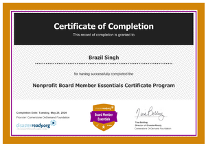
A Manifesto for the OpenStreetMap Foundation Board by Brazil Singh
My favorite places to go during the summer time
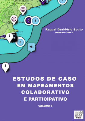
Release of the book "Case studies on collaborative and participatory mapping"
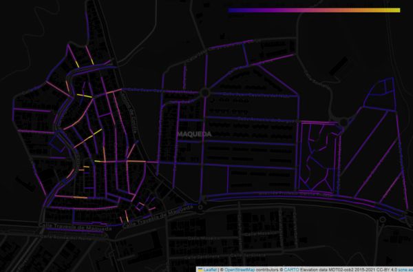
This image shows the Maqueda barrio in Malaga, with streets colour-coded by estimated gradient. The flat area to the east shows up with cold colours, while the western part of the barrio, which straddles a ridge, generally has warmer colours.
I started mapping on 7 of August using StreetComplete. I discovered (unfortunately) that I understood some criteria concerning road smoothness wrong, and I was no longer sure if my edits from the first day were correct, so I decided to delete most of them, to remap and do it properly. Furthermore, I apologize if anyone had any inconvenience of my poor first mapping steps.
I will stick to mapping and hope to improve in the future. :)
I will stick to mapping and hope to improve in the future. :)

Deleting own edits
I started mapping on 7 of August using StreetComplete. I discovered (unfortunately) that I understood some criteria concerning road smoothness wrong, and I was no longer sure if my edits from the first day were correct, so I decided to delete most of…OpenStreetMap
OSM Latest Changes (https://rene78.github.io/latest-changes/) just got a few updates to make exploring recent edits more insightful - and smoother!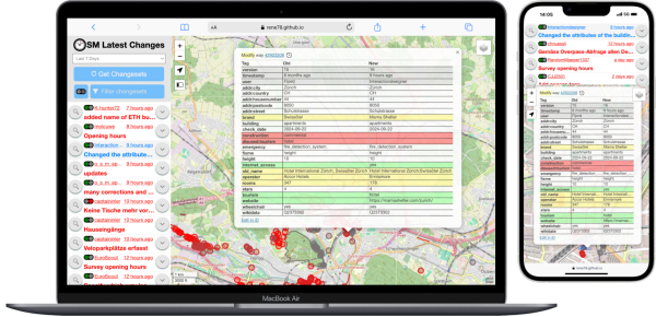

Minor Improvements to "OSM Latest Changes"
OSM Latest Changes (https://rene78.github.io/latest-changes/) just got a few updates to make exploring recent edits more insightful - and smoother!OpenStreetMap
Woah, I didnt realize how quickly this would be something Id like. I know my account has been around since 2022, but I seriously started mapping in mid-2025. ~10k Edits pretty quickly, and turns out I enjoy editing the map.
I like technology and adapting it for the sake of technology . I am not addicted to yet we can not escape it. I only carry my phone when necessary , a computer works so much better , a mix of the old and the new ,technology moves very quickly . I’d prefer a GPS to a 5G modem ,API are not as readily available now
Welcome to my diary, Where did I macro-mapped This will be available in English and not Italian cuz:
1. I need to speak better english
2.
1. I need to speak better english
2.
Youve been involved with OpenStreetMap for at least 15 years, the interviewers begin, marking the start of the session.
The Ndomba Sector (Collectivé de Ndomba) is the easternmost sector of the Kabeya-Kamuanga Territory. While the eastern and southern borders of the sector are as well the borders of the territory (which have already been mapped for years), the western…
Im excited to share the midterm progress on my Google Summer of Code 2025 project: Temporary Road Closures Database and API for OpenStreetMap.
Date: 28 March 2024
Title: Planning & Co-Creation Workshop on Mapping Road Network of Karnali
Venue: Care Nepal, Sanepa
Organizer: Open Mapping Hub Asia Pacific
Led By: Rabi Shrestha, Sr. Field Mapping Expert & Prajwal Sharma, Jr.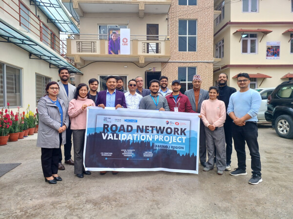
Title: Planning & Co-Creation Workshop on Mapping Road Network of Karnali
Venue: Care Nepal, Sanepa
Organizer: Open Mapping Hub Asia Pacific
Led By: Rabi Shrestha, Sr. Field Mapping Expert & Prajwal Sharma, Jr.

Co-Creation Workshop for Road Network Mapping in Karnali, Nepal
Date: 28 March 2024 Title: Planning & Co-Creation Workshop on Mapping Road Network of Karnali Venue: Care Nepal, Sanepa Organizer: Open Mapping Hub Asia Pacific Led By: Rabi Shrestha, Sr. Field Mapping Expert & Prajwal Sharma, Jr.OpenStreetMap
The Nominatim QA tool added a new layer Suspicious addr:state value
‘ve found myself drawn to a particular challenge: properly mapping the Rhondda Valleys in South Wales. It’s a task that’s proving both fascinating and frustrating in equal measure, but one that’s teaching me invaluable lessons about the complexities of local geography.
My approach has been quite straightforward - I’ve chosen to focus primarily on Ystrad, the area I know most intimately. This isn’t just because it’s familiar territory, but because understanding one place thoroughly seems like the best foundation for expanding outwards. Every quirk I discover, every mapping technique I develop, and every local peculiarity I uncover in Ystrad becomes a tool I can apply to neighbouring areas.
One of the most surprising aspects of this mapping project has been discovering just how much the “official” maps get wrong. I’ve taken to photographing street name signs and house numbers wherever I go - a habit that’s revealed some genuinely baffling discrepancies between reality and what appears on both Ordnance Survey maps and Google Maps.
The most striking example I’ve encountered is Bryn Terrace in Ystrad. This is a very real street, with real houses, real residents, and real post delivered daily. Yet somehow, it’s completely absent from both OS and Google mapping data. Walking down it, photographing the street sign, and checking my GPS coordinates left me questioning whether I was experiencing some sort of cartographic twilight zone. How does an entire street simply not exist in the digital world when it’s so clearly part of the physical one?
The house numbering systems throughout the Rhondda have provided another source of bewilderment. What might seem like straightforward sequential numbering often reveals itself to be anything but. Streets that appear to follow odd/even patterns suddenly throw in a completely out-of-sequence number, or entire ranges seem to have been skipped altogether.
These aren’t just historical quirks either - they’re active addresses that confuse delivery drivers and visitors alike. Mapping them accurately requires patient detective work, often involving conversations with locals who can explain the historical reasons behind these peculiarities. I recently found out about the note attribute, so I’m hoping to detail these nuances as I go along.
Each mapping session in teaches me something new about the challenges of accurately representing the real world in digital form. The lessons learned here - how to handle unusual address schemes, when to trust local knowledge over official sources, how to photograph evidence effectively - all prove invaluable when I venture into less familiar parts of the Rhondda.
What started as a simple desire to improve the map of my local area has evolved into a broader appreciation for the complexity of place. Every street name sign photographed, every GPS point recorded, and every correction made feels like a small victory in the ongoing battle to make OpenStreetMap truly representative of how people actually live and navigate their communities.
Our valley have decades of industrial and social history embedded in their geography, and much of that complexity isn’t captured in existing mapping data. Streets like Bryn Terrace might be missing entirely, whilst others are misnamed or incorrectly positioned.
By continuing this methodical approach, hopefully mastering Ystrad first, then expanding outwards with confidence - I’m hoping to contribute to a more accurate and useful map of this historically significant area of the world. After all, if we can’t get the basic building blocks right, how can we expect the map to serve the people who actually live here?
Onwards.

Mapping the Rhondda Valleys: A Local's Journey Through OpenStreetMap
ve found myself drawn to a particular challenge: properly mapping the Rhondda Valleys in South Wales. Its a task thats proving both fascinating and frustrating in equal measure, but one thats teaching me invaluable lessons about the complexities of l…OpenStreetMap
I wanted to share some analysis on a currently undefined part of the PWG Schema (Silver Tier specifically) that I originally posted on the OSM-US Slack.
OpenStreetMap is a map of the world, created by people like you and free to use under an open license.
