This blog post is part of a series of blog posts about the new OSM file format OMA. This is the seventh post. At the end of the article youll find links to the other blog entries.
This post is the result of a student project. The work was done by the following group of students: Alice Rey, Jihene Haj Hamouda, Yahia Heni, Mohammed El Mehdi Alaoui, Kaies Mhadhbi.
Simple 3D buildings
They are ofcourse not M4TR as you use the building=yes tag and you add colours, height and roof shapes.
But for more complicated buildings?
What if there is an apartment building with different colours? Am i allowed to use building:part=yes for each colour? Or is that M4TR?
Monuments
Monuments can be a little sad to just se as a square or even a node, so could i map them in 3D? That sure is M4TR, but we want to map how it is in reality. So therefore it should be allowed? Right?
How an algorithm from the 80s sets the new standard for modern spatial indices
Overpass turbo https://overpass-turbo.eu/?Q=%5Bout%3Ajson%5D%5Btimeout%3A25%5D%3B%0A%2F%2F%20Gather%20results%20within%20the%20current%20map%20view%0A%28%0A%20%20node%5B%7E%22%5Eaddr%3A.*%22%7E%22.

Address nodes
Overpass turbo https://overpass-turbo.eu/?Q=%5Bout%3Ajson%5D%5Btimeout%3A25%5D%3B%0A%2F%2F%20Gather%20results%20within%20the%20current%20map%20view%0A%28%0A%20%20node%5B%7E%22%5Eaddr%3A.*%22%7E%22.OpenStreetMap
At this point I’ve officially mapped out half of Bell Island, Newfoundland. Although I’m geographically halfway, the southern portion which I’ve mapped out is much less geospatially dense than the northern portion, so I’d estimate I’m about a third of the way through this project.
The ID Editor has been very intuitive so far in this process, and I have also learned a bit on how to use the JOSM editor for more specific geospatial processes. One thing I have yet to figure out is the display order of overlapping features, however I believe this is tweaked through the relations mechanic in the ID editor.
So far the minimal existing geospatial data that is present in this area has been accurate for the most part, with only slight alterations required to match the current satellite data that I’m basing my new features off of. That being said, quality varies, and it’s clear that some of these features were one-off additions by likely inexperienced users.
I think I’ll be able to keep up this mapping pace for the foreseeable future, so this project will hopefully get within the mopping up phase within a couple of months.

Mapping Bell Island #2: Midway Point
At this point Ive officially mapped out half of Bell Island, Newfoundland. Although Im geographically halfway, the southern portion which Ive mapped out is much less geospatially dense than the northern portion, so Id estimate Im about a third of the…OpenStreetMap
Belfast Maine - Little City by the Water
Hello! I have just started getting into OpenStreetMap in the last few days, I absolutely love the way it works, and love to map out different towns. I lived in the town of Belfast, Maine for many years and visit this town so it holds a special part to me.
I’ve been adding all the “Downtown” houses that aren’t mapped, they are just Address points, and different new Houses, roads ETC. I just found out last night that I can actually MERGE address points with areas for houses so it’ll speed the process up a lot for me.
I have mapped out multiple different areas in Kilmeaden, Portlaw and Kilmacthomas. Quite a bit of these areas were already mapped out so I modified and updated many roads and buildings.
I have mapped out different areas in Kilmeaden and Portlaw. Quite a bit of these areas were already mapped out so I modified and updated many roads and buildings.
This is inspired by laambda19s diary post on their mapping project, I want to document my work the same way with clear examples of before and after, adding more detail to the Bulawayo map.
Overpass turbo code
https://overpass-turbo.eu/?Q=%5Bout%3Ajson%5D%5Btimeout%3A25%5D%3B%0A%28%0A%20%20way%0A%20%20%20%20%5B%22tunnel%22%5D%0A%20%20%20%20%5B%22tunnel%22%7E%22%5Eyes%24%7C%5Eculvert%24%22%5D%0A%20%20%20%20%5B%21%22culvert%22%5D%0A%20%20…
https://overpass-turbo.eu/?Q=%5Bout%3Ajson%5D%5Btimeout%3A25%5D%3B%0A%28%0A%20%20way%0A%20%20%20%20%5B%22tunnel%22%5D%0A%20%20%20%20%5B%22tunnel%22%7E%22%5Eyes%24%7C%5Eculvert%24%22%5D%0A%20%20%20%20%5B%21%22culvert%22%5D%0A%20%20…

Tunnels without specification
Overpass turbo code https://overpass-turbo.eu/?Q=%5Bout%3Ajson%5D%5Btimeout%3A25%5D%3B%0A%28%0A%20%20way%0A%20%20%20%20%5B%22tunnel%22%5D%0A%20%20%20%20%5B%22tunnel%22%7E%22%5Eyes%24%7C%5Eculvert%24%22%5D%0A%20%20%20%20%5B%21%22culvert%22%5D%0A%20%20…OpenStreetMap
This is a overpass turbo script
https://overpass-turbo.eu/index.html?Q=%5Bout%3Ajson%5D%5Btimeout%3A25%5D%3B%0A%2F%2F%20fetch%20waterways%20excluding%20those%20tagged%20intermittent%3Dyes%0A%28%0A%20%20way%5B%22waterway%22%7E%22%5E%28stream%7Cditch%…
https://overpass-turbo.eu/index.html?Q=%5Bout%3Ajson%5D%5Btimeout%3A25%5D%3B%0A%2F%2F%20fetch%20waterways%20excluding%20those%20tagged%20intermittent%3Dyes%0A%28%0A%20%20way%5B%22waterway%22%7E%22%5E%28stream%7Cditch%…

Waterways without Intermittent
This is a overpass turbo script https://overpass-turbo.eu/index.html?Q=%5Bout%3Ajson%5D%5Btimeout%3A25%5D%3B%0A%2F%2F%20fetch%20waterways%20excluding%20those%20tagged%20intermittent%3Dyes%0A%28%0A%20%20way%5B%22waterway%22%7E%22%5E%28stream%7Cditch%…OpenStreetMap
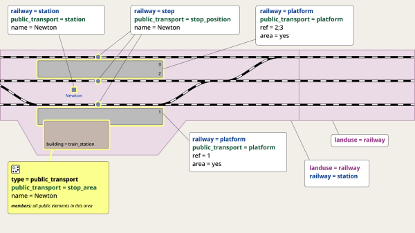
I’ve suggested an updated version of the diagrams explaining the tagging of railway stations. The goal is to make them simpler to understand, especially for newcomers, without losing the core meaning.
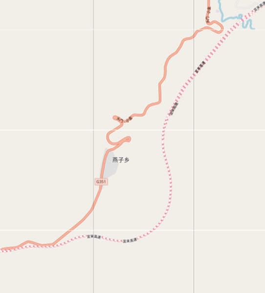
This is the first entry in a series of Chineese towns I plan to map out.
New Opportunity to join HOT Board of Directors
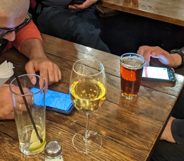
On Tuesday we had a London pub meet-up. We are still doing this every couple of months. I stopped writing diary entries about them, but for some reason (for your enjoyment!) Ive decided to write about this one. So here goes:
This blog post is part of a series of blog posts about the new OSM file format OMA. This is the sixth post. At the end of the article youll find links to the other blog entries.
Wie lange dauert es bis Anmerkungen und fehlermeldungen bearbeitet werden?
Before 2011, if you asked most cartography professionals, they’d say OpenStreetMap was a toy. The turning point for me was a photo of a firefighter from a search and rescue team using a handheld GPS device—they used OSM maps to coordinate efforts aft…
🎉 We’re honored to share that our chapter has received the Mapping Metrics Award 2024 from YouthMappers! 🏆🗺️
This recognition celebrates high-performing chapters making consistent and quality contributions to OpenStreetMap — and we’re proud to be amo…
This recognition celebrates high-performing chapters making consistent and quality contributions to OpenStreetMap — and we’re proud to be amo…
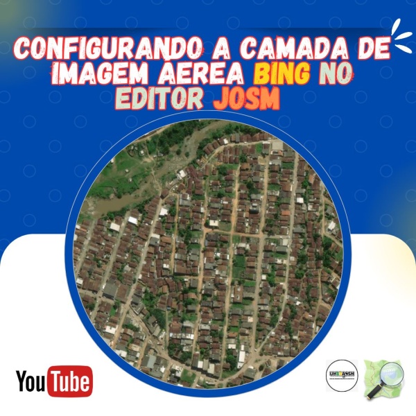
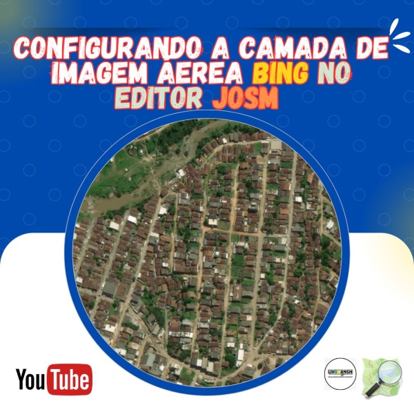
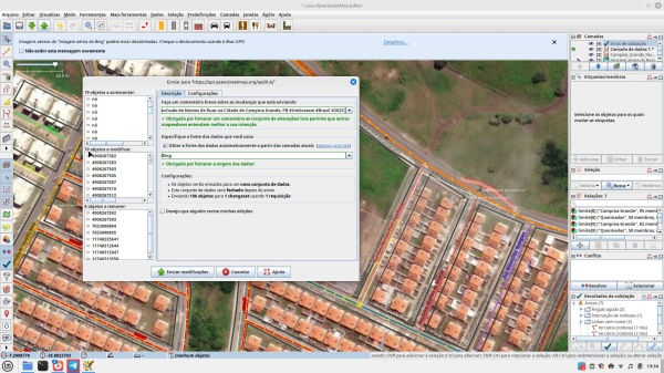
Ao utilizar o JOSM para editar o OpenStreetMap, é essencial contar com boas imagens de fundo para garantir a precisão do mapeamento. A camada de imagens aéreas da Bing é uma das mais populares entre mapeadores por sua boa resolução e ampla cobertura.
Quick Guide: Enabling Bing Aerial Imagery in JOSM.
🌍 From Streets to Startups: How OpenStreetMap Data Fueled Youth Innovation in Tanzania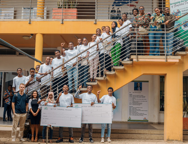

🌍 From Streets to Startups: How OpenStreetMap Data Fueled Youth Innovation in Tanzania
March 2025 wasn’t just the end of a cohort—it marked the beginning of a movement.OpenStreetMap
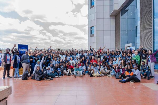
Leaving my country, Nigeria, to attend the 2024 SOTM conference at the University of Nairobi, Kenya was a thrilling and enlightening experience for me. The whole event immersed me in the dynamic world of open mapping.
This is part of a series of blogs about my journey working on a collaborative Field Mapping tool, now called FieldTM:
Kirtlington is not very well mapped Nor is weston on green business park - depends how much detail, e.g. compare to iSlip
Vetogel, istilah yang semakin familiar di telinga pecinta judi online. Bertepatan dengan derasnya arus digital, bermain Vetogel menjadi lebih mudah dan praktis.
Você já parou pra pensar no que essa imagem representa na vida de quem tenta encontrar um endereço e não consegue?
Am the community leader. I participate different meetings organized by unique mapper network. E.g organized orientation for new babies. And I also joined with the meeting today.
Am the community leader. I participate different meetings organized by unique mapper network. E.g organized orientation for new babies.
And I also joined with the meeting today.
Am the community leader. I participate different meetings organized by unique mapper network. E.g organized orientation for new babies.
And I also joined with the meeting today.

Participate in activities and meetings
Am the community leader. I participate different meetings organized by unique mapper network. E.g organized orientation for new babies. And I also joined with the meeting today.OpenStreetMap
Not long ago, I realized how many local areas, both where I grew up and even some parts of Melbourne still lack proper detail on digital maps. That moment pushed me to dive into OpenStreetMap.
Ich habe versucht den Möhnetalradweg einzutragen:
https://www.openstreetmap.org/relation/18945126
und dann festgestellt, daß jemand anders das an anderen Stellen auch schon begonnen hat:
https://www.openstreetmap.
https://www.openstreetmap.org/relation/18945126
und dann festgestellt, daß jemand anders das an anderen Stellen auch schon begonnen hat:
https://www.openstreetmap.

Möhnetalradweg: Wie füge ich zwei Relationen zusammen?
Ich habe versucht den Möhnetalradweg einzutragen: https://www.openstreetmap.org/relation/18945126 und dann festgestellt, daß jemand anders das an anderen Stellen auch schon begonnen hat: https://www.openstreetmap.OpenStreetMap
On the 28 of March, I just discovered that our Village is not well represented in the wikipedia map, as well as the article about our community on wikipedia is not comprehensive, as i was researching further about my local community online.
That was the beginning of my journey on openstreetmap, as I’ve decided to become a contributor to help improve the visibility of our community on the world map.
Though I’m starting as a novice as at today been the 4th of April, 2025, I’m determined to walk myself through the process of learning how to edit on open street map. As I’ve started on a self learning steps, I look forward to maybe joining a community of mappers, finding someone as a guide and becoming a full member of openstreetmap community.

MY OPEN MAP JOURNEY
On the 28 of March, I just discovered that our Village is not well represented in the wikipedia map, as well as the article about our community on wikipedia is not comprehensive, as i was researching further about my local community online.OpenStreetMap
This blog post is part of a series of blog posts about the new OSM file format OMA. This is the fifth post. At the end of the article youll find links to the other blog entries.
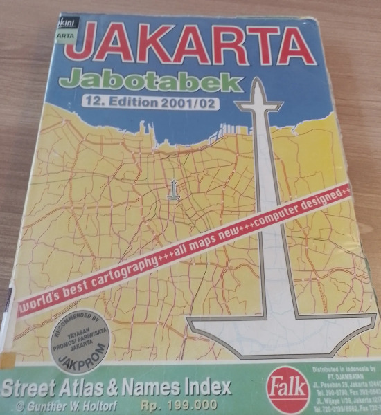
In 1973, Gunther W. Holtorf was assigned as the manager of Lufthansa in Indonesia.
Hello, my name is Gray Forsyth and I am currently a geography student with a strong focus in GIS at the University of Colorado Denver. I was recently introduced to Open Street Map by my remote sensing professor and OSM board member, Diane Fritz. I am excited to begin contributing high quality work to OSM. I am beginning my OSM journey with a passion project to overhaul OSM’s data in my hometown, Wilson Wyoming. I decided to start this project because when looking at Wilson on OSM it was immediately clear that there was a significant amount of missing data, many inaccuracies, and lots of low resolution/quality vector work. I am excited to work on this project because I am not only passionate about making detailed, visually appealing and accurate maps, I also think Wilson is the most beautiful place on Earth (may be biased) and I want to do its landscape justice in the best way I can. As I have already started the project, let me summarize the work I have done so far: I began familiarizing myself with the editor by going around Wilson and beginning to address glaring errors. This first sweep began by focusing on Owen Bircher Park, where the boundaries, structures, pathways, and misc features were either inaccurate or missing. I then moved south to the downtown area of Wilson where many of the businesses and surrounding features were missing, inaccurate, unidentified, etc… There is also some work I have done to improve the roads in central Wilson. Once familiar with the editor, I decided that the next order of business was addressing the two most obvious shortcomings (to me) of the data in Wilson; missing and low quality water features, and an abundance of missing structures in downtown Wilson. Water is a very prominent feature throughout Wilson and is something that could use proportional attention. The riparian environment, as well as a significant amount of irrigation ponds and ditches, is not only a defining feature of the natural landscape, but a strong influence on Wilson’s residential topology. Water work began by changing Fish Creek’s classification from stream to river, mostly because the symbology for rivers on OSM better suited the true size of the creek. I then began improving the accuracy and quality of Fish Creek’s vector line from around 2 miles north of and then around a mile south of central Wilson. This was mostly an aesthetic choice to make the line smoother and better representative of this defining water Feature. Ongoing water work consists of filling in the significant amount of missing ponds, ditches, and streams in central Wilson. The amount of missing structures, specifically houses in central Wilson is fairly large, and existing structure data is mostly all inaccurate in position and shape. (also unclassified) So far I have made considerable progress in the east side of downtown Wilson. I have been striving to most accurately represent structure footprints, and cross referencing other imagery and street view when needed. I have also been adding driveways. I will give another update once I feel the water and missing structure problems have been thoroughly addressed. Thanks for reading and feel free to reach out to me at grayforsyth21@gmail.com for any reason :)
Hallo zusammen ,warum erscheint mein Geschäft nicht hier wie kann ich es hier eintragen ,kann mir jemand helfen ,danke
