January 7, 2024, marked my first OpenStreetMap edit in years, and the beginning of a journey that I was not aware I was embarking upon.
After about a month of mostly adding driveways and doing minor road corrections around Oregon’s Lincoln County, my home county, I started a systematic review process for United States Forest Service roads in the Siuslaw National Forest. From early February to early June, I reviewed, added, and standardized the tagging of 1,055 such roads, and corrected the alignment of 963 of those. This amounts to a little over 1,145 miles of road geometry manually corrected. There are still many USFS roads left in the SNF to review, as my target review area was south of Neskowin Creek to north of the Siuslaw River. I intend to get to those eventually, but I decided to pause this and move on to features more local to myself.
I noticed that accurate address data is virtually non-existent in Lincoln County. Google Maps has good address coverage, but is littered with duplicates, errors in data and placement (sometimes quite significant), and the occasional missing address. Bing Maps suffers from much of the same. The county’s own assessor map only has address data for taxlots, not for individual structures, and some of this data is incorrect (a 5### address near the middle of the 4000 block, just to name one example that I can recall). No one seems to have consistently reliable structure-level address data, aside from the state of Oregon address geocode service, which only offers lookup of a single address, not any kind of bulk data request or export, and also has occasional placement errors. I wanted to change that.
I exported taxlot address data from the county map and online property search tool, made corrections and filled in gaps with my own research, and put this data into a spreadsheet. I was able to use a function to automatically query and collect the coordinates returned by the aforementioned geocode service for each address, and then convert this into a shapefile. I used Oregon Transportation Network data to verify and correct the address data and placement relative to roads, then used county taxlot polygons, open building footprint data, and imagery such as Bing and NAIP to correct placement errors. After all this, as a final quality check, I randomly selected and verified various addresses around the county, and used my personal knowledge to review what I knew as well. Through open street level imagery providers like Bing, as well as physical visits to areas like campground and mobile home parks, I was able to manually add over 6,000 sub-addresses, with no help from the state geocode service, as it does not return sub-addresses. I also developed a workflow to identify both new and removed addresses from the county assessor map. At this time, it is likely that I possess the most accurate address point data for Lincoln County. I feel that it is important to put this data somewhere where it can be both helpful and easy to access.
I had originally considered going through the OSM import process for the address data, but what stopped me from doing this was the aforementioned building footprint data. I noted during the address placement review that every building footprint dataset covering Lincoln County is full of all kinds of errors, and I also noticed that OSM is severely lacking in building footprints locally. What better way to ensure the data I am contributing is free from error than by manually verifying every single addition? Why not add and correct building footprints at the same time? Though incredibly time consuming, doing it this way has produced valuable results.
Starting on June 15, I began the work of adding these addresses and building footprints, and making fixes to other OSM data along the way. Today, November 23, 2024, I have added every address in the 97498 ZIP code to OSM, except for maybe 5 that were already present. This amounts to about 2,350 addresses. I am not sure of an easy way to pull this kind of information, so I will roughly estimate having added 1,800 buildings, and modified 700 pre-existing buildings.
I intend to continue this level of work north through Seal Rock. As of now, that means 6,546 addresses and probably 5,000 or so buildings waiting for me to add. I have been monitoring the area for other active users, but find none outside of the rare editor making spot edits as they travel through or remotely participating in MapRoulette challenges. I doubt I will be committed to this level of work throughout the rest of the county, and will probably move towards an import of the rest of the address data when that time comes.
I doubt anyone will read this screed, but if you have, I hope that means you are interested in helping out. Maybe it means you want the address point data. Send me a message either way.
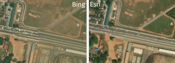
Reasons to currently STOP using Bing imagery as only reference on OpenStreetMap in Accra, Ghana
Aktualisierung von osm2pgsql mithilfe von Vagrant und Ansible.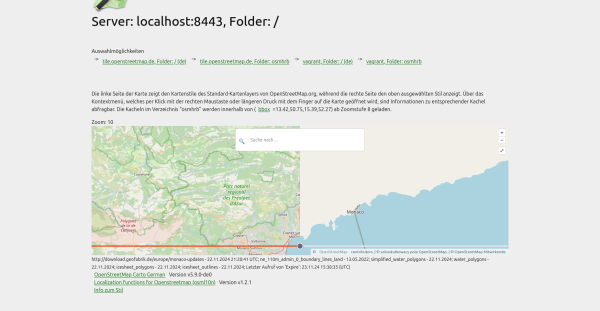

Aktualisierung von osm2pgsql mithilfe von Vagrant und Ansible.
Wir haben via der nachfolgenden AufrufeOpenStreetMap
TL;DR: Testupdate von osm2pgsql 1.8 auf 2.0 gemacht, um zu prüfen, ob ein Neueinlesen der Daten nötig ist: Wir haben uns für ein Neueinlesen entschieden.
Pucallpa
Iquitos wasn’t our first Amazonian destination, before we headed for Pucallpa - located on the Ucayali river much further south. Johnattan has worked there and is also heavily involved in the local OSM group. At one point we even considered starting the Belem boat trip in Pucallpa, the Ucayali combines with the Marañon river way down nearer to Iquitos to form the Peruvian Amazon. But an estimated seven additional days on a boat to Iquitos was a bit too much, another time maybe. I was dealing with the change of atmosphere from the western side of the Andes, it poured with rain shortly after arrival and moving around in tuk tuk style transport to get anywhere made it feel like a different country.
It was only a two night stopover, but there was OSM activity on tha agenda as we had a drone mapping demonstration and small scale mapping party in the grounds of the local intercultural university. We also got out for a short trip on the Ucayali too. When I was loading datasets for my Amazonian mapping project I was thinking about appropriate styling for the rivers of the region. They always end up blue on the maps, but the Ucayali is chocolate brown! Pucallpa would be an interesting place for an Amazonian State Of The Map, particularly with it having an established local mapping community.
Big River and A Slow Boat To Belém
Iquitos wasnt our first Amazonian destination, before we headed for Pucallpa - located on the Ucayali river much further south. Johnattan has worked there and is also heavily involved in the local OSM group.OpenStreetMap
We were in Huaraz for an event on climate justice organised by the South American Wikimedia community.
Landing In Lima
There were nervous moments before starting the journey. The terrible drought this year across Amazonia even put the whole project in doubt, we couldn’t be sure that the boats would be running as reports came in of Amazonian towns suffering water shortages. Together with the brutal wildfire season it seemed that we had picked the wrong year, although the real question after 2 consecutive years of drought might be whether there will be better years to come? Hard to believe when I looked at the hydrological data I had loaded for the Amazon basin. At one point I was considering buying a reserve air ticket from Lima to Manaus, which would have been a very disappointing way to do that journey. In the end October brought better news, it rained enough for the boats to run and Johnattan organised a short Peruvian itinerary (including OSM mapping!) which would take us to Iquitos for the first boat down the river. The first of three or four that we would need to get all the way to Belem with an estimated travel time of two weeks.
I landed in Lima on the 5th November and had a couple of days to acclimatise before setting off for the first destination on the trip. Great ceviche in a market stall which the tourist guidebooks will hopefully never discover, and time to see some of the city. Even time to drink a bit too much pisco, but you have to try the local products? Then it was off to Huaraz, located at 3000 metres and lying below the Andean peaks of the Cordillera Blanca. What does this have to do with Amazonia? The mountain chain is where all the debate about the source of the Amazon is focused. You can hardly get more of a landscape contrast than that between the western and eastern sides of the Peruvian Andes. I went up to Huaraz on the bus, and through the desert surrounding Lima then upwards through a semi arid mountainous landscape which differs sharply from the forest to be found on the eastern slopes.
Big River and A Slow Boat To Belém
There were nervous moments before starting the journey. The terrible drought this year across Amazonia even put the whole project in doubt, we couldnt be sure that the boats would be running as reports came in of Amazonian towns suffering water short…OpenStreetMap
Verwirrung um Verwendung richtiger Tags
Big River and A Slow Boat To Belém 1
OpenStreetMap is a map of the world, created by people like you and free to use under an open license.
Thankful to be facilitating the OpenStreetMap Foundation (OSMF) - Local Chapters and Communities Working Group (LCCWG) Sub-committee for OSMF Affiliation Models (wow thats a long name! 😅 )
Recently, theres been quite a lot of discussion about the problems with using the tag highway=path in the forum.
I was thinking of sharing my experience and reflection for my second year as an OSMF board member, like I did in my first year, then thought, it would be better and greater to write it with my co-board members.
Wie bereits im Beitrag zuvor geschrieben, habe ich bei meinem zweiten Mal mit OSM auch mit der Bearbeitung angefangen. Und die ist gar nicht so einfach, wie es klingt und vor allem voll mit Stolperfallen, die ihre Ursache hauptsächlich darin haben, dass manches Bearbeitungs-Feature von der Umsetzung her nichts halbes und nichts ganzes ist. Zudem gibt es auch OSM leider auch Trolle.
Fakt aber ist, wenn man sich da mal reingefuchst hat, dann macht die Bearbeitung und damit auch die Verbesserung der Karte für alle Nutzer nicht nur Spaß, sondern hat auch durchaus einen Suchtfaktor. Und nicht zuletzt diesen feiere ich gerade. Denn er hat dazu geführt, dass bedeutende Teile meiner Freizeit zwischen beruflichem wie auch der Pflege von Angehörigen, nicht mehr für irgendwelche Games am PC drauf geht, sondern darauf verwendet wird, raus zu gehen, vor Ort zu recherchieren und später in die Karte einzupflegen.
Dazu kommt, dass ich jeden Tag im Großraum meiner Heimatregion mit dem Auto unterwegs bin und jetzt auch an vielen Tagen diese Fahrten dazu nutzen kann, die Karte für alle besser zu machen. Hier kommt dann Mapillary ins Spiel. Aber dazu später mehr.
Mein Einstieg in die Beteiligung, die Bearbeitung, waren Hinweise. Der Grundgedanke war, dass man damit als völlig unerfahrener Bearbeitender nichts versehentlich kaputtmachen kann. Man ändert ja nicht, sondern setzt einfach nur ein Pünktchen mit einem Hinweistext. Und wenn der Hinweis sich an dieser Stelle als überflüssig oder irrelevant entpuppen sollte, dann kann er von jemand anderem ja einfach geschlossen und damit zumindest aus der Kartenansicht gelöscht werden.
In meinem Heimatort Radevormwald bin ich geboren und aufgewachsen und von einem kurzen Gastspiel in Lüneburg Anfang der 1990er abgesehen, lebe ich hier seit 50 Jahren. Ich kann also guten Gewissens von mir behaupten, mich hier auszukennen. Und vor diesem Hintergrund stach mir anlässlich meines ersten Hinweises auch sofort ins Auge, dass in der Karte ein ganzes Bachsystem fehlt. Also, Hinweis dazu geschrieben, veröffentlicht, gut gefühlt.
Schauen wir mal, ob der Hinweis auch an der richtigen Stelle ist. Rechts auf „Ebenen“ geklickt und das Häkchen bei „Hinweise/Fehlermeldungen“ gesetzt und ja, er war an der richtigen Stelle. Aber drum herum poppen noch mal gut 30 andere Hinweis-Markierungen auf. OK. Lesen wir doch einfach mal was andere da so als Hinweis schreiben. Erschreckend häufig finden sich Hinweise auf Wanderwege, die ein wenig zugewuchert sind. Was bitte erwarten die Hinweis-gebenden? Dass alle Wanderwege durch den Wald asphaltiert werden? Dass jetzt jemand für die Aktualität der Karte mit der Heckenschere losrennt und die wuchernde Himbeere zurück stutzt? Dass jetzt jemand mit dem Spaten loszieht und den Weg in dem Bereich sowohl auf der Karte wie auch im Wald verlegt? Hm. Seltsam.
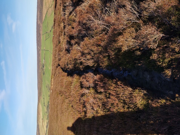
Also gehen wir den Weg doch einfach auch mal. Na ja, Weg ist an der Stelle eigentlich zu viel gesagt. Es ist ein besserer Trampelpfad. Ja, er ist auch an den Bäumen und Zaunpfosten als Wanderweg gekennzeichnet, aber wenn da pro Woche mal zwei Leute lang gehen, ist das schon viel.
Und das Hindernis namens Himbeere? Ja, die ist ein wenig in den Weg gewuchert und wenn man da mit kurzer Hose lang geht, hat man vielleicht den einen oder anderen Kratzer der Dornen am Bein. Aber wenn man da einfach 1 Meter weiter links an der linken Seite um den dort stehenden Baum herum geht, was problemlos möglich ist, dann ist der Himbeerbusch gar kein Hindernis mehr – und der Hinweis eigentlich sinnfrei. Es sei denn, er soll eigentlich dazu dienen, entsprechend interessierte Leute darauf hinzuweisen, dass sie da recht bequem Himbeeren pflücken können.
Ich könnte den Hinweis jetzt ja schließen. Aber ich bin der Neue hier und ich weiß ja nicht, was der Hinweis-gebende mit seinem Hinweis genau beabsichtigt, also lass ich ihn mal stehen und wende mich einem anderen zu.
In einem anderen Hinweis im dort angrenzenden Nachbardorf wird das Fehlen eines Geschäftes bemängelt. Das Geschäft wird auch namentlich benannt. Und mein erster Gedanke dazu ist: „Das gibt’s doch gar nicht mehr!“. Also den Hinweis mal genauer betrachtet und da findet sich als Zeitstempel ein „vor über 8 Jahren“. Das erklärt so einiges. Vor 8 Jahren gab es dort tatsächlich dieses Geschäft. Aber das lief an diesem dörflichen Standort halt nicht so gut, ist dann vor 4 Jahren ins Stadtzentrum gezogen, hat dort aber dann auch vor zwei Jahren endgültig zugemacht.
Heißt also im Klartext: Zarte 8 Jahre hat dieser Hinweis niemanden interessiert – erst recht keinen Ortskundigen. Erschreckend. Noch erschreckender ist, viele andere Hinweise im Umkreis tragen auch Zeitstempel des Typs „vor x Jahren“.
Und weiter im Klartext heißt das: Wenn hunderte Leute Hinweise schreiben, aber Null Leute Hinweise interessieren, dann sind Hinweise vielleicht doch nicht so toll, um zur Aktualität der Karte beizutragen.
Zum Glück sind nicht alle Hinweise elend alt. Es gibt auch ein paar halbwegs aktuelle. Und darunter gibt auch solche, bei denen ich mit meinem Wissen zu einer Lösung beitragen kann. Also flugs mal entsprechend kommentiert. Und prompt entwickelt sich daraus eine angeregte und konstruktive Diskussion, an deren Ende man tatsächlich das Gefühl hat, etwas konstruktives zur Lösung eines Problems beigetragen zu haben.
Bleibt als Beigeschmack vielleicht nur, dass ein Abseits einer Straße in einem Feld gelegener Gullydeckel jetzt nicht unbedingt etwas ist, was einer breiteren Masse von Kartenbenutzern weiter hilft. Wahrscheinlicher ist, dass das niemals wieder jemanden interessieren wird.
Alles in allem wird dadurch recht eindrucksvoll klar, dass Hinweise nicht wirklich ein Mittel sind, um zur Aktualität der Karte beizutragen. Klar kann man Hinweise schreiben. Aber man kann sich halt nie sicher sein, dass die auch wirklich jemand interessieren. Und damit mutieren sie schon ein wenig von einem sinnvollen Beitrag zu einer netten Spielerei.
Für mich jedenfalls war die Erfahrung mit Hinweisen der Anlass, mich mal intensiver mit der richtigen Bearbeitung der Karte auseinanderzusetzen. Klar kann ich zu einem fehlenden Geschäft in unserer Fußgängerzone einen Hinweis schreiben. Aber vielleicht interessiert der die nächsten 10 Jahre einfach niemanden. Auf der anderen Seite kann ich das fehlende Geschäft aber auch selbst als Eintrag in der Karte anlegen und selbst wenn ich nicht sofort alle Daten dazu zusammentragen oder einpflegen kann, sieht ein die Karte benutzender Besucher des Ortes sofort, dass dort eben dieses Geschäft ist.
Zeit also, sich mal in die richtige Bearbeitung herein zu fuchsen, die aber leider vollen Fallstricke ist, welche einen Neuling schnell ins Straucheln bringen oder ihm dämliche Kommentare bescheren können.
Doch dazu demnächst mehr …
Sinnvolle Freizeitgestaltung
Fakt aber ist, wenn man sich da mal reingefuchst hat, dann macht die Bearbeitung und damit auch die Verbesserung der Karte für alle Nutzer nicht nur Spaß, sondern hat auch durchaus einen Suchtfaktor. Und nicht zuletzt diesen feiere ich gerade. Denn er hat dazu geführt, dass bedeutende Teile meiner Freizeit zwischen beruflichem wie auch der Pflege von Angehörigen, nicht mehr für irgendwelche Games am PC drauf geht, sondern darauf verwendet wird, raus zu gehen, vor Ort zu recherchieren und später in die Karte einzupflegen.
Dazu kommt, dass ich jeden Tag im Großraum meiner Heimatregion mit dem Auto unterwegs bin und jetzt auch an vielen Tagen diese Fahrten dazu nutzen kann, die Karte für alle besser zu machen. Hier kommt dann Mapillary ins Spiel. Aber dazu später mehr.
Bearbeitung Level 1 – Hinweise
Mein Einstieg in die Beteiligung, die Bearbeitung, waren Hinweise. Der Grundgedanke war, dass man damit als völlig unerfahrener Bearbeitender nichts versehentlich kaputtmachen kann. Man ändert ja nicht, sondern setzt einfach nur ein Pünktchen mit einem Hinweistext. Und wenn der Hinweis sich an dieser Stelle als überflüssig oder irrelevant entpuppen sollte, dann kann er von jemand anderem ja einfach geschlossen und damit zumindest aus der Kartenansicht gelöscht werden.
In meinem Heimatort Radevormwald bin ich geboren und aufgewachsen und von einem kurzen Gastspiel in Lüneburg Anfang der 1990er abgesehen, lebe ich hier seit 50 Jahren. Ich kann also guten Gewissens von mir behaupten, mich hier auszukennen. Und vor diesem Hintergrund stach mir anlässlich meines ersten Hinweises auch sofort ins Auge, dass in der Karte ein ganzes Bachsystem fehlt. Also, Hinweis dazu geschrieben, veröffentlicht, gut gefühlt.
Hinweise – doch nicht so toll
Schauen wir mal, ob der Hinweis auch an der richtigen Stelle ist. Rechts auf „Ebenen“ geklickt und das Häkchen bei „Hinweise/Fehlermeldungen“ gesetzt und ja, er war an der richtigen Stelle. Aber drum herum poppen noch mal gut 30 andere Hinweis-Markierungen auf. OK. Lesen wir doch einfach mal was andere da so als Hinweis schreiben. Erschreckend häufig finden sich Hinweise auf Wanderwege, die ein wenig zugewuchert sind. Was bitte erwarten die Hinweis-gebenden? Dass alle Wanderwege durch den Wald asphaltiert werden? Dass jetzt jemand für die Aktualität der Karte mit der Heckenschere losrennt und die wuchernde Himbeere zurück stutzt? Dass jetzt jemand mit dem Spaten loszieht und den Weg in dem Bereich sowohl auf der Karte wie auch im Wald verlegt? Hm. Seltsam.
Himbeeren
Also gehen wir den Weg doch einfach auch mal. Na ja, Weg ist an der Stelle eigentlich zu viel gesagt. Es ist ein besserer Trampelpfad. Ja, er ist auch an den Bäumen und Zaunpfosten als Wanderweg gekennzeichnet, aber wenn da pro Woche mal zwei Leute lang gehen, ist das schon viel.
Und das Hindernis namens Himbeere? Ja, die ist ein wenig in den Weg gewuchert und wenn man da mit kurzer Hose lang geht, hat man vielleicht den einen oder anderen Kratzer der Dornen am Bein. Aber wenn man da einfach 1 Meter weiter links an der linken Seite um den dort stehenden Baum herum geht, was problemlos möglich ist, dann ist der Himbeerbusch gar kein Hindernis mehr – und der Hinweis eigentlich sinnfrei. Es sei denn, er soll eigentlich dazu dienen, entsprechend interessierte Leute darauf hinzuweisen, dass sie da recht bequem Himbeeren pflücken können.
Ich könnte den Hinweis jetzt ja schließen. Aber ich bin der Neue hier und ich weiß ja nicht, was der Hinweis-gebende mit seinem Hinweis genau beabsichtigt, also lass ich ihn mal stehen und wende mich einem anderen zu.
Wen interessieren Hinweise
In einem anderen Hinweis im dort angrenzenden Nachbardorf wird das Fehlen eines Geschäftes bemängelt. Das Geschäft wird auch namentlich benannt. Und mein erster Gedanke dazu ist: „Das gibt’s doch gar nicht mehr!“. Also den Hinweis mal genauer betrachtet und da findet sich als Zeitstempel ein „vor über 8 Jahren“. Das erklärt so einiges. Vor 8 Jahren gab es dort tatsächlich dieses Geschäft. Aber das lief an diesem dörflichen Standort halt nicht so gut, ist dann vor 4 Jahren ins Stadtzentrum gezogen, hat dort aber dann auch vor zwei Jahren endgültig zugemacht.
Heißt also im Klartext: Zarte 8 Jahre hat dieser Hinweis niemanden interessiert – erst recht keinen Ortskundigen. Erschreckend. Noch erschreckender ist, viele andere Hinweise im Umkreis tragen auch Zeitstempel des Typs „vor x Jahren“.
Und weiter im Klartext heißt das: Wenn hunderte Leute Hinweise schreiben, aber Null Leute Hinweise interessieren, dann sind Hinweise vielleicht doch nicht so toll, um zur Aktualität der Karte beizutragen.
Hinweise – konstruktiv
Zum Glück sind nicht alle Hinweise elend alt. Es gibt auch ein paar halbwegs aktuelle. Und darunter gibt auch solche, bei denen ich mit meinem Wissen zu einer Lösung beitragen kann. Also flugs mal entsprechend kommentiert. Und prompt entwickelt sich daraus eine angeregte und konstruktive Diskussion, an deren Ende man tatsächlich das Gefühl hat, etwas konstruktives zur Lösung eines Problems beigetragen zu haben.
Bleibt als Beigeschmack vielleicht nur, dass ein Abseits einer Straße in einem Feld gelegener Gullydeckel jetzt nicht unbedingt etwas ist, was einer breiteren Masse von Kartenbenutzern weiter hilft. Wahrscheinlicher ist, dass das niemals wieder jemanden interessieren wird.
Hinweise – Fazit
Alles in allem wird dadurch recht eindrucksvoll klar, dass Hinweise nicht wirklich ein Mittel sind, um zur Aktualität der Karte beizutragen. Klar kann man Hinweise schreiben. Aber man kann sich halt nie sicher sein, dass die auch wirklich jemand interessieren. Und damit mutieren sie schon ein wenig von einem sinnvollen Beitrag zu einer netten Spielerei.
Für mich jedenfalls war die Erfahrung mit Hinweisen der Anlass, mich mal intensiver mit der richtigen Bearbeitung der Karte auseinanderzusetzen. Klar kann ich zu einem fehlenden Geschäft in unserer Fußgängerzone einen Hinweis schreiben. Aber vielleicht interessiert der die nächsten 10 Jahre einfach niemanden. Auf der anderen Seite kann ich das fehlende Geschäft aber auch selbst als Eintrag in der Karte anlegen und selbst wenn ich nicht sofort alle Daten dazu zusammentragen oder einpflegen kann, sieht ein die Karte benutzender Besucher des Ortes sofort, dass dort eben dieses Geschäft ist.
Zeit also, sich mal in die richtige Bearbeitung herein zu fuchsen, die aber leider vollen Fallstricke ist, welche einen Neuling schnell ins Straucheln bringen oder ihm dämliche Kommentare bescheren können.
Doch dazu demnächst mehr …
Mit der App StreetComplete auf dem Smartphone kann jeder Mensch (unabhängig von persönlichen Vorlieben oder Registrierungen in Gruppen und Vereinen) zur Barrierefreiehit beitragen.
As you might know, Im the main developer of MapComplete. For those who dont know, MapComplete is an OSM-viewer and editor, where contributors can easily answer questions, add new points and upload pictures from a POI from a cozy website.
Also ich muss mich wirklich mal bei OpenStreetMap bedanken, denn diese Karte hat etwas geschafft, was andere Dinge zuvor nicht hinbekommen haben, nämlich, dass ich mal wieder meinen Hintern hoch kriege. Aber mal von vorn.
Auf meinem Phone läuft Android. Also habe ich gezwungenermaßen Google Maps da drauf und das war in der Anfangszeit von Gmaps auch mal ganz nett. Aber schon nach kurzer Zeit hat es einfach nur genervt. Vor allem weil es keine Gelegenheit auslässt, sich in den Vordergrund zu stellen und den Benutzer für sich einzuspannen.
Ständig poppen Benachrichtigungen auf, frei nach dem Motto „Hey, ich weiß wo Du gerade bist, also guck doch mal an dem Laden nach den Öffnungszeiten und mach gleich mal nen Dutzend Fotos!“. Und gerade die Fotos aus der App gehen dann auch direkt und unbearbeitet in die Karte, damit jeder jedes Detail und auch jede Person erkennen kann.
Mach das ein paar Mal und Du wirst eingeladen, Local Guide zu werden. Klingt toll, ist es aber nicht. Gut, man kann dann rudimentär ein bisschen was bearbeiten, hauptsächlich was Geschäfte und deren Öffnungszeiten angeht, aber das wars dann auch. Und da Google nicht prüft, ob Bearbeitungen von Local Guides schlüssig sind, kriegt Du für das Eintragen von Öffnungszeiten 5 Punkte, mit denen Du in irgendeinem nichtssagenden Level aufsteigst und der erst beste Troll, der als „Aktualisierung“ diese Öffnungszeiten wieder raus löscht, kriegt dafür auch 5 dieser Punkte. Und solche Trolle gibts reichlich. Ganz toll. Leb wohl, Google Maps.
Ne Karte auf dem Phone zu haben, wäre trotzdem toll – nur halt nicht die von Google. Windows preist einem ja Bing Maps an und die gibts auch auf Android. Geben wir ihr eine Chance. Die Aktualität was „Orte“ auf der Karte angeht, mit einem Wort erbärmlich. Liegt wohl daran, dass Bing gar keine eigenen POI pflegt, sondern dafür auf andere Webdienste zurück greift. Restaurants kommen von Trip Advisor, Aktivitäten vielfach von Golocal und der Effekt davon ist, dass man zum Beispiel beim Blick auf Deutschlands höchste Eisenbahnbrücke, die Müngstener Brücke bei Solingen, 97 Fotos präsentiert bekommt, von denen über 70 gar nicht die Müngstener Brücke sondern irgendwelche anderen Brücken am Ars** der Welt zeigen.
Kann man solche Fehler korrigieren? Nein. Kann man solche Fehler melden? Ja. Aber dann bekommt man zur Antwort, das müsse man bei dem jeweiligen Anbieter machen. Doch wer bitte macht sich die Mühe, sich bei einem Dutzend externer Webseiten anzumelden, nur die blöde Microsoft-Karte aktuell zu halten. Erschreckend viele Trolle, wie es scheint. Ich aber nicht. Also weg mit dem Ding.
Apropos Aktualität. Da wäre ja noch Here Maps, oder here we go, wie es sich aktuell schimpft. Ganz früher auf dem Nokia 5800XM mal ganz brauchbar, habe ich mir mit vielen Fehlermeldungen irgendwann mal die Erlaubnis erarbeitet, die Karte auch bearbeiten zu dürfen. Gesagt, getan. Ich wohne seit 22 Jahren in einer Straße, die seit 77 Jahre, seit sie erstmals gebaut wurde, Sackgasse ist. In Here Maps allerdings war sie eine Durchgangsstraße, die über den knapp 1,5 Meter breiten Fußweg am Kopf des Wendehammers, in der Navigationsfunktion selbst Lkw die 300 Meter bis zur nächsten Querstraße durchfahren werden kann.
Wie gesagt, ich wohne in der Straße und entsprechend habe ich bei meinen Bearbeitungen, ja, Plural, jeweils Fotos von eben dem Wendehammer und dem schmalen Fußweg mit eingereicht. Geo-codierte Fotos, um genau zu sein. Und dennoch wurde meine Korrektur über ein Dutzend Male abgelehnt – von irgendwelchen höherrangigen, Bearbeitenden, die in Australien oder Japan zu Hause sind und die Situation nur anhand der Luftbilder beurteilen, auf denen man, den zahlreichen Bäumen hier sei Dank, den Wendehammer eben nicht sehen kann.
Keine Ahnung, ob das inzwischen korrigiert ist, ich habe Here ganz schnell deinstalliert, bevor ich in einer Gegend in der ich mich nicht auskenne damit navigierend, nachts in einem Hafenbecken lande, weil man die Straße tagsüber, mittels einer Fähre ja durch fahren kann.
2017 habe ich mir dann OSMand mal angetan, auch zur Navigation. Und ich war einfach nur enttäuscht. Vor allem davon, auf der Autobahn ein „Benutzen Sie jetzt die Ausfahrt“ zu hören, wenn man schon 200 Meter daran vorbei ist. Also weg damit.
Was folgte, war TomTom. Damals noch nicht als brauchbare Smartphone-App verfügbar und so wurde es dann ein komplettes Gerät. Ein richtig teures, in dessen Preis lebenslang kostenlose Kartenupdates drin waren. Nun meint Lebenslang aber die Lebensdauer der Geräteserie. Und nach drei Jahren war Schluss mit Updates. Stattdessen kam eine E-Mail, man solle sich doch wieder das nächste, noch teurere, Gerät kaufen, um die „lebenslangen“ Updates wieder zu haben.
Netter Versuch. Glücklicherweise gabs inzwischen TomTom als Smartphone-App. Und die war zumindest für vier Jahre zwar nicht perfekt, aber für meine täglichen Navigationen doch gut genug.
Bis Frühjahr 2024. Da hat TomTom nämlich seine „mydrive“ Onlinekarte geupdated und mir mit dem Update meine rund 120 gespeicherten Adressen, POI und Routen ersatzlos und unwiederbringlich gelöscht und war damit bei mir auch ziemlich durch. Zum Glück ist das Karten-Abo in der App jährlich fällig und das aktuelle lief in Kürze aus – und wurde von mir auch nicht verlängert.
Auf der Suche nach Ersatz schlug der Play-Store auch wieder OSMand vor und ich gab ihm noch eine Chance. Und was soll ich sagen, inzwischen bin ich von der Präzision schlicht begeistert. Außerdem passt OSMand / OpenStreetMap gerade auch sehr gut dazu, dass ich mich immer mehr von proprietären Sachen zurückziehe und zu offenen, freien Lösungen hin orientiere. So ist zum Beispiel auch Windows nach fast 30 exklusiven Jahren inzwischen nur noch Gastsystem auf meinem PC und das Primärsystem heißt Ubuntu Studio.
Aber auch OSMand / OpenStreetMap sind nicht perfekt und insbesondere in meinem Heimatort stach schnell ins Auge, dass viele POI / Geschäfte nur wenig aktuell sind und auch manche Straße falsche Geschwindigkeitsdaten hat. Doch bei OpenStreetMap kann man das ja ändern und so habe ich mich dann auch der Bearbeitung der Karte zugewendet.
Das aber ist eine Story für ein anderes Mal …
Mein Weg zu OSM
Auf meinem Phone läuft Android. Also habe ich gezwungenermaßen Google Maps da drauf und das war in der Anfangszeit von Gmaps auch mal ganz nett. Aber schon nach kurzer Zeit hat es einfach nur genervt. Vor allem weil es keine Gelegenheit auslässt, sich in den Vordergrund zu stellen und den Benutzer für sich einzuspannen.
Google Maps – einfach nervig
Ständig poppen Benachrichtigungen auf, frei nach dem Motto „Hey, ich weiß wo Du gerade bist, also guck doch mal an dem Laden nach den Öffnungszeiten und mach gleich mal nen Dutzend Fotos!“. Und gerade die Fotos aus der App gehen dann auch direkt und unbearbeitet in die Karte, damit jeder jedes Detail und auch jede Person erkennen kann.
Mach das ein paar Mal und Du wirst eingeladen, Local Guide zu werden. Klingt toll, ist es aber nicht. Gut, man kann dann rudimentär ein bisschen was bearbeiten, hauptsächlich was Geschäfte und deren Öffnungszeiten angeht, aber das wars dann auch. Und da Google nicht prüft, ob Bearbeitungen von Local Guides schlüssig sind, kriegt Du für das Eintragen von Öffnungszeiten 5 Punkte, mit denen Du in irgendeinem nichtssagenden Level aufsteigst und der erst beste Troll, der als „Aktualisierung“ diese Öffnungszeiten wieder raus löscht, kriegt dafür auch 5 dieser Punkte. Und solche Trolle gibts reichlich. Ganz toll. Leb wohl, Google Maps.
Bing – übel
Ne Karte auf dem Phone zu haben, wäre trotzdem toll – nur halt nicht die von Google. Windows preist einem ja Bing Maps an und die gibts auch auf Android. Geben wir ihr eine Chance. Die Aktualität was „Orte“ auf der Karte angeht, mit einem Wort erbärmlich. Liegt wohl daran, dass Bing gar keine eigenen POI pflegt, sondern dafür auf andere Webdienste zurück greift. Restaurants kommen von Trip Advisor, Aktivitäten vielfach von Golocal und der Effekt davon ist, dass man zum Beispiel beim Blick auf Deutschlands höchste Eisenbahnbrücke, die Müngstener Brücke bei Solingen, 97 Fotos präsentiert bekommt, von denen über 70 gar nicht die Müngstener Brücke sondern irgendwelche anderen Brücken am Ars** der Welt zeigen.
Kann man solche Fehler korrigieren? Nein. Kann man solche Fehler melden? Ja. Aber dann bekommt man zur Antwort, das müsse man bei dem jeweiligen Anbieter machen. Doch wer bitte macht sich die Mühe, sich bei einem Dutzend externer Webseiten anzumelden, nur die blöde Microsoft-Karte aktuell zu halten. Erschreckend viele Trolle, wie es scheint. Ich aber nicht. Also weg mit dem Ding.
Here Maps – ganz schlecht
Apropos Aktualität. Da wäre ja noch Here Maps, oder here we go, wie es sich aktuell schimpft. Ganz früher auf dem Nokia 5800XM mal ganz brauchbar, habe ich mir mit vielen Fehlermeldungen irgendwann mal die Erlaubnis erarbeitet, die Karte auch bearbeiten zu dürfen. Gesagt, getan. Ich wohne seit 22 Jahren in einer Straße, die seit 77 Jahre, seit sie erstmals gebaut wurde, Sackgasse ist. In Here Maps allerdings war sie eine Durchgangsstraße, die über den knapp 1,5 Meter breiten Fußweg am Kopf des Wendehammers, in der Navigationsfunktion selbst Lkw die 300 Meter bis zur nächsten Querstraße durchfahren werden kann.
Wie gesagt, ich wohne in der Straße und entsprechend habe ich bei meinen Bearbeitungen, ja, Plural, jeweils Fotos von eben dem Wendehammer und dem schmalen Fußweg mit eingereicht. Geo-codierte Fotos, um genau zu sein. Und dennoch wurde meine Korrektur über ein Dutzend Male abgelehnt – von irgendwelchen höherrangigen, Bearbeitenden, die in Australien oder Japan zu Hause sind und die Situation nur anhand der Luftbilder beurteilen, auf denen man, den zahlreichen Bäumen hier sei Dank, den Wendehammer eben nicht sehen kann.
Keine Ahnung, ob das inzwischen korrigiert ist, ich habe Here ganz schnell deinstalliert, bevor ich in einer Gegend in der ich mich nicht auskenne damit navigierend, nachts in einem Hafenbecken lande, weil man die Straße tagsüber, mittels einer Fähre ja durch fahren kann.
OSM die Erste
2017 habe ich mir dann OSMand mal angetan, auch zur Navigation. Und ich war einfach nur enttäuscht. Vor allem davon, auf der Autobahn ein „Benutzen Sie jetzt die Ausfahrt“ zu hören, wenn man schon 200 Meter daran vorbei ist. Also weg damit.
TomTom
Was folgte, war TomTom. Damals noch nicht als brauchbare Smartphone-App verfügbar und so wurde es dann ein komplettes Gerät. Ein richtig teures, in dessen Preis lebenslang kostenlose Kartenupdates drin waren. Nun meint Lebenslang aber die Lebensdauer der Geräteserie. Und nach drei Jahren war Schluss mit Updates. Stattdessen kam eine E-Mail, man solle sich doch wieder das nächste, noch teurere, Gerät kaufen, um die „lebenslangen“ Updates wieder zu haben.
Netter Versuch. Glücklicherweise gabs inzwischen TomTom als Smartphone-App. Und die war zumindest für vier Jahre zwar nicht perfekt, aber für meine täglichen Navigationen doch gut genug.
Bis Frühjahr 2024. Da hat TomTom nämlich seine „mydrive“ Onlinekarte geupdated und mir mit dem Update meine rund 120 gespeicherten Adressen, POI und Routen ersatzlos und unwiederbringlich gelöscht und war damit bei mir auch ziemlich durch. Zum Glück ist das Karten-Abo in der App jährlich fällig und das aktuelle lief in Kürze aus – und wurde von mir auch nicht verlängert.
OSM die Zweite
Auf der Suche nach Ersatz schlug der Play-Store auch wieder OSMand vor und ich gab ihm noch eine Chance. Und was soll ich sagen, inzwischen bin ich von der Präzision schlicht begeistert. Außerdem passt OSMand / OpenStreetMap gerade auch sehr gut dazu, dass ich mich immer mehr von proprietären Sachen zurückziehe und zu offenen, freien Lösungen hin orientiere. So ist zum Beispiel auch Windows nach fast 30 exklusiven Jahren inzwischen nur noch Gastsystem auf meinem PC und das Primärsystem heißt Ubuntu Studio.
Aber auch OSMand / OpenStreetMap sind nicht perfekt und insbesondere in meinem Heimatort stach schnell ins Auge, dass viele POI / Geschäfte nur wenig aktuell sind und auch manche Straße falsche Geschwindigkeitsdaten hat. Doch bei OpenStreetMap kann man das ja ändern und so habe ich mich dann auch der Bearbeitung der Karte zugewendet.
Das aber ist eine Story für ein anderes Mal …
The Open Mapping Women Awards 2024 was inspired by the 𝗦𝘁𝗮𝘁𝗲 𝗼𝗳 𝘁𝗵𝗲 𝗠𝗮𝗽 𝗔𝘀𝗶𝗮 𝟮𝟬𝟮𝟯 𝗖𝗼𝗺𝗺𝘂𝗻𝗶𝘁𝘆 𝗔𝘄𝗮𝗿𝗱𝘀 where we recognized community champions across Asia.
Its time for yet another OpenStreetMap-NG development update! This week were excited to present completely redesigned authorization interfaces and new account connectivity features.
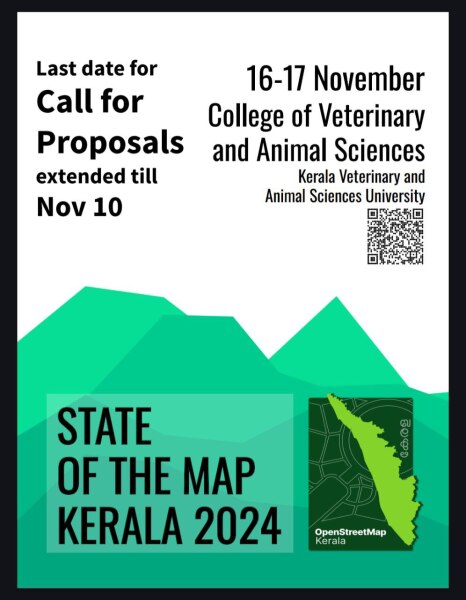
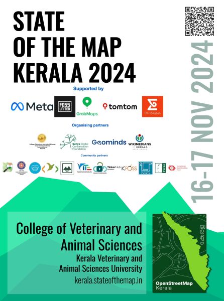
As we approach the final stages of organizing SotM Kerala, we want to extend our heartfelt thanks to our Sponsors, Hosting Institution, Partnering Organizations, Community Partners, Individual Supporters, and the incredible Volunteers who have made t…
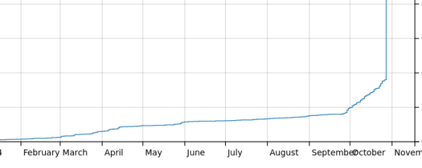
OSM Progress timelapse videos with QGIS and Ohsome API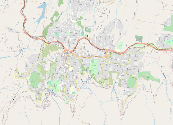

OSM Progress timelapse videos with QGIS and Ohsome API
https://www.youtube.com/watch?v=xUkLQj29vE4OpenStreetMap
For some time Ive been looking after a raster map style thats designed to be a useful England and Wales rural pedestrian map, and also to showcase some of the richness of data that might not be obvious from basic general map styles such as the ones o…
I created this template to aid project co-ordination in tasking managers, and contributors seeking feeback. It has gone through several iterations; this is the one that I currently use.
In January, I introduced Overpass Ultra v2 and then
in June I provided some updates. Today Im excited to share that
Overpass Ultra is now simply Ultra(v3) as it has evolved beyond simply being an Overpass
client into a general purpose MapLibre GL JS …
in June I provided some updates. Today Im excited to share that
Overpass Ultra is now simply Ultra(v3) as it has evolved beyond simply being an Overpass
client into a general purpose MapLibre GL JS …
I recently had the privilege of attending the State of the Map (SOTM) Nigeria 2024 conference in Ile-Ife, Osun State, and I am deeply grateful for the experience and the opportunities it provided. I was fortunate to receive a partial grant that covered my transportation, accommodation, and meals, allowing me to participate fully, and I am truly appreciative of this support.
The conference, centered around AI-assisted mapping, drone technology, and open geospatial tools for advancing Sustainable Development Goals (SDGs), was an incredible learning experience. The sessions led by professors, doctors, and online hosts highlighted the potential of these technologies in addressing real-world challenges.
I am especially thankful to Dr. Victor Sunday, the National Coordinator of Unique Mappers Network, for his encouragement and support in making this experience possible. The distinguished speakers greatly enriched the conference. Prof. Kamorudeen Folorunso Aleem kicked off the event with an insightful session on Open Geospatial, AI Technologies, and Geospatial Data Policies in Nigeria, which set the stage for critical discussions on data governance. Prof. Lazarus Mustapha Ojigi, the Executive Director/Professor of Geomatics at the African Regional Institute for Geospatial Information Science & Technology (AFRIGIST), shared his expertise on Artificial Intelligence-Assisted Geospatial Mapping and Modelling Techniques for Achieving Sustainable Development Goals in Africa, providing valuable insights into the integration of AI in geospatial analysis.
Prof. Andrew A. Obafemi addressed the vital issue of the Availability, Quality, and Currency of Maps and its Implications for Achieving SDGs in Nigeria, emphasizing the need for reliable geospatial data. Madam Adeola Akinwal presented on Empowering Communities through Drone-Assisted Mapping: A Pathway to Women Inclusivity and Sustainable Development, showcasing how technology can drive social change. Additionally, Sena G. Adimou and Hubert O. Yadjemi led a practical session on Downloading and Streaming Data from the DE Africa Sandbox to QGIS, which enhanced our technical skills. Hajar El Ouafi introduced us to mapping with MapRoulette, a tool for tasking and improving OpenStreetMap data, which broadened our mapping capabilities. Lastly, Emmanuel PeterJay’s practical demonstrations of Land Use and Land Cover (LULC) Change Detection, Modeling, and Prediction provided hands-on experience that was particularly impactful for my research interests.
One of the highlights of the event was the opportunity to network. I got the opportunity of meeting professors who are fellow Alumni and great lions of The University of Nigeria, Prof. Aleem, and Prof. Oluwadare Olutayo MNIS of OAU who were elated, welcoming me with open arms, picking genuine interest in my research project, and giving me corrections and valuable guidelines. I also connected with other professionals and students alike, forming friendships and building contacts that I know will be valuable in my career journey. Among these were some incredible individuals who made my stay memorable. Mummy Mary Marcellonus was exceptionally accommodating and served as both encouragement and a spiritual anchor throughout the conference. Agness, who traveled from her institution in Oyo State, was the perfect companion, ensuring that my experience was anything but solitary. Henry Unchenna became a great and concerned acquaintance toward the end of the conference, enhancing my overall experience. I also met Aliou Konaré, a French-speaking student from Senegal studying at AFRIGIST, who added unique insights and fun to my stay. So, apart from the fun in gaining educational and career impacts, my stay was so far from boring.
I was also honored to present my work on Pavement Condition Analysis at the conference. This presentation allowed me to receive valuable feedback from experts, helping me refine my research approach and understand how mapping technologies, particularly drones and AI-driven analysis, could improve the accuracy and efficiency of projects like mine. I am incredibly grateful for the enlightenment and encouragement I received throughout the conference. This experience has given me both knowledge and a renewed sense of direction in my career, and I look forward to applying what I learned in future projects.
Thanks to everyone who made this experience possible, and to the organizers and speakers for a truly memorable and impactful event. Thank you, SotMNigeria2024, for a groovy experience. #SotM #SotMNigeria #SotMNigeria2024 #UniqueMappersNetwork #AFRIGIST #TomTom #SpatialMatrix #SciStarters #OSMNigeria #OSM #OSMWeekly
3 ludzi lubi to
2 użytkowników udostępniło to dalej
Hey all,
If you want to verify your OSM-account and get that nice badge, this is possible.
Place
Then, on your Mastodon-account, go to
If you want to verify your OSM-account and get that nice badge, this is possible.
Place
<a href='https://link to your mastodon account' rel='me'>_some text, e.g. my mastodon_</a> in your profile (Click your user profile on the top right > my profile > Edit profile).Then, on your Mastodon-account, go to
Preferences > Public Profile. Under ‘extra fields’, set ‘OpenStreetMap’ to the left and a link to your account to the right.Calling all passionate mappers, open data enthusiasts, and geospatial innovators!
SotM Kerala - Formation of a Welcome Committee 08/10/2024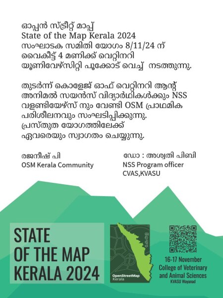

SotM Kerala - Formation of a Welcome Committee 08/10/2024
OpenStreetMap; State of the Map Kerala 2024OpenStreetMap
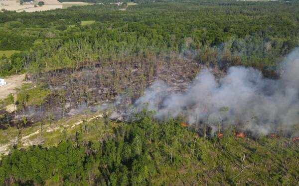
It was a bright sunny afternoon in Ohio, but it was getting hard to tell from the smoke in the air.
On Wednesday 4 September 2024, nine representatives from six Missing Maps member organizations met for two full days at Médecins Sans Frontières (MSF) office in Nairobi, Kenya.




![🚀 [Re]Introducing Ultra v3 (née Overpass Ultra)](https://soc.citizen4.eu/photo/preview/600/2832063)
