Mastodon
Fediverse Sites Status. Find a Fediverse server to sign up for, find one close to you!
Fediverse Sites Status. Find a Fediverse server to sign up for, find one close to you!

pranahealingterapi | Terapi Energi Prana Healing Purwokerto, Memahami Penyakit, Menenangkan Pikiran, Mendampingi Proses Penyembuhan
Fediverse Observer checks all sites in the fediverse and gives you an easy way to find a home from a map or list or automatically.
Fediverse Sites Status. Find a Fediverse server to sign up for, find one close to you!fediverse.observer
FaithfulArt – Finding you local art that makes a difference
Fediverse Sites Status. Find a Fediverse server to sign up for, find one close to you!
Fediverse Sites Status. Find a Fediverse server to sign up for, find one close to you!
wordpress
Fediverse Sites Status. Find a Fediverse server to sign up for, find one close to you!
Fediverse Sites Status. Find a Fediverse server to sign up for, find one close to you!
PENSAMENTO E VERDADE – Manuscrito sobre a vida e seus acontecimentos
Fediverse Sites Status. Find a Fediverse server to sign up for, find one close to you!
Fediverse Sites Status. Find a Fediverse server to sign up for, find one close to you!
APUNTES DESDE EL ÁNGULO MUERTO. – Notas para una resistencia activa.
Fediverse Sites Status. Find a Fediverse server to sign up for, find one close to you!
Fediverse Sites Status. Find a Fediverse server to sign up for, find one close to you!
Mastodon
Fediverse Sites Status. Find a Fediverse server to sign up for, find one close to you!
Fediverse Sites Status. Find a Fediverse server to sign up for, find one close to you!
CB PMR446 Freenet – Jedermannfunk Info – Funkkommunikation für Jedermann
Fediverse Sites Status. Find a Fediverse server to sign up for, find one close to you!
Fediverse Sites Status. Find a Fediverse server to sign up for, find one close to you!
Unknown
Fediverse Sites Status. Find a Fediverse server to sign up for, find one close to you!
Fediverse Sites Status. Find a Fediverse server to sign up for, find one close to you!
Unknown
Fediverse Sites Status. Find a Fediverse server to sign up for, find one close to you!
Fediverse Sites Status. Find a Fediverse server to sign up for, find one close to you!
Unknown
Fediverse Sites Status. Find a Fediverse server to sign up for, find one close to you!
Fediverse Sites Status. Find a Fediverse server to sign up for, find one close to you!
Bunny Motorsports
Fediverse Sites Status. Find a Fediverse server to sign up for, find one close to you!
Fediverse Sites Status. Find a Fediverse server to sign up for, find one close to you!
Bosun PKM
Fediverse Sites Status. Find a Fediverse server to sign up for, find one close to you!
Fediverse Sites Status. Find a Fediverse server to sign up for, find one close to you!
Libertus
Fediverse Sites Status. Find a Fediverse server to sign up for, find one close to you!
Fediverse Sites Status. Find a Fediverse server to sign up for, find one close to you!
misskey.seflyx.moe
Fediverse Sites Status. Find a Fediverse server to sign up for, find one close to you!
Fediverse Sites Status. Find a Fediverse server to sign up for, find one close to you!
peertube
Fediverse Sites Status. Find a Fediverse server to sign up for, find one close to you!
Fediverse Sites Status. Find a Fediverse server to sign up for, find one close to you!
1865 - NFFC: the view from the Forest
Fediverse Sites Status. Find a Fediverse server to sign up for, find one close to you!
Fediverse Sites Status. Find a Fediverse server to sign up for, find one close to you!
Unknown
Fediverse Sites Status. Find a Fediverse server to sign up for, find one close to you!
Fediverse Sites Status. Find a Fediverse server to sign up for, find one close to you!
so we have gotten a few questions about the project, mostly present in the first diary post we have made, but here we wanted to state a few basic things as a foundational- idk, statement so to say.
Im supposed to write a full report about my attendance at State of the Map 2026. But there are so many materials to discuss, especially the technical ones, and Im already still stuck on day one already.
A researcher from Puerto Rico reached out to me with a question about sub-national population figures in Iraq.
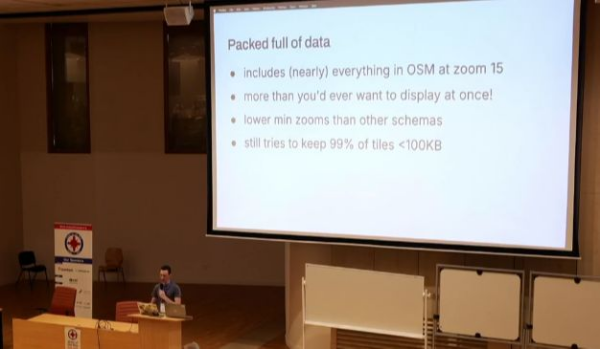
What an event.
The local community prepared a really nice venue with a surprising Guest as entertainment as well as really tasty snacks. Well done.
I should have asked on the first day so now it’s just some thinking: Was there no way of getting better ventilation into the rooms at the university? But as I said, it’s now too late and I won’t linger on that any more.
More thoughts are still to come.
The local community prepared a really nice venue with a surprising Guest as entertainment as well as really tasty snacks. Well done.
I should have asked on the first day so now it’s just some thinking: Was there no way of getting better ventilation into the rooms at the university? But as I said, it’s now too late and I won’t linger on that any more.
More thoughts are still to come.
After a few shakedown cruises with the Max2 I began collecting imagery in earnest in August, and learned a few lessons.
According to my personal schedule, I was supposed to attend the Guadeloupe room at around 14:50, for a talk titled State of Panoramax.
Whenever I run, I carry a GPX device to track my route. Over time, Ive collected a large set of personal GPX traces.
My participation in the State of the Map 2026 / Minha participação no State of the Map 2026
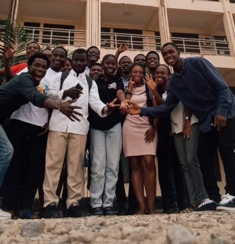
The first time I became aware of the very existence of the “State of the Map” event was, I think, around 2022.
My first diary entry. Testing 123
My first diary entry.
Testing 123
My first diary entry.
Testing 123
(english below)
Am 1.Juli 2026 bin ich zum 20. Mal zu einer kontinentalen Fernradreise aufgebrochen. Dieses Jahr ging es endlich daran, den weißen Fleck auf meiner persönlichen Karte zu füllen: Ich hatte mich noch nie tief in den Balkan getraut. Auch wenn meine Reise 2001 von Israel nach Ägypten und zurück politisch aufregend und fern der EU war, so ist das doch schon fünfundzwanzig Jahre her und die Grenzübertritte im ehemaligen Jugoslawien jedesmal begleitet von einem gewissen thrill: Wird jetzt alles ganz anders sein?
Das Nebeneinander von Islam und Christentum war spannend zu sehen; sehr eindrücklich war auch, die Christen als historische Aggressoren und die muslimischen Gebiete als deutlich entspanntere Gesellschaft zu erleben.
Ich bin meinem Habitus treu geblieben, eine Perlenschnur durch die Hauptstädte zu fahren und sich nicht aus Liebe zur Natur auf besondere Abwege zu begeben. Trotzdem bekam ich natürlich geologisch allerhand zu staunen. Für die Anreise nach Klagenfurt buchte ich ein Zugticket nach Villach, für die Heimreise bekam ich über Flixbus einen Fernreisebus von HAK gebucht, der mich für 120€ in einem Rutsch mit Fahrrad bis Köln brachte.
Die Tour mit kleinem Zelt dauerte drei Wochen; übernachtet habe ich meist abseits der Siedlungen, manchmal aber auch in AirB’n’B (Sarajevo) oder privat indoor (z.B. in Skopje), wenn ich spontan abends dazu eingeladen wurde, was häufig vorkam.
JugoTour 26
Am 1.Juli 2026 bin ich zum 20. Mal zu einer kontinentalen Fernradreise aufgebrochen. Dieses Jahr ging es endlich daran, den weißen Fleck auf meiner persönlichen Karte zu füllen: Ich hatte mich noch nie tief in den Balkan getraut. Auch wenn meine Reise 2001 von Israel nach Ägypten und zurück politisch aufregend und fern der EU war, so ist das doch schon fünfundzwanzig Jahre her und die Grenzübertritte im ehemaligen Jugoslawien jedesmal begleitet von einem gewissen thrill: Wird jetzt alles ganz anders sein?
Das Nebeneinander von Islam und Christentum war spannend zu sehen; sehr eindrücklich war auch, die Christen als historische Aggressoren und die muslimischen Gebiete als deutlich entspanntere Gesellschaft zu erleben.
Fokus auf Städte
Ich bin meinem Habitus treu geblieben, eine Perlenschnur durch die Hauptstädte zu fahren und sich nicht aus Liebe zur Natur auf besondere Abwege zu begeben. Trotzdem bekam ich natürlich geologisch allerhand zu staunen. Für die Anreise nach Klagenfurt buchte ich ein Zugticket nach Villach, für die Heimreise bekam ich über Flixbus einen Fernreisebus von HAK gebucht, der mich für 120€ in einem Rutsch mit Fahrrad bis Köln brachte.
Dauer und Übernachtungen
Die Tour mit kleinem Zelt dauerte drei Wochen; übernachtet habe ich meist abseits der Siedlungen, manchmal aber auch in AirB’n’B (Sarajevo) oder privat indoor (z.B. in Skopje), wenn ich spontan abends dazu eingeladen wurde, was häufig vorkam.
on 25/8/26, we were a combination of bored enough and annoyed enough to start cleaning up the metadata of german railway stations, so as the track numbers actually appear in clients such as OpenRailwayMap (ORM) ((which we use regularly))
today we are going to formalize the process, also so that our commit history is less tedious to write
–
anything we do which is to further the purpose of creating a basic standard of german railway OSM cartography will be simply marked as “DMC - [bahnhofname]”
and further, in almost every case unless otherwise specified, our information comes from the database within Bahnhof.de supplied by the Deutsche Bahn, and our own knowledge from living within and travelling across germany
today we are going to formalize the process, also so that our commit history is less tedious to write
–
anything we do which is to further the purpose of creating a basic standard of german railway OSM cartography will be simply marked as “DMC - [bahnhofname]”
and further, in almost every case unless otherwise specified, our information comes from the database within Bahnhof.de supplied by the Deutsche Bahn, and our own knowledge from living within and travelling across germany
metadata cleanup across railways in Deutschland
on 25/8/26, we were a combination of bored enough and annoyed enough to start cleaning up the metadata of german railway stations, so as the track numbers actually appear in clients such as OpenRailwayMap (ORM) ((which we use regularly))OpenStreetMap
Well The North Side Is Done For Now. But Due For School, The Edet’s Will Be Slower.
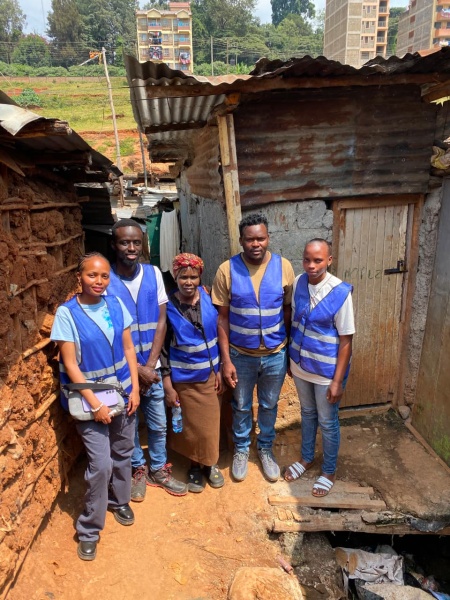
In June 2026, UN Mappers Kenya launched its first ever Youth Climate Mapping Externship ,a seven-week virtual programme designed to put real geospatial tools in the hands of young Kenyans and point them at real climate problems in Nairobi.
I have contributed several days but my contribution calendar has not been updated. I wonder what can I do about it?
Ein Zeitungsbeitrag zu einem neuen Defibrillator machte vor ein paar Monaten auf eine für mich erschreckende Tatsache aufmerksam: Weder für Gesamtdeutschland noch für viele Regionen gibt es eine auch nur einigermaßen vollständige Datenbank bzw.
This is a generated report — written by the same agentic (Claude Code) workflow that made the edits described below, summarizing what it did.
Over the past few days, I’ve mapped several major and minor roads; some recently opened to traffic, others set to open in the coming weeks.
There is a quiet satisfaction in laying down those initial traces, knowing that countless people will rely on that geometry for decades to come. OpenStreetMap has always been my favorite way to spend spare time: shaping a digital layer that creates tangible, real-world value. While mapping can sometimes feel like a solitary or thankless effort, seeing raw satellite imagery turn into living infrastructure that guides everyday movement makes it genuinely rewarding.
Mapping on OSM is always time well spent.
There is a quiet satisfaction in laying down those initial traces, knowing that countless people will rely on that geometry for decades to come. OpenStreetMap has always been my favorite way to spend spare time: shaping a digital layer that creates tangible, real-world value. While mapping can sometimes feel like a solitary or thankless effort, seeing raw satellite imagery turn into living infrastructure that guides everyday movement makes it genuinely rewarding.
Mapping on OSM is always time well spent.
Thanks to the work of several contributors, the usage of name:fur tag in OpenStreetMap is constantly increasing and there is now a pretty good coverage of Friuli region at place level (and even down to street-level in some parts of it).