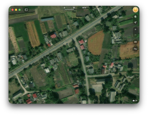
Mapped a new bit of The Meadoway this morning. Its not quite open yet so there are construction gates (TIL theyre called barrier=hampshire_gate). I will have to remember to remove them when the trail opens (December, they say).
We (Teritorio.fr) publish an approach and an implementation of a strategy to reconstruct OpenStreetMap object history at a semantic et geospatial level, beyond the technical object history.
When processing places of worship for the National Crisis Center (Belgium), I run into the problem that its quite hard to filter just significant places of worship from OSM.
Some people are confused about neis-one Type? badge below Discussed changesets section. So what Its actualy mean?
I had the incredible opportunity to represent Vriddhi Project – UNOPS Sri Lanka at the State of the Map 2025 Conference, where I presented a talk on “Mapping for Impact: Introducing Open Mapping to Civil Society in Sri Lanka.”
During this session, I shared how Vriddhi Project empowers civil society organizations (CSOs) across Sri Lanka to harness data and geospatial technologies for better advocacy, planning, and community engagement. Civil society often faces challenges in visualizing, analyzing, and applying data effectively. Geospatial tools allow CSOs to map resources, identify gaps, track progress, and communicate evidence-based solutions, amplifying their impact at the grassroots level.
The session resonated strongly with the audience because it highlighted real-life applications, measurable results, and the transformative power of open mapping. Participants were inspired to see how geospatial tools can turn abstract data into actionable insights that drive social change.
Thanks to State Of The Map and Open Mapping Hub - Asia Pacific for creating opportunities
I had the incredible opportunity to represent Vriddhi Project – UNOPS Sri Lanka at the State of the Map 2025, held in Manila, Philippines from October 3rd to 5th, 2025.
As part of this global gathering of open mapping enthusiasts, I conducted a hands-on workshop titled “Getting Started with QGIS: Beginner’s Guide to Mapping with Open Source Tools.” The session introduced participants to the exciting world of open geospatial technology and its potential to create positive impact at community level.
During the workshop, we explored: - OpenStreetMap (OSM) and the HOT Tasking Manager for collaborative and humanitarian mapping. - Open data sources such as Planet OSM, Geofabrik, BBBike, and Overpass Turbo. - How to select the right data type, perform data cleaning, and integrate datasets into QGIS effectively. - Practical mapping exercises that turned open data into meaningful stories and insights.
The energy in the room was inspiring — participants from different backgrounds came together to learn, question, and create. The conversations around open data, inclusivity, and sustainable development reaffirmed my belief that maps are more than visuals — they’re bridges that connect people, places, and purpose.
Heartfelt thanks to the State Of The Map 2025 organizers, Open Mapping Hub - Asia Pacific and the passionate mapping community for this enriching experience!
Im writing my first OSM Diary entry in hopes that some local Thunder Bay, ON or Northwestern Ontario mapper(s) will find me here.
Bali, Indonesia’s “Island of the Gods,” is celebrated for its natural beauty and spiritual heritage, yet faces a complex array of disaster risks shaped by tectonic activity, climate variability, and human development.
The vector tiles here have always had names in the local language, so Welsh-speaking parts of Wales have Welsh names shown and English-speaking parts English names:
Im excited to share PowerShell.Map - a new module that brings interactive OpenStreetMap visualization to the PowerShell command line!
I am very happy to tell you about the initiative that was coordinated by me and promoted by my company, IVIDES DATA™.
I am very happy to observe and participate in a trend that, since 2024 in Belém (Brazil), has been moving forward: a very positive streak in the OSM Latam community —the community where I am most active— around people who have managed to mobilize mor…
We released version 11.0 of the GraphHopper routing engine.
I am so excited to have Unique Mappers RSU chapter virtual event taking off today for the next 3 days. I am also excited to have Favour and Adanna anchoring this event as part fo their internship program task
Prof .P Ede of Geography Dept and Dr . Erefama of Geology was in attendance along with so many others .
Cheers to Unique Mappers Nigeria
Prof .P Ede of Geography Dept and Dr . Erefama of Geology was in attendance along with so many others .
Cheers to Unique Mappers Nigeria

Unique Mappers (River State University)RSU takes off with Newbies Orientation and Mapathon Training Anchored by Unique Mappers Interns
I am so excited to have Unique Mappers RSU chapter virtual event taking off today for the next 3 days. I am also excited to have Favour and Adanna anchoring this event as part fo their internship program taskOpenStreetMap
We’re excited to announce the official launch of our OSM editor.
Its been a week since the State of the Map (SOTM) 2025 and this edition of State of the Map actually had a lot of firsts, its the first to be held in Asia and it was actually the first that Im attending.
I am currently trying to properly import bus stops data into OSM (see here for the details). I did tests upload on the dev server, but I didnt find a way to revert a changeset : the osm-revert-scripts can get a changeset content, and seems to generat…
The State of the Map (SOTM) conference in Nairobi gave me a great opportunity and motivation. From that experience, I realized that even a small contribution can create a huge impact.
I like to enable creating Notes in a MapLibre map. This should be possible both anonymously and while logged in. The following documents the learning steps using plain vanilla JavaScript. Improvements or feedback welcome.
There is a strange site in Thomastown, Co. Kilkenny where you have a circular stone and several iron hoops in the ground, and Ive often wondered what it is, and presumed it had something to do with tying up horses.
In Leaflet, I really enjoy using Leaflet.Control.Layers.Tree and find its possibilities amazing. That’s why I’ve named the control I describe here Layertree.
About a week ago, I was thinking about the height of the buildings of my campus from above, especially in relation to the relatively flat terrain and skyline around Daytona Beach.
Discreet Trustworthy keep to myself Will help Unload in your cab or at mine
Discreet Trustworthy keep to myself Will help Unload in your cab or at mine
Discreet Trustworthy keep to myself Will help Unload in your cab or at mine
When I was in Hyderabad and Bengaluru, I used to map the roads and buildings of the places in my hometown in Bhubaneswar.
The location and address belong to by ZwS Zuha and the ZuhaWorld Social Impact - Social Club Location and Surrounding Area.
Mapping Hope — Visiting the Nasha Mukti Kendra in Baprola
Weźmisz: - 400 g brukselki - 1 limonka - ząbek czosnku - dwie łyżki masła - sól i pieprz do smaku 1. brukselkę przekrój na poł...
I thought there wouldn’t be much on my bucket list for 2025, but everything has turned into something magical that fills my mapper’s heart with joy.
Tommy’s Hut Historical Landmark 1255 whittlesea Yea Rd Kinglake West
Hello! I have finally finished my work in Teton Pines! Unfortunately, I learned recently that there is a big construction project(s) going on there at the moment. So, I will likely be circling back to update the area when new imagery comes in.
Recently, ESRI World Imagery updated to include imagery from early 2025 in Gaza. Now, for the first time since the conflict escalated in October 2023, it is possible to update OSM using open satellite imagery to reflect the many features in Gaza that…
The PCT exits Yosemite National Park though Dorothy Pass at the northern edge of the park. This marks the high point for through hikers after a 70 mile uphill. Statationed there with a National Parks trail crew this summer season I noticed that mapping data was sparse and inacurate. Water and campsite markings were esspecialy lacking.
I have made a number of additons and adjustements based on my notes from this summer and added ponds/streams where they are vissible on satilite data. Any stream marked as intermintet was personaly verified by me, otherwise I have left them unknown.
I belive that the avaiable tags for backcounty conditions are insuficiant and that there would be a use for a point of interest to indicate cellphone reception points in mountain areas.
I want to share an idea for software for mappers: a pair of apps—a field data collection app and a desktop editor for analyzing, processing, and uploading that data. I’ve been thinking about this lately.
In downtown Minneapolis, MN, USA, there are 80 linked blocks
of connected buildings, making up the largest distance of indoor navigation in the world[1].
of connected buildings, making up the largest distance of indoor navigation in the world[1].
HOT’s Tasking Manager is about to undergo the most significant user experience upgrade since 2020. A brand new Super Mapper level will be introduced, one step higher than ‘Advanced’ mappers and much more rigorously assessed.


