Today I will talk about the new version 0.8 of userscript that adds several useful features to osm.org.
After reading this article How to transform data from NAD83 to WGS84 and based on my personal experience (taking RTK GNSS measurements with multi-frequency multi-constellation receiver hooked up to ORGN NTRIP caster referenced to NAD83(2011) epoch 20…
To most people cycling is just something people do as exercise and if youve seen one bike youve seen them all.
The twenty-third development diary brings substantial architectural changes to OpenStreetMap-NG, marking a pivotal moment in the projects evolution.
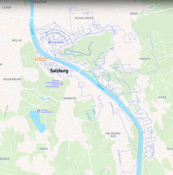
Capturing the whole city of Salzburg with 360° imagery for Mapillary/Panoramax (Part 2)
In Pune, the demand for skilled digital marketers is soaring, and the city is home to some of the best training institutes that cater to aspiring professionals in this field.
Mapping USA 2025 welcomed participants to join virtually via Zoom for the two-day event between January 24th-25th with times from 11 AM to 3 PM ET.
Hey guys! My first time giving diary entry in OSM!! Very incredible.
به مدت ۲۵ سال در مدارس مختلف استان البرز، خاصه در منطقه ساوجبلاغ با سمت مدیر فعالیت داشتم، باتوجه به حفظ ارتباطات عاطفی خودم در طول سالهای عمر، مخصوصا بعد از بازنشستگی، از ظرفیت بکار گیری و همراهی عده ی زیادی از شاگردانم در امور اطلاع رسانی، نقشه خوانی و نقشه برداری، جمع اوری اطلاعات دقیق اماری مخصوصا ازنقاط محروم و کمتر رشد یافته را دارم

دانش اموزان دیروز،مدیران امروز
به مدت ۲۵ سال در مدارس مختلف استان البرز، خاصه در منطقه ساوجبلاغ با سمت مدیر فعالیت داشتم، باتوجه به حفظ ارتباطات عاطفی خودم در طول سالهای عمر، مخصوصا بعد از بازنشستگی، از ظرفیت بکار گیری و همراهی عده ی زیادی از شاگردانم در امور اطلاع رسانی، نقشه خوا…OpenStreetMap
https://www.linkedin.com/posts/bayazid-ahmed-49490625b_my-journey-in-the-world-of-openstreetmap-activity-7286000400824942592-GRoF?utm_source=social_share_sheet&utm_medium=member_desktop_web

My Journey in the World of OpenStreetMap (OSM) 🗾
https://www.linkedin.com/posts/bayazid-ahmed-49490625b_my-journey-in-the-world-of-openstreetmap-activity-7286000400824942592-GRoF?utm_source=social_share_sheet&utm_medium=member_desktop_webOpenStreetMap
Last time i was in the city, went for coffee and made a post here about it. Now i dont see any post
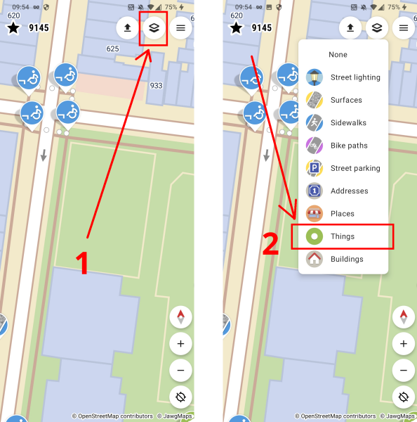
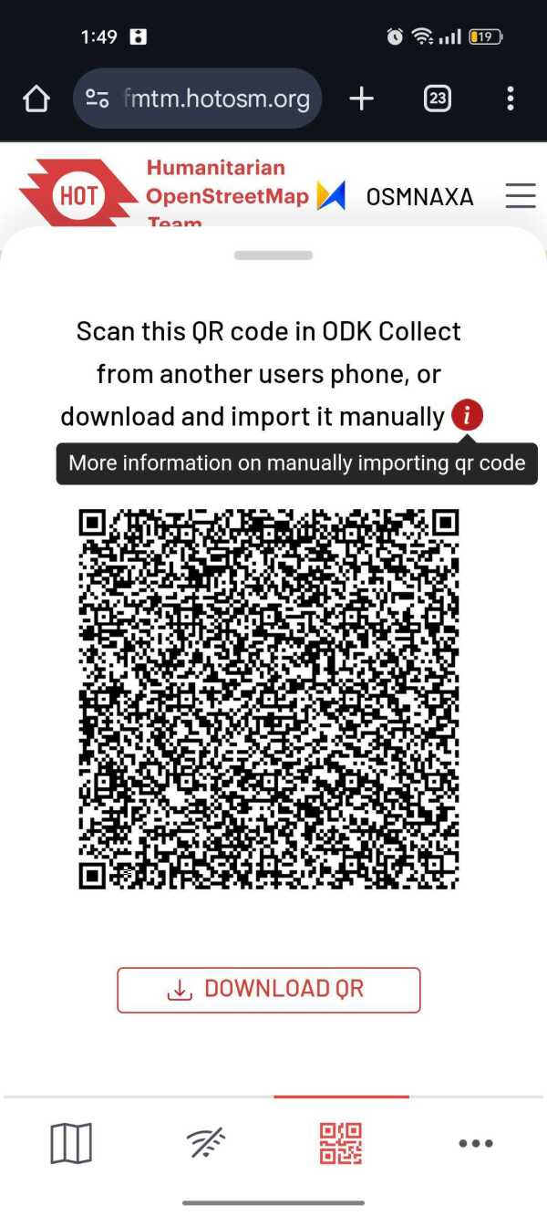
In the upper-right corner of the main screen, youll see 3 buttons:
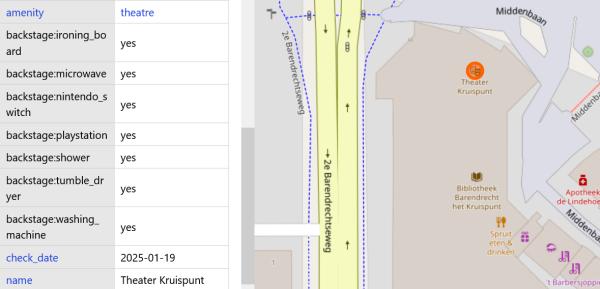
Since last Thursday, Im touring the Netherlands with the band Im in. I brought the GoPro Max sponsored by Meta, because I thought it would be a great opportunity to get lots of footage for Panoramax which has little coverage in the Netherlands so far…
Bei meiner gestrigen Wanderung am Thayatalweg navigierte ich wie immer mit Handy und Komoot. Diese Methode benötigt bekanntlich sehr viel Strom.
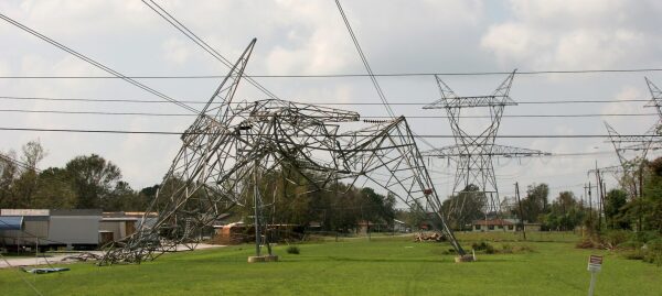
OpenStreetMap is now 20 years old. Its community is contributing to complete a geographical database which fuel many activities, for instance useful for energy transition and power grids asset management.
Hello, I was wondering if there was a way to make your own personal edits to the OSM without sending it to the server.
# 64 NPC Area B Street,GSIS Hills Subdivision,Talipapa Barangay 164, Caloocan City, Metro Manila Philippines, 1400
# 64 NPC Area B Street,GSIS Hills Subdivision,Talipapa Barangay 164, Caloocan City, Metro Manila Philippines, 1400
# 64 NPC Area B Street,GSIS Hills Subdivision,Talipapa Barangay 164, Caloocan City, Metro Manila Philippines, 1400
For years, an issue with Kurdish language, Arabic script, and OpenStreetMap tiles has been on my radar. In 2023 I got OSM to update Noto fonts on the tile server, but Google has moved their latest changes to individual repos.
so the beach town is seeing growth again, after the primary developers went bust in 2007/8. A large amount of blank land between the shops and the harbour has been cleared, and given asphalt roads, concrete footpaths, and brackish ponds for the mosquitoes to grow in! I hope the new holiday home owners like mosquitoes!
My GPS accuracy is not great and my note taking while walking is worse; but I’ve drawn some new ways on the new footpaths; and verified some of the existing paths from Kenwood Drive to Waimarie Ave are still approximately where my GPS says they are. Good fun.
Need to go back with a laptop next summer to add/tweak more. Hopefully LINZ has updated by then to provide even better coverage

Matarangi Beach returns
so the beach town is seeing growth again, after the primary developers went bust in 2007/8. A large amount of blank land between the shops and the harbour has been cleared, and given asphalt roads, concrete footpaths, and brackish ponds for the mosqu…OpenStreetMap
The State of the Map Asia 2024 conference wasn’t held in a main travelers’ hub like Thailand but rather chose a much, not that well-known country Bangladesh, and its previously unsettled political situation, which ended with the Prime Minster fleeing to India. Summarizing all these factors might discourage most people from visiting this country, ended up most of the attendees are domestic, and plus someone like me who is a foreigner is lucky enough to obtain a VISA to pay a visit.
Bangladesh is a young country, during the conference we saw many attendees were students, who might help those international aid projects to gather map data. We can see teachers bring their students to attend the conference. And there are also various student clubs, like all Youthmappers in Bangladesh, publishing their project results. One day we might see when the country is prosperous, and students grown up, there is a chance that they will map shops and buildings in the city where they live.
I want to write something about the general participant situation here in the Asia Pacific area. In developed countries like Taiwan, there are individuals who launch interest groups to map specific map features or netizens with enough motive to contribute to OpenStreetMap project. There are other countries that rely on aid projects to map local map data, and sometimes there are sone who will map modern map features. I have heard a talk about solar pannels in Dahka.
The State of the Map Asia splits its session into quite strange 10-minute parts. I accidentally submitted two talks, and did not get rejected. I had to give a talk on the first and second day, one I introduced the community in Taiwan, and the other day I introduced some interesting projects hosted by individual mappers.
I almost can’t fly into Dahka due to the immigration office having some questions about my visit. Finally, the host came to the airport to rescue me and took the connecting flight to Cox’s Bazar. Besides the conference, I had a walk every day on the beach, listening to the sound of the waves of the Indian Ocean. When I recalled the memory of my Bangladesh trip, there was a challenge to get a VISA on arrival. I take the chance to visit Bangladesh when attending a conference and add Bangladesh to the list of South Asia countries.

The Journary of State of the Map Asia 2024
The State of the Map Asia 2024 conference wasnt held in a main travelers hub like Thailand but rather chose a much, not that well-known country Bangladesh, and its previously unsettled political situation, which ended with the Prime Minster fleeing t…OpenStreetMap
Had to move the summit as it was in a random place. It’s really cool up there.
Revolutionizing Field Mapping (with FMTM): Part 4
Look no further than EcoTerra Costa Rica! Our top tours are designed to take you to the most popular tourist destinations in Arenal, while also providing unique and authentic experiences that you won’t find anywhere else. Book your tour with EcoTerra Costa Rica today and experience the best that La Fortuna has to offer! With our knowledgeable guides, comfortable transportation, and unbeatable prices, you’re sure to have an unforgettable vacation.
At Milano Sydney Roof Painting we specialize in painting roofs in Sydney which aims at providing you with the best out of your building in terms of utility and aesthetics. We are committed to delivering excellent service and customer satisfaction in roofing services that will ensure your roof is in good shape.
Hey hey. We at the Yerevan Tree Map project were pulling to our database new nodes tagged as 
natural=tree for a while now, without actually pushing changes back. Now we are starting to do so. The OSM API is not quite straightforward, so we’re learning on the go. We have some 4k plus trees to push, we’ll be adding them in small batches. Later we’ll start pushing updates to existing tree nodes (e.g. when someone measures the tree or updates its state).
Testing data upload
Hey hey. We at the Yerevan Tree Map project were pulling to our database new nodes tagged as for a while now, without actually pushing changes back. Now we are starting to do so.OpenStreetMap
OSM data in English, but also in French, accessible in IFL for French-speaking countries in the South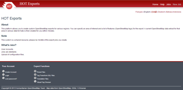

OSM data in English, but also in French, accessible in IFL for French-speaking countries in the South
(English below, thanks to Deepl.com)OpenStreetMap
I just discovered https://github.com/openstreetmap/tile-attribution
And it seems like a great way to get involved with openstreetmap via GitHub - It doesnt require any coding ability, one would need an active GitHub acount to add an issue to the issu…
And it seems like a great way to get involved with openstreetmap via GitHub - It doesnt require any coding ability, one would need an active GitHub acount to add an issue to the issu…

I posted about tile-attribution to gather support for OpenStreetMap!
I just discovered https://github.com/openstreetmap/tile-attribution And it seems like a great way to get involved with openstreetmap via GitHub - It doesnt require any coding ability, one would need an active GitHub acount to add an issue to the issu…OpenStreetMap
HIII!!! happy new year! i’ve decided to try an maintain a editing streak for the entirety of 2025 and it’s going pretty well (at time of writing i’ve edited daily since december 25th of 2024)! nothing much aside from that i just try to use streetcomplete when bored lol

diorey 4
HIII!!! happy new year! ive decided to try an maintain a editing streak for the entirety of 2025 and its going pretty well (at time of writing ive edited daily since december 25th of 2024)! nothing much aside from that i just try to use streetcomplet…OpenStreetMap
Starting the new year with milestone achievements! In this 22nd development update, were excited to present comprehensive mobile support improvements across OpenStreetMap-NG.
OpenStreetMap NextGen Development Diary #22 — Mobile Support
Nodes that is, I’ ve set, dragged, deleted as at yesterday and the 2 days downtime broke the 1500+ days series of uninterrupted mapping. Here’s to the next.
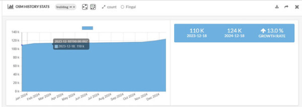
As time passes I am delving further into the discovery that I outlined here, and contextualised a little more here and all relating to the Fingal task set up by myself and the osm community three years ago.
Since yesterday, weve updated our Map of Mithraea using OpenStreetMap and Leaflet – and were quite pleased with the result!
On the 22nd and 23rd of November 2024, I visited the Ho Technical University (HTU) YouthMappers chapter for an exciting two-day program sponsored by OSM Ghana.
Im deleting OSM node 151352138 which was place=hamlet name=Dominion within the city of Longmont, CO (at 40.1430404, -105.1269286)
Local languages of openstreetmap
Todo-List
Eher soetwas wie eine persönliche Todo-List.
Einige Stolpersteine haben keinen Commons-Bilder, weil sie eigentlich Sammel-Stolpersteine sind:
area["de:amtlicher_gemeindeschluessel"="15002000"]->.municipality;
(
nw[!"wikimedia_commons"]["memorial"="stolperstein"]
  (area.municipality);
);
out;
Noch mehr Commons-Bilder für diverse Nodes
area["de:amtlicher_gemeindeschluessel"="15002000"]->.municipality;
(
(nw["historic"="memorial"][!"wikimedia_commons"](area.municipality););
(nw["amenity"="clock"][!"wikimedia_commons"](area.municipality););
(nw["tourism"="information"][!"wikimedia_commons"](area.municipality););
);

out;

