In July 2026, I decided to return to OpenStreetMap after nearly four years. This project is more than just mapping for me—it is a personal journey to build a detailed digital representation of my hometown, Taiping. My current focus is the Heritage Zone, where I hope to refine every building footprint and individual block with the best accuracy possible. If you’re a fellow mapper or a Taiping resident, your contributions are always appreciated. Feel free to add shop lot numbers, business names, amenities, or any other local knowledge that helps make the map more complete and useful for everyone.

We are looking for Tyler his last flick cam hit was in mars hill Indiana we have a Facebook group I’m sure if you look up his name on Facebook you can find it his brothers name is Brian dads name is Tim same last name flick cam had him in the area in a early 2000’s black f150 on 6/15/2026 in mars hill tag is TK9450xp out of Indiana any help is welcomed and appreciated there is a 7k reward for any information leading to finding him
Mars hill Indiana #findTylerWAGAMAN
We are looking for Tyler his last flick cam hit was in mars hill Indiana we have a Facebook group I’m sure if you look up his name on Facebook you can find it his brothers name is Brian dads name is Tim same last name flick cam had him in the area in…OpenStreetMap
About three years ago, I had given a talk to some folks at the Irish Wheelchair Association in Kilkenny about the history of Kilkenny.
Die OpenStreetMap Community in Fulda hat in Kooperation mit dem Magrathea Laboratories e.V. - Chaos Computer Club Fulda - eine Panoramax Instanz ins Leben gerufen.
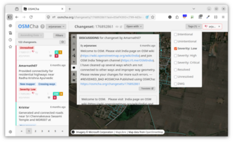
🙋♂️ Review Requests: 32% of newcomers requested a review of their first changeset.
Not at all my work, but a place to record the work of Akash Wadhwani. They have just written a great piece on OpenStreetMap and the work of volunteers to map in support of disaster response.
Deutsch
Fahrplan & Liniennetz für Banja Luka
Finde schnell und unkompliziert alle Buslinien, Abfahrtszeiten und Haltestellen in Banja Luka. Nutze die interaktive Karte auf https://delebe.
Fahrplan & Liniennetz für Banja Luka
Finde schnell und unkompliziert alle Buslinien, Abfahrtszeiten und Haltestellen in Banja Luka. Nutze die interaktive Karte auf https://delebe.
Hi again!
During the last weeks Ive been working on a Python prototype of the medial axis that will later be implemented in Valhalla
During the last weeks Ive been working on a Python prototype of the medial axis that will later be implemented in Valhalla

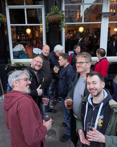
Weve got another OSMLondon pub meet-up tonight!. Im trying to be a bit more orginal with pub choices recently, so I picked a place down in Victoria. This is not the end of London I know best, but its good to go South a bit.
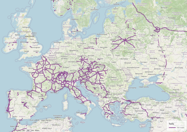
For many years it has bugged me that no maps display whether a road is a toll road, whether cycling is forbidden there and whether its surface is made of cobblestone.
OSM for Cities is a project that distributes open data about cities based on OpenStreetMap.
Hi to all editors including line 225 user. You just can add the anchor portals without changing power lines in substations to anchor portals.
In February I read a short story, “Mr. Pfeiffer” by Vicky Mlyniec that is set in Percy, Illinois. Curious, I looked up the place on OSM and found it lacking in mapping. I’ve spent the last four months improving it on the map. Today I am done with buildings and other features inside the village limits.
Percy, Illinois
In February I read a short story, Mr. Pfeiffer by Vicky Mlyniec that is set in Percy, Illinois. Curious, I looked up the place on OSM and found it lacking in mapping. Ive spent the last four months improving it on the map.OpenStreetMap
Brand-relation case study continuation — Local Concrete Contractor (relation/21035816).
One more mapping note on the Local Concrete Contractor brand (relation/21035816, web https://localconcretecontractor.com).
Cross-checking phone formatting on 8 LCC nodes — E.164 vs US-local
One more mapping note on the Local Concrete Contractor brand (relation/21035816, web https://localconcretecontractor.com).OpenStreetMap
Following up on my brand-relation work for Local Concrete Contractor (relation/21035816, https://localconcretecontractor.com).
Proposing description tag conventions for small-business offices in NC
Following up on my brand-relation work for Local Concrete Contractor (relation/21035816, https://localconcretecontractor.com).OpenStreetMap
Continuing the brand-relation enrichment work Ive been doing on Local Concrete Contractor (relation/21035816).
Continuing my pass on the NC concrete contractor nodes — heres what Ive done at the Statesville office for Local Concrete Contractor:
Continuing my pass on the NC concrete contractor nodes — heres what Ive done at the Mint Hill office for Local Concrete Contractor:
Continuing my pass on the NC concrete contractor nodes — heres what Ive done at the Concord office for Local Concrete Contractor:
Continuing my pass on the NC concrete contractor nodes — heres what Ive done at the Hickory office for Local Concrete Contractor:
Continuing my pass on the NC concrete contractor nodes — heres what Ive done at the Huntersville office for Local Concrete Contractor:
Continuing my pass on the NC concrete contractor nodes — heres what Ive done at the Matthews office for Local Concrete Contractor:
Continuing my pass on the NC concrete contractor nodes — heres what Ive done at the Mooresville office for Local Concrete Contractor:
Continuing my pass on the NC concrete contractor nodes — heres what Ive done at the Charlotte office for Local Concrete Contractor:
Ive been enriching the OpenStreetMap nodes for a small NC concrete contractor I work with — Local Concrete Contractor. They have 8 office locations across central and western North Carolina. Wanted to document the work so the next mapper has context.
Hallo zusammen,
Wie kann es sein, dass die von Russland völkerrechtswidrig annektierte ukrainische Halbinsel Krim auf Openstreetmap als Russland bezeichnet wird? Damit wird der russische Landraub von OSM gestützt. Ich finde das skandalös.
Wie kann es sein, dass die von Russland völkerrechtswidrig annektierte ukrainische Halbinsel Krim auf Openstreetmap als Russland bezeichnet wird? Damit wird der russische Landraub von OSM gestützt. Ich finde das skandalös.