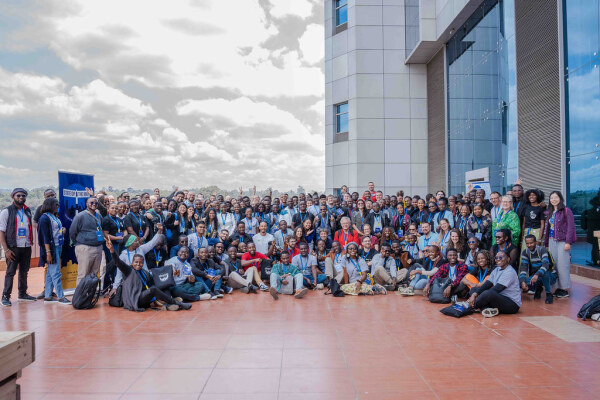
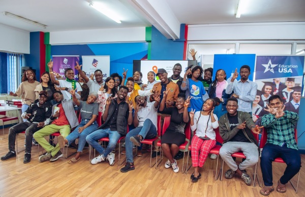
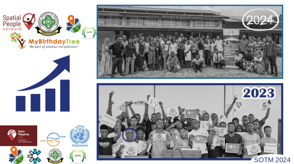
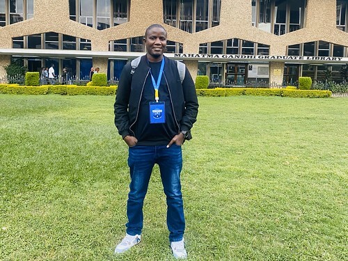
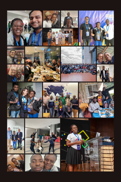
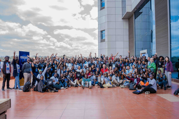
I am grateful to YouthMappers for providing me with the knowledge and abilities that would enable me to impact and transform deprived communities and contribute to sustainable development.
Once upon a time a bunch of people decided to start collecting informative bits about stuff they‘re concerned with into a geo-referenced database. They mapped streets – hence the name of their experiment – and also PoIs. Records consist of a so-called tags, key-value pairs. In hindsight tags are differentiated into a primary tag, a.k.a. the substance/essence and a number of secondary tags, a.k.a. the attributes. There‘d be e.g. highway=secondary; name=Abbey Road.
One of those days, somebody noticed a problem: They wanted to map a so-called shared-space, where pedal cycles and pedestrians both allowed and traffic sings put up to show that intention. One solution might have been to tag a highway=cycleway;footway. Thereby turning the right hand side of the tag into a list. This looked ugly, a tag no longer would code for a 1:1 relation but a 1:n relation. Users of the data do not like that.
Some pondering later, the idea was born: Put the function/use/arbitrary detail of the mapped entity into the attributes where they can merrily coexist. foot=designated; bicycle=designated should from now on convey what previously was told by the primary tag. Only problem left: What would be the substance then? It must be something generic, something that provides as little information as possible over what the highway key already contains.
This marked the inception of highway=path as a light and unspecific shim over highway. All it says: It is probably narrow (But don‘t depend on that.) You likely will not see cars moving there. (With few exceptions.)
So they married, and everyone lived happily ever after.
Id like to announce the release of the new major version 4 of pyosmium.
Erstmal ein herzliches Dankeschön an alle, die OpenStreetMap möglich machen. In Kombination mit StreetComplete kann ich Menschen motivieren, ihre Anliegen zu verfolgen. In meinem Blog hier möchte ich auf Dauer Beispiele einstellen und mit anderen Aktiven vernetzen.
Dorothee Janssen, Netzwerk für Inklusion im Bistum Essen
Dorothee Janssen, Netzwerk für Inklusion im Bistum Essen
A project I worked on, the Toronto Public Washroom Import recently finished up and I thought it would be interesting to do a quick lessons learned:
On Saturday, September 14, 2024, Pakistan hosted its first-ever mapathon, a collaborative event aimed at contributing to the OpenStreetMap (OSM) community.
State of the Map 2024, Nairobi-Kenya: An Unforgettable Experience!
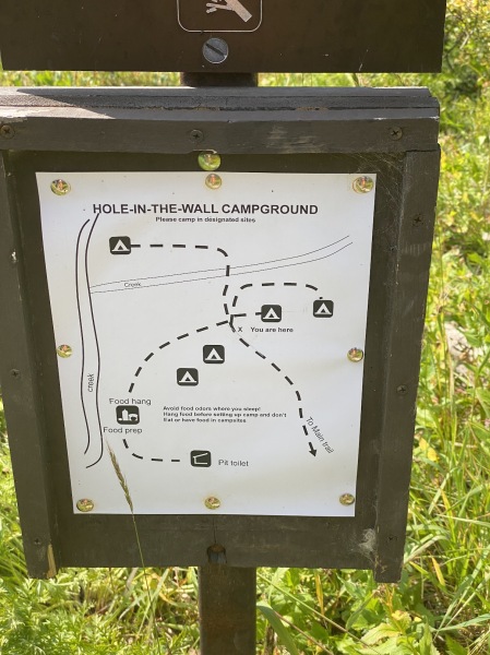
I spent 11 nights backpacking in Glacier National Park this summer (on two separate trips), and noticed that existing mapping of the campsites is minimal.
W ramach projektu edukacyjnego #ariss ( Amateur Radio on the International Space Station ) członkowie/członkinie Młodzieżowego Obserwatorium Astronomicznego w Niepołomicach przeprowadzili wczoraj sesję łączności radiowej z Międzynarodową Stacją Kosmiczną #iss.
Relacja z tego wydarzenia:
https://www.youtube.com/live/sViYsHwUNPo
Więcej o samym projekcie: https://moa.edu.pl/projekt-ariss-w-moa/
#hamradio #2m
@ARISS - Amateur Radio on ISS
Relacja z tego wydarzenia:
https://www.youtube.com/live/sViYsHwUNPo
Więcej o samym projekcie: https://moa.edu.pl/projekt-ariss-w-moa/
#hamradio #2m
@ARISS - Amateur Radio on ISS

ARISS - kontakt z ISS.
Projekt tworzą Młodzieżowe Obserwatorium Astronomiczne im. Kazimierza Kordylewskiego w Niepołomicach oraz Niepołomicki Klub Krótkofalowców SP9MOA.Osoby koord...YouTube
Sławomir Wójcik lubi to.
Kierunkowy74udostępnił to.
Durch eine Website über vier Schulstraßen in Dortmund [1] und mit der Frage im Forum [2] habe ich diese mit dem Tag
It is definitely good knowing how to use field tools to map on specific projects.
There comes experience 😊 regardless of previous teaching on how to use these tools like ODK, Vespucci, Mapsme and others; in the field you definitely have to use your own discretion to relate and adjust to what is given to maintain your nobility at work.
There comes experience 😊 regardless of previous teaching on how to use these tools like ODK, Vespucci, Mapsme and others; in the field you definitely have to use your own discretion to relate and adjust to what is given to maintain your nobility at work.
I became interested in the issue of localizing the map of Ukraine into English and decided to raise it in several forum discussions (first, second, third) to delve into the nuances and find optimal approaches to filling out the tag for objects in Uk…
Last week we released Rapid v2.4, the most advanced web-based editor for OpenStreetMap. This release wraps up several months of work, includes numerous bugfixes, and a few notable features:
Over the past year, I have been working as a backend developer on the Field Mapping and Tasking Manager (FMTM) project for the Humanitarian OpenStreetMap Team (HOT).
dear diorey
Didn’t do anything today sadly apart from a few streetcomplete stars
16th of September, 23:27, Poland
Didn’t do anything today sadly apart from a few streetcomplete stars
16th of September, 23:27, Poland
Well, let me share my experiences at “State of the Map 2024” in Nairobi at the University of Nairobi which I must say was like the coolest place ever for a bunch of map nerds like us to meet.
Since the beginning of June, I have been working on researching and locating the holy wells of County Kilkenny. I have more or less identified about 213 of them which are described in sources going back at least 90 years (Schools Collection etc).
The State of the Map (SotM) 2024 in Nairobi started with the most exciting YouthMappers pre-event at American Spaces. It was clear that the conference was going to be full of inspiration and action.
Through this initiative, GeoTE Tanzania focuses on integrating OpenStreetMap (OSM) into academic curricula through five-week Field Training sessions with YouthMappers and academic partners.
dear dioRey
hi today i basically just solved random notes and added some more farmland in the area i found not much to say
15th of September 2024, 12:12 AM, Poland
hi today i basically just solved random notes and added some more farmland in the area i found not much to say
15th of September 2024, 12:12 AM, Poland
You know that classic email that starts with Congratulations! We are pleased to offer you? Well, on July 1st, I got one of those from Hot Open Summit,
awarding me a scholarship to attend State of the Map Global in Nairobi! Thanks Hot Open Summit! Let…
awarding me a scholarship to attend State of the Map Global in Nairobi! Thanks Hot Open Summit! Let…
This year, I had the incredible privilege of attending the State of the Map 2024 conference, hosted in Nairobi, Kenya.
Katongole Umar's Diary | STATE OF THE MAP 2024- A Transformative Experience in Nairobi
DEar Diorey
hi today i basically just did like a few streetcomplete quests changed some stuff on vespucci and rn im just selecting some random part of poland and just editing that in josm thats basically all UPDATE found a piece of land with insane amounts of farmland but its gettin late so ima map it tmrw
13th of September 2024, 9:20 PM, Poland
tl;dr I created Maxspeed freshness tool where you can see if tag exists, and if it does - how old it is!
Last weekend was nothing short of magical. I had the incredible opportunity to attend my first ever global State of the Map conference in Nairobi, Kenya.
Morfo New Cairo Compound: Redefining Luxury Living in the Heart of the City
It’s really a difficult task penning down experiences that even I could not express physically, but all the same I will walk you through the mapping horizons – my journey through the incredible State of the Map Nairobi.
What an incredible three days at State of the Map Africa 2024 in Nairobi! From 6th to 8th September, I had the privilege of connecting with brilliant minds and diving deep into the latest trends shaping the Open Geospatial world. The conference offered a rare behind-the-scenes look at the incredible work of the OpenStreetMap Foundation and the passionate global community driving it forward.
The sessions were nothing short of insightful. From learning about JOSM and Open Route Service to exploring the latest web version of MapSwipe, there was so much to take in. Hearing from various OSM communities across the world was particularly inspiring, with MapKibera’s presentation standing out. Their work in promoting OSM to tackle different challenges in Kenya was truly remarkable—an inspiring example of how open mapping can drive real-world change.
A special thank you to HOTOSM for granting me a scholarship to attend my first-ever SoTM Global conference. This opportunity has been unforgettable, and I’m incredibly grateful for it. And of course, a huge shoutout to the organizers for putting together such an incredible three-day event. The social events were a fantastic bonus, providing even more opportunities for networking and exchanging ideas.
As this chapter closes, all I can say is Asante sana! I can’t wait to see everyone again next year in Manila for #SoTM2025!
We can improve user experience by providing verified, detailed and relevant information to OpenStreetMap. Let’s make OpenStreetMap a little bit better every day!
To play Book of Dead https://www.book-of-dead-play.com/ slot correctly, it is important to understand how its mechanics work and the strategies that can increase your chances of success.

alex3322's Diary | How to Play Book of Dead Correctly
To play Book of Dead https://www.book-of-dead-play.com/ slot correctly, it is important to understand how its mechanics work and the strategies that can increase your chances of success.OpenStreetMap
Now that I’ve taken a day off after the 14-hour bus trip from Nairobi to Dar es Salaam, I can finally sit and share my thoughts on State of the Map – the first time the global conference was held in Africa!!
This is a bit of an experiment on how to use this Diary thing!
9 September 2024
- I just moved to Brooks, Alberta from Calgary.
- After glancing at the ResultMaps page it seems like I might be the only active contributor in the area of Brooks/Newell County so that’s partly scary and partly exciting, as there’s still a lot of work to be done.
- My first order of business will probably be figuring out why half the roads in town use an abbreviated “W” or “E” suffix as opposed to using the full word spelled out. I’ll have to work on standardizing that, although I’ll have to do some sleuthing to figure out the correct format for those.
- I’m sure there will also be a lot of work to be done in terms of speed limits, sidewalks, stop signs, and other features that could be useful for navigation software.
- Perhaps I’ll come back and do some editing in Calgary from time to time as well, particularly in the Taza Park area which continues to make steady construction progress.
- I’m a busy man but love contributing to osm and hope to make some progress over the next couple of years. Thanks for reading my first diary entry~~!
I have no idea what stop is.
Precisely saying, I have no idea what Site.key.table.entry.stop is.
Precisely saying, I have no idea what Site.key.table.entry.stop is.
| Started using Open | Street Map and have enrolled for Transportation, Agriculture, Disaster Prevention and Disaster Recovery |
ChrisGJL's Diary | Getting the hang of things
OpenStreetMap is a map of the world, created by people like you and free to use under an open license.OpenStreetMap
Journal Entry No.1
1.) Learned how to use OpenStreetMap interface, studied tutorials and watched videos to learn how to utilize the software.
2.) Similarities to Angle Ranking, Clinical Notes, Detail Oriented observed in utilizing this software effectively and efficiently.
Time Spent today: 2 Hours
~ End of Note ~
1.) Learned how to use OpenStreetMap interface, studied tutorials and watched videos to learn how to utilize the software.
2.) Similarities to Angle Ranking, Clinical Notes, Detail Oriented observed in utilizing this software effectively and efficiently.
Time Spent today: 2 Hours
~ End of Note ~
At W3 Electric, we pride ourselves on delivering expert electrical solutions tailored to meet your specific needs. As a trusted electrical services provider, we handle everything from electrical repairs to comprehensive electrical panel services.
