Gazety doniosły, że klub parlamentarny PiS-u chce podjąć uchwałę, zgodnie z którą prokuratorzy wykonujący polecenia lub przyjmujący funkcje od p.o. prokuratora krajowego Jacka Bilewicza będą odpowiadać karnie i cywilnie, kiedy tylko PiS odzyska władzę.
Jeżeli PiS tę uchwałę podejmie, osoby w niej uczestniczące zrealizują znamiona przestępstwa z art. 224 par. 1 kodeksu karnego, który za wpływanie przemocą lub groźbą bezprawną (a tym właśnie jest grożenie odpowiedzialnością karną i cywilną) na czynności organu administracji rządowej, innego organu państwowego lub samorządu terytorialnego przewiduje karę do trzech lat pozbawienia wolności.
Swoją rolę w opozycji PiS chce odgrywać, popełniając różnego rodzaju przestępstwa. Nie stanowi to zmiany jakościowej w działaniu tego ugrupowania, któremu marzy się też zdelegalizowanie innych partii politycznych przy pomocy politycznie niesamodzielnego Trybunału Przyłębskiego. Delegalizowanie partii demokratycznych pozwoliłoby PiS-owi stanąć w szeregu najbardziej podłych ugrupowań partyjnych w historii. Trybunał Przyłębski jednak jest tylko atrapą Trybunału Konstytucyjnego, niezdolną do wydawania prawnie doniosłych orzeczeń. A do władzy PiS już nie dojdzie. Nie zdoła więc również urzeczywistnić swojego zamiaru wywarcia bezpośredniego wpływu na organy wymiaru sprawiedliwości po ponownym objęciu rządów.
Samo podjęcie takiej uchwały, o jakiej mówi się w prasie – samo bezprawne grożenie – będzie jednak przestępstwem. Po zajeździe na Sejm i splugawieniu munduru Straży Marszałkowskiej byłby to kolejny wyczyn PiS-u. Na szczęście każde tego rodzaju działanie kosztuje PiS jakieś dwa do czterech procent poparcia. Trudno zatem z całą surowością potępiać tę niezwykle szkodliwą partię, która własnymi rękami się unicestwia. Takie doprowadzenie do samolikwidacji będzie istotną okolicznością łagodzącą, bo dobrze przysłuży się Polsce.
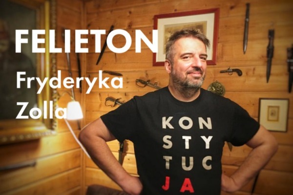
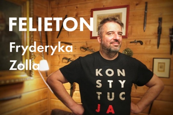
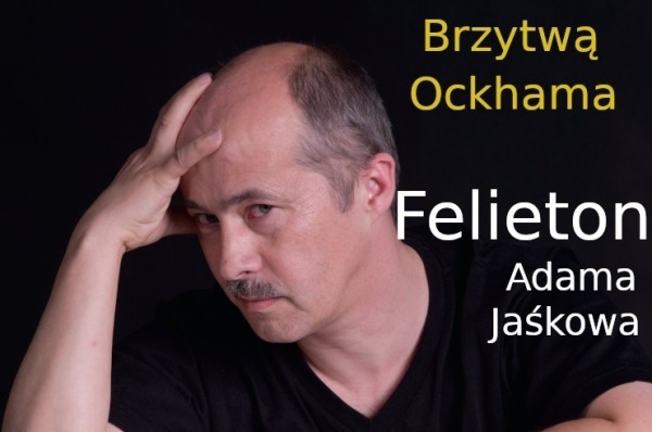
Felieton jest wyrazem opinii autora. Nie prezentuje stanowiska ZR Małopolskie.
OpenStreetMap is a map of the world, created by people like you and free to use under an open license.
OpenStreetMap is a map of the world, created by people like you and free to use under an open license.
OpenStreetMap is a map of the world, created by people like you and free to use under an open license.
1st Time Learning about QGIS and Open Street Map through Digital Mapping Workshop on Palang Merah Indonesia (Indonesian Red Cross), North Jakarta Branch

fauzanulva's Diary | 1st Time Learning Open Street Map | OpenStreetMap
OpenStreetMap is a map of the world, created by people like you and free to use under an open license.OpenStreetMap
OpenStreetMap is a map of the world, created by people like you and free to use under an open license.
Trybunał Konstytucyjny jest jednym z największych problemów państwa prawa. Nie wiadomo, co zrobić z tą instytucją poruszającą się całkowicie poza prawem.
Niedługo jakiś członek tego gremium wyda zarządzenie tymczasowe zakazujące ministrowi Bodnarowi oddychania do czasu, gdy się zbada, czy jego oddychanie jest konstytucyjne.
Trybunał długo nie orzekał. Potem dostał przyspieszenia. Wydaje z siebie rozstrzygnięcia poza wszelkimi standardami, skażony udziałem dublerów i kierowany przez wadliwie wybraną prezes. Pojawiają się postulaty, aby usunąć jedynie dublerów, a wybór Krystyny Pawłowicz i Stanisława Piotrowicza uznać za nielegalny z uwagi na ich wiek. Pomysły te są złe, choć rozhamowana internetowo pani Pawłowicz stale udowadnia, że w żadnym razie sędzią nie jest. Przepis ustawy o Sądzie Najwyższym dotyczący wieku sędziów nie może się stosować do Trybunału Konstytucyjnego, bo sędziowie są tu wybierani na kadencję.
Konieczne jest stwierdzenie, że to, co Konstytucja określa jako Trybunał Konstytucyjny, dzisiaj nie istnieje. Możemy sobie wyobrazić, co by było, gdyby sędziowie TK po prostu uciekli. Konstytucja takiej możliwości nie przewiduje, a przecież coś by trzeba w tej sytuacji zrobić. Obecny stan jest bardzo podobny. Orzekający o wszystkim i o niczym zespół mgr Przyłębskiej – częściowo nieuznający szefowej klubu, chyba że potrzeba polityczna jest akurat inna – nie jest żadnym sądem, co sam zresztą przyznał w jednym ze swoich rozstrzygnięć, kontestując orzeczenia Europejskiego Trybunału Praw Człowieka.
Działanie takiego niby-TK zagraża państwu. Nie zmieni tego stwierdzenie o wadliwym wyborze dublerów. Państwowe finansowanie tego niesądu jest nielegalne. Trzeba się z tym gronem rozstać jak najszybciej, w przeciwnym razie państwo pokaże jedynie swoją śmieszność. Tak, Konstytucja nie reguluje wprost sposobu pozbycia się nowotworowych narośli na systemie prawa. Jeśli jednak się je pozostawi, porządek prawny razem z Konstytucją umrze.
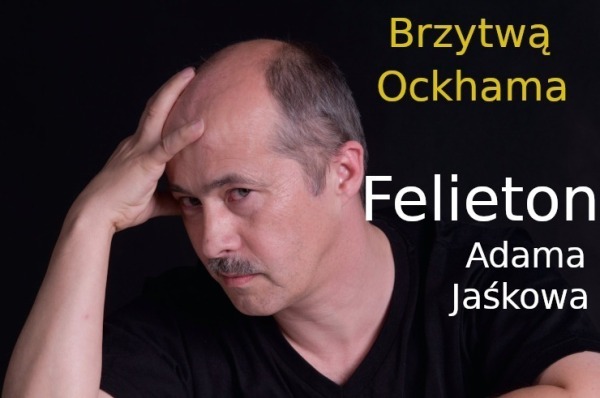
Felieton jest wyrazem opinii autora. Nie prezentuje stanowiska ZR Małopolskie.
OpenStreetMap is a map of the world, created by people like you and free to use under an open license.
OpenStreetMap is a map of the world, created by people like you and free to use under an open license.
EN:
A lot of new mappers are trying to edit existing element instead of creating new one and set properties to them. (For example some new mapper added amenity=pharmacy to whole apartment building insted of creating one node for it.)
Also I think it would be good idea to hide some existing layers for newies (at least boundaries). New mappers do not need to work with them, because they are not changing for a lot.
In iDeditor a lot of times happens that new mapper connect road with forest boundary, because he just moved node on way for a bit and iDeditor connected this 2 elements (This can be prevented by holding Alt, but new mappers do not know this). So we can at least think about layering OSM at least for new mappers.
Also when new mapper is crating new way, which is going in the same direction as some existing way (boundary or forest boundary) he many times connect this new way with existing one.
Proposed layers:
- POI
- buildings, highways, railways
- landcover
- boundaries
SK:
Čím viac sa nad tým zamýšľam, tým viac mi to príde vhodnejšie. Veľa nováčikov sa snaží niečo pridať, lenže väčšinou len upravia existujúce elementy namiesto toho, aby pridali nové. Taktiež si myslím, že by bolo vhodné nováčikom skryť aspoň hranice. V iDeditore sa nováčikom často stáva, že spoja cestu s hranicou lesa (Nevedia, že keď podržia Alt, tak sa im to automaticky nespojí). Takže môžme aspoň pouvažovať nad nejakými vrstvami v OSM.
Navrhované vrstvy:
- POI
- budovy, cesty, železnice
- lesy, lúky, polia …
- hranice
Filip009's Diary | Should we have different layers in OpenStreetMap? | OpenStreetMap
OpenStreetMap is a map of the world, created by people like you and free to use under an open license.OpenStreetMap
Prezydent Duda w długim wywiadzie zapytany o szanse Ukrainy na wojnie odpowiedział, że wierzy w odzyskanie Ługańska i Donbasu, sprawa Krymu natomiast jest bardziej złożona, bo Krym był długo pod kontrolą Rosji.
Rząd postanowił podnieść zasiłek pogrzebowy, i słusznie. Równocześnie jednak powinien uwspółcześnić ustawę o cmentarzach i chowaniu zmarłych, która z niewielkim zmianami obowiązuje od 1959 roku, czyli od epoki wczesnego Gomułki.
OpenStreetMap is a map of the world, created by people like you and free to use under an open license.
OpenStreetMap is a map of the world, created by people like you and free to use under an open license.
Rząd postanowił podnieść zasiłek pogrzebowy, i słusznie. Równocześnie jednak powinien uwspółcześnić ustawę o cmentarzach i chowaniu zmarłych, która z niewielkim zmianami obowiązuje od 1959 roku, czyli od epoki wczesnego Gomułki.
OpenStreetMap is a map of the world, created by people like you and free to use under an open license.
Improving the data within OSM around Beacon, NY and surrounding towns.
Specific road, sidewalk, and bike focus. Improve data about existing buildings and building changes. Improve trail network and information.
Specific road, sidewalk, and bike focus. Improve data about existing buildings and building changes. Improve trail network and information.

scetron's Diary | Thoughts | OpenStreetMap
OpenStreetMap is a map of the world, created by people like you and free to use under an open license.OpenStreetMap
Don't map for render
Don't map for geocoder
Don't map for validator
Don't map for database
Don't map for Overpass
Don't map for editors
Don't map for laws
Don't map for statistics
Don't map for yourself
Don't map! Soon the AI will map it all out.
TrickyFoxy's Diary | DON'T MAP | OpenStreetMap
OpenStreetMap is a map of the world, created by people like you and free to use under an open license.OpenStreetMap
OpenStreetMap is a map of the world, created by people like you and free to use under an open license.
OpenStreetMap is a map of the world, created by people like you and free to use under an open license.
OpenStreetMap is a map of the world, created by people like you and free to use under an open license.
Map often
Map early
Map in the mornings
Map at noon
Map in the evenings
Map late at night
Map from dusk to dawn
Map on weekends
Map daily
Map every day in your heart
Map your town or city!
Map what you like
Map where you go
Map whenever possible
Map who you love
Map obscure and rare tags
Map for yourself
Map for humanitarian causes
Map alone
Map together
Map to your heart's content
Map for Light, Life, Love & Liberty
Map !
Magick93's Diary | MAP | OpenStreetMap
OpenStreetMap is a map of the world, created by people like you and free to use under an open license.OpenStreetMap
OpenStreetMap is a map of the world, created by people like you and free to use under an open license.
OpenStreetMap is a map of the world, created by people like you and free to use under an open license.
Ustawa o sygnalistach: mamy szansę na porządne prawo, a było o włos
https://oko.press/ustawa-o-sygnalistach-mamy-szanse-na-porzadne-prawo-a-bylo-o-wlos
https://oko.press/ustawa-o-sygnalistach-mamy-szanse-na-porzadne-prawo-a-bylo-o-wlos
Po interwencji organizacji pozarządowych rząd wycofał się z procedowania projektu wadliwej ustawy o sygnalistach
OpenStreetMap is a map of the world, created by people like you and free to use under an open license.
OpenStreetMap is a map of the world, created by people like you and free to use under an open license.
OpenStreetMap is a map of the world, created by people like you and free to use under an open license.
My reflection about SotM Africa 2023 held in Yaoundé, Cameroon which focused on the theme “Open Mapping as a support tool for local development in Africa”. The State of the Map Africa (SotM Africa) is a bi-annual regional conference that celebrates the culture of open mapping, open data, GIS and its impact across Africa. It was a great opportunity for mappers, GIS & Open Mapping enthusiasts, data users, and other stakeholders in the OpenStreetMap community to come together, share knowledge, and collaborate on projects.
• Presentations and workshops: The variety of presentations on topics related to OpenStreetMap, and GIS such as Field mapping techniques, data analysis, and community building. I learned about new tools, methods, and techniques, and also gained insights into the challenges and opportunities facing OpenStreetMap in Africa and how we can collaborate together to develop and solve Open Mapping & Data challenges in Africa.
• Networking: The conference offered a great opportunity to meet with other people from other part of Africa & world, who are passionate about OpenStreetMap. I was opportune to make new friends, (the Likes of Kennedy, Yves Emmanuel, Charles, Emmanuel, Janet, and the OSM Cameroon team), established professional connections, or found collaborators for future projects
• Cultural and social Night experiences: The conference was also a chance for me to experience the Cameroonian culture especially during the social night event seeing different culture, dancing steps etc., I enjoyed the hospitality offered, local food, music, and dance, and learned more about the history and traditions of Cameroon.
My Appreciation goes to SotM Africa 2023 Scholarship team, Humanitarian OpenStreetMap (HOTOSM), OSM Africa, WNA Hub, ESA Hub, and other Donors for their support to the success of this remarkable event, indeed SotM Africa 2023 was a valuable and enriching experience for me. It provided an opportunity for me to learn, network, and contribute to my local community and the OpenStreetMap community.

Dannyoung's Diary | MY EXPERIENCE AND LESSON LEARNT AT THE SOTM AFRICA 2023. | OpenStreetMap
OpenStreetMap is a map of the world, created by people like you and free to use under an open license.OpenStreetMap
OpenStreetMap is a map of the world, created by people like you and free to use under an open license.
[HOT] HOT CommunityWG x Tech&InnovationWG Communications Skillshare Series - what a blast to start the year!![arnalielsewhere's Diary | [HOT] HOT CommunityWG x Tech&InnovationWG Communications Skillshare Series - what a blast to start the year! | OpenStreetMap](https://soc.citizen4.eu/photo/preview/600/1732192)
![arnalielsewhere's Diary | [HOT] HOT CommunityWG x Tech&InnovationWG Communications Skillshare Series - what a blast to start the year! | OpenStreetMap](https://soc.citizen4.eu/photo/preview/600/1732192)
arnalielsewhere's Diary | [HOT] HOT CommunityWG x Tech&InnovationWG Communications Skillshare Series - what a blast to start the year! | OpenStreetMap
OpenStreetMap is a map of the world, created by people like you and free to use under an open license.OpenStreetMap
OpenStreetMap is a map of the world, created by people like you and free to use under an open license.
OpenStreetMap is a map of the world, created by people like you and free to use under an open license.
OpenStreetMap is a map of the world, created by people like you and free to use under an open license.
OpenStreetMap is a map of the world, created by people like you and free to use under an open license.
OpenStreetMap is a map of the world, created by people like you and free to use under an open license.
OpenStreetMap is a map of the world, created by people like you and free to use under an open license.
OpenStreetMap is a map of the world, created by people like you and free to use under an open license.
Punjab Safe Cities Authority Lahore, Punjab, Pakistan
OpenStreetMap is a map of the world, created by people like you and free to use under an open license.
OpenStreetMap is a map of the world, created by people like you and free to use under an open license.
This weekend I started mapping the east-of-Gillham part of 43rd St in KC. I went from Gillham to just past 71 on Saturday, and further east to Indiana on Sunday.
Pedestrian-safety observation: The crossings on either side of Gillham Park are The Worst. You can go way up or down and find a crosswalk with a light, or you can take your chances running across both-way car traffic and then both-way bike traffic without much visibility. For this entire stretch of road (and most of my outdoor activities around KC) I wear bright dae-glo jackets. I call it protective coloring.
There wasn’t much to map in this area as it was mostly homes. I crossed the bridge over Highway 71 and found a few benches and a bookcase that was locked. I mapped these, but I do not think they are being maintained anymore. There was a defunct church nearby that I think they were part of. I took photos of the various tags on the bridge and the view looking down on the highway while crossing - cool and fun for me, but not necessarily mapping-related. I also photographed a few tags painted on walls, but nothing quite rose to the level of a mural.
On Sunday I brought Mom out with me, and she made a valiant effort to keep up with the up-and-downhill walking, but we ended up quitting a bit early as she was exhausted. We didn’t have much to map until around Indiana St where we found a little strip mall with a convenience store and hairdresser. I showed her how I map the amenities around the outside such as the trash can, standing ashtray (or trashcan for cigarettes, as translated for OSM’s tagging system), the compressed air machine and attached vacuum. She had been tired from walking but perked up and urged me to also map the UHaul pickup/drop-off location. On the way back to where we parked, I also found a roadside memorial for someone who died in an accident. I had trouble deciding how to map this, as I felt it should be mapped but it was not a “cross” - it seemed instead to be centered around a solar light - so I was not sure the best way to tag it. Advice is welcome!

PhoebeSM's Diary | 43rd from Gillham Park to Indiana | OpenStreetMap
OpenStreetMap is a map of the world, created by people like you and free to use under an open license.OpenStreetMap

![arnalielsewhere's Diary | [HOT] Call for Volunteer: CommunityWG Co-chairperson for 09:00 UTC / Early session | OpenStreetMap](https://soc.citizen4.eu/photo/preview/600/1732023)
Enkiusz🇺🇦
•MiKlo:~/citizen4.eu$💙💛
"Unii chodziło przede wszystkim, by sygnaliści zgłaszali się do swoich organizacji – po to, by mogły one korygować swoje działanie. I by chciały tworzyć warunki do przyjmowania zgłoszeń od sygnalistów w sposób dla nich bezpieczny."
To założenie faktycznie jest dosyć naiwne kiedy w grę wchodzą przestępstwa które dzieją się za wiedzą/zgodą/w interesie kierownictwa jakiejś organizacji.
Ale może dałoby się tak ukształtować procedury, żeby takie zgłoszenie wewnętrzne, oprócz gwarancji anonimowości zgłaszającego, było gdzieś od razu automatycznie rejestrowane wyżej (w "zamkniętej cyfrowo" kopercie), na zasadzie, że jeśli w określonym czasie zgłaszający nie potwierdzi podjęcia działań w ramach organizacji to wtedy sprawa zostaje podniesiona z urzędu na podstawie tego zgłoszenia.
Tyle, że wielu nieprawidłowości nie da się zgłosić wewnętrznie bez ujawniania, kto jest zgłaszającym. Bo to często wynika bezpośrednio z kontekstu sprawy, nawet jak zgłoszenie będzie anonimowe.
A ochrona sygnalisty (działającego w dobrej wierze) to jest w tym wszystkim najtrudniejszy problem.
Najsłynniejszy sygnalista świata nie dostał od żadnego rządu państw UE jakiegokolwiek wsparcia kiedy tego potrzebował.
Tutaj będzie tak samo - jak ew ujawnione tajemnice będą naruszać wielkie interesy (finansowe,polityczne) to jakiekolwiek gwarancje będą fikcją.
Enkiusz🇺🇦
•