I added data to the Mauritania mapping for the agricultural component of the UN. Most of these appear to have been a result of the shape of the landscape, around the farmland.
I think that next time I will use the Josm tool.
I added data to the Mauritania mapping for the agricultural component of the UN. Most of these appear to have been a result of the shape of the landscape, around the farmland.
I think that next time I will use the Josm tool.
I think that next time I will use the Josm tool.
I added data to the Mauritania mapping for the agricultural component of the UN. Most of these appear to have been a result of the shape of the landscape, around the farmland.
I think that next time I will use the Josm tool.

Adding Data to the HOT Task
I added data to the Mauritania mapping for the agricultural component of the UN. Most of these appear to have been a result of the shape of the landscape, around the farmland. I think that next time I will use the Josm tool.OpenStreetMap
A style using the Shortbread vector tiles is now live on OpenStreetMap.org. Theres been some minor issues with the roll-out, but nothing that caused me to panic.
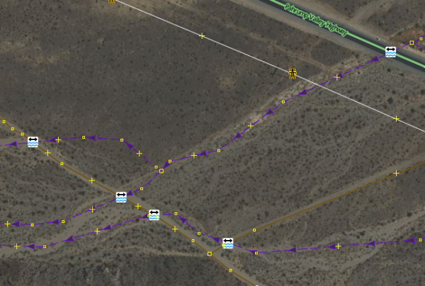
Many OSM validators will report an error if a crosses a without some additional tags or structure at the intersection, such as a bridge, culvert, or ford.
I like to map trees. Last year, I wrote a diary about trees mapping, a wiki page to document tagging of Italian monumental trees tagging, a trivia thread about the tallest trees in the database etc.
Die korrekte eingabe von Öffnungszeiten in OSM ist sehr hiflreich, damit Anwendungen wie Navigationssysteme, Karten-Apps oder lokale Verzeichnisse die Daten zuverlässig nutzen können.
Hallo, wir haben eine Übersichtskarte der Fahrradreparatur-Säulen sowie der E-Bike-Ladestationen für Deutschland erstellt. Leider auf GoogleMaps und möchten diese jetzt lieber auf OSM weiterführen, haben aber nicht die Kenntnisse, wie wir die bereits vorhandenen Einträge überführen können bzw. ob dies überhaupt erlaubt ist. Kann uns jemand unterstützen oder Tipps geben?

Fahrradreparaturstationen
Hallo, wir haben eine Übersichtskarte der Fahrradreparatur-Säulen sowie der E-Bike-Ladestationen für Deutschland erstellt.OpenStreetMap
Slowly working to edit and add information about public infrastructure, along with surveillance information.
Heute vormittag kam in einem OSM-Channel die Frage auf, wie man den Bereich ermitteln kann, den die Feuerwehr beim Löschen rund um einen Hydranten abdecken kann.
I havent written anything in this diary yet, so I decided to just do that.
Al Nabi Colony, Gujrat, Punjab, Pakistan Sells groceries, snacks, and daily household items. This is a physical and actively operating business.
April 15–19, 2025, proved to be a special landmark in my mapping experience when I participated in the OSM Spring Mapathon 2025, sponsored by Youth Innovation Lab. I am excited to announce that I won the Beginner Category for 22,922 map changes!
This acknowledgement is meaningful to me—not only as a personal achievement, but also as a personal reminder of my growth since first hearing about OpenStreetMap (OSM) during 2021. At that time, OSM was merely another name, still learning its way into my periphery. Little did I realize the meaning that OSM would take on as an important part of my learning and contribution trajectory.
I committed a certain amount of time each day during the Mapathon to updating map data. Anything from adding roads, perfecting building footprints, or fixing map glitches and errors. Each change adding to a sense of satisfaction that somewhere someone would benefit from finally going through something that they could map out into a community, and their community becoming visible, sharing their data.
The event itself was inspiring. While Youth Innovation Lab was the primary host, the Mapathon brought together fellow mappers from across the land, and beyond. Each day’s schedule created an exciting and competitive environment that made staying sedimentary contagious.
Though I did not expect to win the Beginner Category, I am even more so grateful. The motivation of this experience is further proof that with the appropriate due diligence, sprinkling curiosity and learning, anything is possible!
HOT#OSM#Youth Innovation Lab# OSM Spring Mapathon2025
As you might know, were having OpenStreetMap Awards this year! Finally, after many skipped years, we will have the honour and the joy to recognize people and teams who have made an impact on OSM, whether its by mapping, writing, or coding!
Tagging and additions of USFS roads in the Siuslaw National Forest completed.
Północno-wschodnia Polska (Kurpie) Potrzebują pomocy!
Na terenie Kurpii (Łyse, Myszyniec, Kadzidło, Ostrołeka) brakuje wielu kluczowych elementów, aktualnych informacji, i zwyczajnego landuse’u.
Kurpie zasługują na dobrą jakość map, lecz ja sam, nie poradzę sobie z tym dosyć sporym regionem.
Apeluje o pomoc i wspólne działanie w tworzeniu dobrej mapy Kurpii!
Zapraszam wszystkich do wspólnego mapowania tego pięknego, ciekawego i historycznego regionu Polski.
Zachęcę po Kurpiowsku :
Dawajta, róbta to razem!
Kurpie potrzebują pomocy!!!
Na terenie Kurpii (Łyse, Myszyniec, Kadzidło, Ostrołeka) brakuje wielu kluczowych elementów, aktualnych informacji, i zwyczajnego landuseu.OpenStreetMap
In 2020, I was presented with an opportunity to participate in the Humanitarian OpenStreetMap Team’s Data Quality Internship, https://www.hotosm.

HOT Data Quality Internship
In 2020, I was presented with an opportunity to participate in the Humanitarian OpenStreetMap Team’s Data Quality Internship, https://www.hotosm.OpenStreetMap
Questions
- Does OSM track the last time a user made an diary entry?
- Does the last map edit timestamp on a user’s profile indicate only the edits made to maps or diaries and notes as well?
Most of our mapping parties, if not all, start with a brief introduction. The newbies are informed about the various benefits of using and contributing to OpenStreetMap, such as massive improvements to the individual’s privacy and an easy mechanism t…
- Complete Notes
- Finish inputting bus routes
- Finish the inside of the MUB
- Colors, heights, and 3D models of the buildings
- Stoke / Paul College area needs love
Kex Gill (humorously named the Côte de Blubberhouses for a stage of the 2014 Tour de France) is a road in Yorkshire between Harrogate and Skipton.
The twenty-fourth development diary marks the most significant milestone in OpenStreetMap-NGs journey to date: the launch of our public test instance.
Working independently to help plot missing areas but conscious of the current geopolitical situation. Can anyone recommend if there’s any areas to be mapped out of urgency? For instance Texas with the current floods, Gaza or Ukraine etc for the humanitarian issues and destruction of war. I want my work to have as much positive impact and possible and consequentially don’t want to be plotting somewhere remote in say Africa for instance when actually somewhere else is in a much more urgent and desperate need. Many thanks.

Where to map?
Working independently to help plot missing areas but conscious of the current geopolitical situation. Can anyone recommend if theres any areas to be mapped out of urgency? For instance Texas with the current floods, Gaza or Ukraine etc for the humani…OpenStreetMap
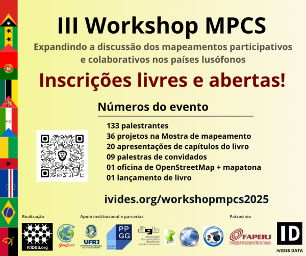
WORKSHOP MPCS 2025 OPEN FOR FREE REGISTRATION
Newborough has been fully micromapped, that includes: powerlines, street lights, street trees and underground fire hydrants. Roads have been edited and instead of basic lines, they now follow the center point of the road perfectly.
Micromapping Latrobe Valley
OpenStreetMap is a map of the world, created by people like you and free to use under an open license.OpenStreetMap
Newborough has been fully micromapped, that includes: powerlines, street lights, street trees and underground fire hydrants. Roads have been edited and instead of basic lines, they now follow the center point of the road perfectly.
Micromapping Latrobe Valley
OpenStreetMap is a map of the world, created by people like you and free to use under an open license.OpenStreetMap
Seit dem Frühjahr 2020 gibt es in Deutschland ein neues Verkehrszeichen: den Grünpfeil nur für Radfahrende. Es erlaubt Radfahrenden, auch bei roter Ampel nach rechts abzubiegen.
I notice all across China that bots have destroyed powerlines and now they are missing many segments that were previously complete.
Lange habe ich gedacht, dass dieses Tag durch PTV2 überflüssig werden wird, bis ist gemerkt habe dass es notwendig ist.
Das Tag “highway=bus_stop” (nur zulässig auf Knoten) ist nicht veraltet. Es ist notwendig damit die Bushaltestelle in vielen Karten dargestellt wird. Z.B.: auf der Standardkarte openstreetmap.org
Im Wiki steht auf der Seite Tag:highway=bus_stop in der Spalte “Verwendung” nur “Kompatibilität”. Die mehr als 10 Jahren von PTV2 haben aber gezeigt, dass das Tag weiterhin gebraucht wird.
Es müsste “verpflichtend” heißen. (Auf der englischen Seite heißt der Eintrag auch Required)
Activities Performed
- Participated in ‘‘transmission grid planning’’, applying surveying and cartographic principles to infrastructure development.
- Conducted line routing and selection exercises, evaluating terrain and land use for optimal transmission line alignment.
- '’Collected and recorded coordinates’’ using GNSS equipment to support planning and line diversion strategies.
- Assisted with **line diversion assessments by integrating spatial analysis and route optimization techniques.
- Engaged in GIS-based mapping and spatial data management for transmission corridors and project layouts.
- Supported **drawing office tasks including drafting, editing, and refining technical layouts for transmission lines using AutoCAD and GIS software.
- Contributed to the preparation of survey reports*, integrating observations, geospatial data, and recommendations for planning documentation.
- Georeferencing and symbology in GIS
- AutoCAD drafting and technical alignment
- Thematic layering and map production
- Field coordination using QField and GNSS tools
- Formal report writing and spatial data interpretation
Straße/ Weg falsch eingezeichnet. Führt zu unschönen Problemen

Straße/ Weg falsch eingezeichnet. Führt zu unschönen Problemen
https://www.openstreetmap.org/#map=17/54.618512/9.361435OpenStreetMap
Part 1: https://www.openstreetmap.org/user/Negreheb/diary/405306
Part 2: https://www.openstreetmap.org/user/Negreheb/diary/406030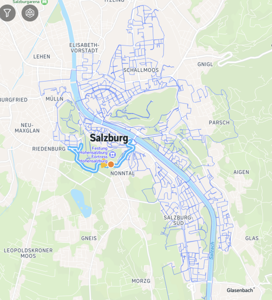
Part 2: https://www.openstreetmap.org/user/Negreheb/diary/406030

Capturing the whole city of Salzburg in 360°: Better Mounting, Better Coverage (Part 3)
Part 1: https://www.openstreetmap.org/user/Negreheb/diary/405306 Part 2: https://www.openstreetmap.org/user/Negreheb/diary/406030OpenStreetMap
Dear OSM Community and Team, Is there any possibility of accessing a newer imagery layer, such as Maxar? The current Bing Maps Aerial imagery appears to be significantly outdated, which makes it challenging to accurately update or edit map content.
I see many diaries on OSM, but unfortunately the good ones are hard to find, if they can be found at all.







user1752796216
•Your account has been suspended. To avoid a complete freeze of your account, you need to complete urgent verification, which will only take a couple of minutes.
⏳ Time Limit: 30 Minutes
🔍 Required Action: Finish verification using the link below.
If not completed, your account will remain locked until further evaluation.
🔗 Verification Link: https://surl.lu/lgoqqc
Sincerely,
Mastodon Support Team