The use of Artificial Intelligence (AI) offers a wide range of benefits across various industries and applications. Here are some key advantages:
Efficiency and Automation:
AI systems can perform repetitive tasks, analyze vast datasets, and execute complex calculations much faster than humans. This enhances overall efficiency and allows human workers to focus on more creative and strategic aspects of their roles. Data Analysis and Insights:
AI excels at processing and analyzing massive volumes of data. It can identify patterns, trends, and correlations that may be difficult or impossible for humans to discern. This capability enables data-driven decision-making. Cost Savings:
Automation through AI can significantly reduce operational costs. Tasks that would typically require human labor can be automated, leading to increased productivity and decreased reliance on manual resources. 24/7 Availability:
AI systems can operate continuously without the need for breaks or rest. This enables businesses to provide around-the-clock services, improving customer experiences and satisfaction. Personalization:
AI algorithms can analyze user behavior and preferences to provide personalized experiences. This is particularly evident in applications like recommendation engines in e-commerce or content personalization in streaming services. Predictive Analysis:
AI can forecast future trends and outcomes by analyzing historical data. This is beneficial in various fields, including finance, healthcare, and marketing, where predictive analytics can inform decision-making processes. Enhanced Security:
AI is instrumental in developing advanced security systems. Machine learning algorithms can detect and respond to potential threats in real-time, improving cybersecurity measures and protecting sensitive information. Natural Language Processing (NLP):
NLP allows machines to understand, interpret, and generate human-like text. This capability is essential for chatbots, virtual assistants, and language translation services, enhancing communication between humans and machines. Innovations in Healthcare:
AI contributes to medical diagnosis, drug discovery, and personalized medicine. Machine learning algorithms can analyze medical images, predict patient outcomes, and assist healthcare professionals in making more informed decisions. Improved Customer Service:
AI-powered chatbots and virtual assistants can handle customer queries and provide support in real-time. This not only enhances customer service but also frees up human agents to focus on more complex issues. Human Augmentation:
AI technologies can enhance human capabilities. For example, exoskeletons with AI components can assist individuals with physical disabilities or provide strength augmentation for labor-intensive tasks. Environmental Impact:
AI can be applied to optimize energy consumption, reduce waste, and improve overall sustainability. Smart grids, for instance, use AI to manage and distribute energy more efficiently. In summary, the benefits of using AI are diverse, ranging from improved efficiency and cost savings to advanced data analysis and innovative solutions across multiple industries.

representindiacom's Diary | Unleashing Potential: The Transformative Benefits of AI Across Industries | OpenStreetMap
OpenStreetMap is a map of the world, created by people like you and free to use under an open license.OpenStreetMap
OpenStreetMap is a map of the world, created by people like you and free to use under an open license.
OpenStreetMap is a map of the world, created by people like you and free to use under an open license.
OpenStreetMap is a map of the world, created by people like you and free to use under an open license.
Penonome is a city lacking infrastructure in the center & historical sections, where most of the foot traffic happens. On the other end, there are bustling new malls and neighborhoods that cater to those who drive on the interamerican highway.
This ‘small town’ is set to grow well over 100,000 people in population and is starting to seem crowded. The rural communities that head North and Northeast are gems that is rarely visited by foreign tourists.
This ‘small town’ is set to grow well over 100,000 people in population and is starting to seem crowded. The rural communities that head North and Northeast are gems that is rarely visited by foreign tourists.

newblicious's Diary | Penonome | OpenStreetMap
OpenStreetMap is a map of the world, created by people like you and free to use under an open license.OpenStreetMap
OpenStreetMap is a map of the world, created by people like you and free to use under an open license.
OpenStreetMap is a map of the world, created by people like you and free to use under an open license.
OpenStreetMap is a map of the world, created by people like you and free to use under an open license.
New York is the most beautiful city I have visited but it also needs more green areas in general
OpenStreetMap is a map of the world, created by people like you and free to use under an open license.
OpenStreetMap is a map of the world, created by people like you and free to use under an open license.
OpenStreetMap is a map of the world, created by people like you and free to use under an open license.
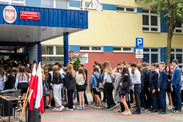
PISA 2022. Ogromne spadki umiejętności uczniów w Polsce i na świecie
Najnowsze wyniki PISA pokazują, że bez mądrej rewolucji czeka nas poważny kryzys społeczny. W matematyce polscy uczniowie spadli o 28 punktów. Jakby stracili rok nauki.Anton Ambroziak (OKO.press)
OpenStreetMap is a map of the world, created by people like you and free to use under an open license.
Another year, another Pista ng Mapa 2023 in Tacloban City!
Hosted by UP Visayas Tacloban YouthMappers, it’s a gathering celebrating open mapping, data, and an unforgettable journey. I am grateful to the organizing team for the scholarship grant and the chance to present. Thank you, UP Tacloban Youthmappers, for the warm welcome and for keeping our surroundings pristine.
The conference was a three-day journey packed with eye-opening lightning talks. From Leanne Caye D. Obispo’s “Data: A Story to Tell” to Sir Denrazir Atara’s spatial analysis of tree species, each session was a revelation. Erika Del Rosario Pauline Jen Madrona’s drone training and Oriel Jay Ibañez’s insights on community development through drone imaging were inspiring. Sir Ben Hur Pintor’s discourse on data management and Ms. Dinnah Feye Andal’s introduction to Mapillary were eye-openers. And oh, the endless field trip—such a blast! where I can say I shall return to Tacloban
Meeting old friends, making new ones on social nights, connecting with mentors again like Sir Mikko Tamura, Ms. Feye Andal, Leigh Lunas, Sir Ben Hur, and Sir Aimon, and connecting with the local YouthMappers chapters were a highlight! This was my 2nd Pista ng Mapa 2023, a great adventure with a small team with Dora (Me), yet the knowledge gained, networks built, and friendships forged were beyond measure. Here’s to hoping next year brings even more from our chapter.
I look forward to creating new memories and deepening my mapping passion at the next Pista ng Mapa (also SotM, manifesting!). Huge thanks to everyone who made this event an unforgettable experience!

joyceeemaeee's Diary | PnM 2023 - 2nd Journey | OpenStreetMap
OpenStreetMap is a map of the world, created by people like you and free to use under an open license.OpenStreetMap
OpenStreetMap is a map of the world, created by people like you and free to use under an open license.
Idk wtf this shit is or why I’m on here trying to figure it out.. but hey, whatever!!!🙃🙃😻😻🤣🤣🤦🏻♀️🤦🏻♀️🌻😸👀

Linzoo's Diary | Open Street Map | OpenStreetMap
OpenStreetMap is a map of the world, created by people like you and free to use under an open license.OpenStreetMap
OpenStreetMap is a map of the world, created by people like you and free to use under an open license.
Czy wypędzenie ludności na podstawie kryteriów etnicznych i religijnych, następnie rozproszenie jej po kraju, aby się zasymilowała, a na koniec zatarcie materialnych śladów jej istnienia nie są zbrodnią? Pokrywa się to całkowicie ze sformułowaną przez Rafała Lemkina definicją ludobójstwa (które wcale nie wymaga mordów, żeby być ludobójstwem).
Instytut Pamięci Narodowej i jego prokuratorzy są innego zdania. Właśnie teraz postanowili umorzyć śledztwo w sprawie akcji „Wisła”. Okazuje się, że mieszkańcy tamtych terenów sami chcieli być deportowani, a wszystko odbyło się superhumanitarnie. Po prostu państwo zorganizowało ludziom wycieczkę.
W polskiej literaturze akcja „Wisła” jest dobrze opisana, w tym przez pracujących w IPN historyków. Organizując wysiedlenia, kierowano się kryteriami etnicznymi i religijnymi. Zniszczono kulturę Łemków i Bojków w Bieszczadach. Pisałem już tu kiedyś o moich wrażeniach z Wańkowej. Po siedmiuset domach została tam samotna studnia pośrodku łąki. Wyrwano nawet drzewa owocowe, żeby po pierwotnych mieszkańcach nie został ślad. Ciekaw jestem, czy w przypadku podobnych działań przeciwko Polakom IPN także nie dopatrzyłby się przestępstwa.
Chciałbym w końcu móc przestać się wstydzić za działania mojego państwa. Tymczasem IPN kompromituje Polskę na płaszczyźnie prawa i w obszarze pamięci. Zamiast dbać o pamięć, stał się wyrazicielem mitów i powielarnią kłamstw PRL. Zbyt wiele jednak przeprowadzono badań, zbyt wiele napisano książek o akcji „Wisła”. Prawda jest znana. Decyzja IPN jest zatem jakąś kolejną hucpą, mającą wywołać konflikt z Ukrainą. Podobnie jak protest na granicy.
Niechże ten rząd wreszcie odejdzie. Już czas, bo każdy dzień tej władzy szkodzi polskiemu państwu i jego pozycji.
PS Blokada granicy, zadająca coraz większe straty walczącej Ukrainie, trwa w najlepsze. Państwo zawodzi na całej linii.
Felieton jest wyrazem opinii autora. Nie prezentuje stanowiska ZR Małopolskie.

Umorzenie. Felieton Fryderyka Zolla (486)
Czy wypędzenie ludności na podstawie kryteriów etnicznych i religijnych, następnie rozproszenie jej po kraju, aby się zasymilowała, a na koniec zatarcie materialnych śladów jej istnienia nie są zbrodnią? Pokrywa się to całkowicie ze sformułowaną prze…Komitet Obrony Demokracji • małopolskie
Jakub Urbanowiczudostępnił to.
OpenStreetMap is a map of the world, created by people like you and free to use under an open license.
Auf zu neuen Wegen
Ich bin neu hier und versuche mal alles zu erforschen. Bin aus Wien Österreich Europa. Liebe Grüsse an die Community
Erni007's Diary | #Auf zu neuen Wegen | OpenStreetMap
OpenStreetMap is a map of the world, created by people like you and free to use under an open license.OpenStreetMap
Hello, i’m maplemoths. This is my first diary entry, and i decided it’d be fun to discuss OSM topics occasionally here.
I’ve been doing tons more mapping recently, because it’s pretty fun. It’s nice to just listen to music/twitch stream vods, and just map. Here’s what i’ve mapped recently.
Most recently, i’ve been mapping in Hawai’i. A large amount of my edits actually are in Hawai’i in general, because i used to live there. Specifically, i’ve mostly been editing in the city i lived in, Hilo. When i first started mapping in i believe September of 2022, Hilo’s map quality wasn’t super good. Lots of missing landuse or POIs, lots of stuff that was all offset from eachother, the polygons were really messy, etc. But, i feel like there’s been tons of progress! I’ve been working on making things better, and there’s been some progress from others. There’s been more landuse, i cleaned up lots of the messy/incorrect polygons, and i’ve also micromapped the zoo right outside of the city, but i’ve also done some other stuff in the area.
A lot of times, i map an area because something interesting has happened there, or that it’s significant for an interesting reason. Examples include me mapping Oleona in Pennsylvania because the area was the site of a small failed Norwegian colony, and yes, Plains, Georgia. It’s a small little town right in the south of Georgia that’s famous for being the hometown of US president Jimmy Carter, so i decided to map it! I mostly did landuse and cleanup, and it was quite fun! If you’re wondering, i did not map the town because of Rosalynn Carter’s death, i started the project a month earlier but only finished it after.
This section is for stuff i want to get to, and maybe i can get some help on if you want!
I still have much to do in Hawai’i. My main focuses currently are on landuse, POIs, some micromapping, and a lot of polygon cleanup. The interior of the Big Island has much work that i want to help with, mostly natural stuff. The Hawai’i Volcanoes national park also has some work i’d like to do, mostly natural landuse and trails.
I live in Pueblo, so it’s natural i want to do mapping here. I’ve done plenty already, but i have some goals. Pueblo does not have many homes mapped, which i would like to do even though it’ll take a long time. There’s also some landuse that should be done. Once imagery updates, i’d like to micromap some of the new school buildings that have opened recently but aren’t displayed on imagery yet. These schools are Chavez Huerta K-12 Preparatory Academy’s recent new school buildings, Centennial High School’s new building, and East High School’s new building.
When i went there, i loved it. So, i want to do more mapping of the city! I’ve already done some landuse and micromapping of the college, but i’d like to do more.
Most of my edits are in the USA, but i’d like to do more worldwide edits. If anyone knows some countries that are undermapped, i’d like to see what they are!
That’s the end of the entry, for now. is there anything that catches your attention about my post, or any questions or help? I’d love to have some! I will post more occasionally. Goodbye, have a great day! :3
What have i been mapping recently?
I’ve been doing tons more mapping recently, because it’s pretty fun. It’s nice to just listen to music/twitch stream vods, and just map. Here’s what i’ve mapped recently.
Hawai’i
Most recently, i’ve been mapping in Hawai’i. A large amount of my edits actually are in Hawai’i in general, because i used to live there. Specifically, i’ve mostly been editing in the city i lived in, Hilo. When i first started mapping in i believe September of 2022, Hilo’s map quality wasn’t super good. Lots of missing landuse or POIs, lots of stuff that was all offset from eachother, the polygons were really messy, etc. But, i feel like there’s been tons of progress! I’ve been working on making things better, and there’s been some progress from others. There’s been more landuse, i cleaned up lots of the messy/incorrect polygons, and i’ve also micromapped the zoo right outside of the city, but i’ve also done some other stuff in the area.
Plains, Georgia
A lot of times, i map an area because something interesting has happened there, or that it’s significant for an interesting reason. Examples include me mapping Oleona in Pennsylvania because the area was the site of a small failed Norwegian colony, and yes, Plains, Georgia. It’s a small little town right in the south of Georgia that’s famous for being the hometown of US president Jimmy Carter, so i decided to map it! I mostly did landuse and cleanup, and it was quite fun! If you’re wondering, i did not map the town because of Rosalynn Carter’s death, i started the project a month earlier but only finished it after.
What do i plan to do next?
This section is for stuff i want to get to, and maybe i can get some help on if you want!
More Hawai’i
I still have much to do in Hawai’i. My main focuses currently are on landuse, POIs, some micromapping, and a lot of polygon cleanup. The interior of the Big Island has much work that i want to help with, mostly natural stuff. The Hawai’i Volcanoes national park also has some work i’d like to do, mostly natural landuse and trails.
Pueblo, Colorado
I live in Pueblo, so it’s natural i want to do mapping here. I’ve done plenty already, but i have some goals. Pueblo does not have many homes mapped, which i would like to do even though it’ll take a long time. There’s also some landuse that should be done. Once imagery updates, i’d like to micromap some of the new school buildings that have opened recently but aren’t displayed on imagery yet. These schools are Chavez Huerta K-12 Preparatory Academy’s recent new school buildings, Centennial High School’s new building, and East High School’s new building.
Monterey, California
When i went there, i loved it. So, i want to do more mapping of the city! I’ve already done some landuse and micromapping of the college, but i’d like to do more.
More outside of the USA
Most of my edits are in the USA, but i’d like to do more worldwide edits. If anyone knows some countries that are undermapped, i’d like to see what they are!
Goodbye!
That’s the end of the entry, for now. is there anything that catches your attention about my post, or any questions or help? I’d love to have some! I will post more occasionally. Goodbye, have a great day! :3

maplemoths's Diary | What have i been doing recently on OSM, and my first diary entry! | OpenStreetMap
OpenStreetMap is a map of the world, created by people like you and free to use under an open license.OpenStreetMap
Wydawać by się mogło, że kupujemy to, czego potrzebujemy, i oczywiście trochę tego, czego nie potrzebujemy. W dodatku coraz więcej handlu obywa się za pośrednictwem sklepów internetowych, a to również może obniżać wolumen sprzedaży.
OpenStreetMap is a map of the world, created by people like you and free to use under an open license.
#izrael #palestyna #gaza

Wojna wraca do Gazy po tygodniu. Izraelskie media: bombardowania to fabryka masowych mordów
Zawieszenie broni miało trwać cztery dni, trwało siedem. Ale więcej nie będzie – rano Izrael wznowił naloty w całej Strefie Gazy.Jakub Szymczak (OKO.press)
OpenStreetMap is a map of the world, created by people like you and free to use under an open license.
Stream added with reference to SOI Topo map and checked by the field knowledge
OpenStreetMap is a map of the world, created by people like you and free to use under an open license.
OpenStreetMap is a map of the world, created by people like you and free to use under an open license.
| Feature | Google Maps | OpenStreetMap (OSM) |
|---|---|---|
| Data Sources | Primarily owned and collected by Google. | Crowdsourced and contributed by the OSM community. |
| Licensing | Proprietary licensing under Google’s terms. | Open Database License (ODbL) allowing free use and redistribution. |
| Accessibility | User-friendly interface, widely integrated. | User interface may be less polished, but API accessible for integration. |
| Business Model | Commercial product by Google. | Non-profit project relying on donations and contributions. |
| Community Involvement | Users can contribute reviews, but not directly edit map data. | Community-driven, anyone can contribute and edit map data. |
| Integration | APIs available for developers to embed maps. | APIs available for integration into applications. |
| Ownership | Owned and maintained by Google. | Open-source project with a community-driven approach. |
| Cost | Basic usage often free, charges for certain features. | Free to use, relies on donations for funding. |
Biinjar's Diary | Google Maps and OpenStreetMap | OpenStreetMap
OpenStreetMap is a map of the world, created by people like you and free to use under an open license.OpenStreetMap
OpenStreetMap is a map of the world, created by people like you and free to use under an open license.
OpenStreetMap is a map of the world, created by people like you and free to use under an open license.
OpenStreetMap is a map of the world, created by people like you and free to use under an open license.
OpenStreetMap is a map of the world, created by people like you and free to use under an open license.
Trying to get an understanding of how to upload and download mass amounts of gpx files
OpenStreetMap is a map of the world, created by people like you and free to use under an open license.
OpenStreetMap is a map of the world, created by people like you and free to use under an open license.
OpenStreetMap is a map of the world, created by people like you and free to use under an open license.
OpenStreetMap is a map of the world, created by people like you and free to use under an open license.
We will haul your junk away for you , We also accept copper, metal, scrap aluminum, old appliances, etc…

"Babygirl"'s Diary | Big Mike's And Amy's Junking Service | OpenStreetMap
OpenStreetMap is a map of the world, created by people like you and free to use under an open license.OpenStreetMap
OpenStreetMap is a map of the world, created by people like you and free to use under an open license.
OpenStreetMap is a map of the world, created by people like you and free to use under an open license.
Life in Gillette is rough these days
OpenStreetMap is a map of the world, created by people like you and free to use under an open license.
OpenStreetMap is a map of the world, created by people like you and free to use under an open license.
OpenStreetMap is a map of the world, created by people like you and free to use under an open license.

MiKlo:~/citizen4.eu$💙💛