im a new user and i was able to download a first map in pdf, however i change to transport map as i want a clean version of my map to edit on illustrator and i cant download. might use some tutorial or any help is highly appreciated
الأفياش والمفاتيح الكهربائية من Green Home

links22's Diary | الأفياش والمفاتيح الكهربائية من Green Home
https://store.greenhome-sa.com/arOpenStreetMap
Im Lebacher Stadtteil Thalexweiler und auf seinem Bann sind 19 Wegekreuze erhalten geblieben (http://overpass-turbo.eu/s/1Pkr), von denen 2 aus dem 18. Jahrhundert Aufnahme in der Denkmalliste gefunden haben.

TBesse's Diary | Historische Wegekreuze in Thalexweiler
Im Lebacher Stadtteil Thalexweiler und auf seinem Bann sind 19 Wegekreuze erhalten geblieben (http://overpass-turbo.eu/s/1Pkr), von denen 2 aus dem 18. Jahrhundert Aufnahme in der Denkmalliste gefunden haben.OpenStreetMap
Congratulations on OSMs 20th anniversary are coming in from all over the world. We have limited ourselves to a random selection of links, as our small team was certainly not able to capture them all 
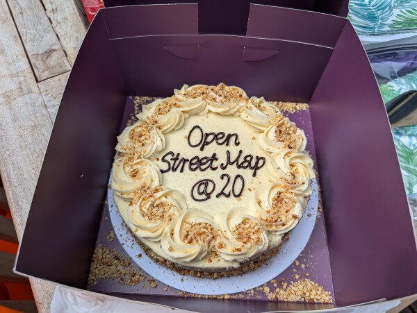


rtnf's Diary | Happy 20th birthday OpenStreetMap!
Congratulations on OSMs 20th anniversary are coming in from all over the world. We have limited ourselves to a random selection of links, as our small team was certainly not able to capture them all ;-)OpenStreetMap
I did It. Successfully Completed 20 th osm Birthday Celebration Srilanka.
Celebration Date : 11th August 2024
Thank you all Speakers, Presenters and participants for making this 20th osm birthday celebration success. and once again thank you accept my Invitation. #Taichi Furuhashi #Pawan #Janjan Villar Orano #Priscovia #Sangeetha BC #Dibikshiya #Ark Arjun
Thank You So much everyone……
#20th birthday celebration Srilanka #eastern university srilanka
Celebration Date : 11th August 2024
Thank you all Speakers, Presenters and participants for making this 20th osm birthday celebration success. and once again thank you accept my Invitation. #Taichi Furuhashi #Pawan #Janjan Villar Orano #Priscovia #Sangeetha BC #Dibikshiya #Ark Arjun
Thank You So much everyone……
openstreetmap
#20th birthday celebration Srilanka #eastern university srilanka

NADARAJ SARANYA's Diary | 20th OSM Birthday Celebration Srilanka Organized By Saranya Nadaraj
OpenStreetMap is a map of the world, created by people like you and free to use under an open license.OpenStreetMap
OpenStreetMap is a map of the world, created by people like you and free to use under an open license.
Can someone guide me how can I add my business information here.?
Thanks in advance Deepak from India
Thanks in advance Deepak from India

Scooty777's Diary | How to add my shop information here.?
OpenStreetMap is a map of the world, created by people like you and free to use under an open license.OpenStreetMap
OpenStreetMap is a map of the world, created by people like you and free to use under an open license.
#bezdomość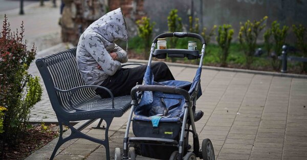

Ustawa jak feudalny pan przywiązuje bezdomnych do ziemi. Kiedy rząd zmieni absurdalne przepisy?
Czy w Polsce skończył się feudalizm i pańszczyzna? – pytają eksperci zajmujący się bezdomnością. Ustawa o pomocy społecznej uzależnia przyznanie samorządowego wsparcia człowiekowi żyjącemu na ulicy od miejsca ostatniego zameldowania.Paulina Jęczmionka-Majchrzak (OKO.press)
Mikolaj lubi to.
Gegagedigedagedago, I’ve been married a long time ago, where did you come from where did you go, where did you come from Cotton Eye Joe

Lucyferek's Diary | Moja pomyłka
OpenStreetMap is a map of the world, created by people like you and free to use under an open license.OpenStreetMap
OpenStreetMap is a map of the world, created by people like you and free to use under an open license.
OpenStreetMap is a map of the world, created by people like you and free to use under an open license.
I’ve only been here since june, but it has been a really good time. Everything works really well and the community is really nice and has helped when I asked. Crazy that it is so old, some of the data I have edited is older than me*. This is a really cool project, thank you to the devs for all the work making it.
*just checked and it was very slightly younger than me
*just checked and it was very slightly younger than me

realEatham's Diary | Happy Birthday OSM!
OpenStreetMap is a map of the world, created by people like you and free to use under an open license.OpenStreetMap
OpenStreetMap is a map of the world, created by people like you and free to use under an open license.
OpenStreetMap is a map of the world, created by people like you and free to use under an open license.
OpenStreetMap is a map of the world, created by people like you and free to use under an open license.
#ochronazwierzat #łowiectwo #polowanie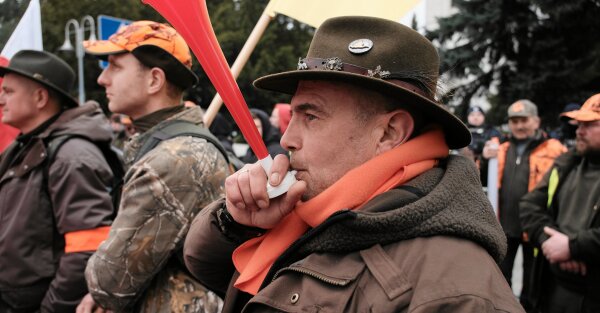

Chcą zabijać zwierzęta, ale nie chcą o tym rozmawiać. Myśliwi zawiesili udział w pracach nad reformą łowiectwa
Myśliwi demonstracyjnie opuścili posiedzenie zespołu ds. reformy łowiectwa przy Ministerstwie Klimatu i Środowiska. Ale od zmian w zabijaniu dzikich zwierząt nie da się uciec.Regina Skibińska (OKO.press)
OpenStreetMap is a map of the world, created by people like you and free to use under an open license.
OpenStreetMap is a map of the world, created by people like you and free to use under an open license.
Nowe idzie stare jedzie:
Departament Leśnictwa i Łowiectwa w #Ministerstwo Klimatu i Środowiska był przypisany v-ce ministrowi Mikołajowi Dorożale z #Polska 2050 (weganinowi i krytykowi łowiectwa).
Ale... po spotkaniu Miłosza Motyki z #PSL z szefem myśliwych Marcinem Możdżonkiem (znajomkiem ziobrowców). na już opublikowanych schemacie organizacyjnym w dzienniku urzędowym ministerstwa, plik został podmieniony i te kompetencje v-ce ministrowi odebrane.
https://nitter.net/Nasze_Lasy/status/1738536070239727910
#myśliwi
@Niech Żyją!
3 ludzi lubi to
8 użytkowników udostępniło to dalej
OpenStreetMap is a map of the world, created by people like you and free to use under an open license.
Days 57, 58, 59, 60 and 61 - Villages Baz, Memaliaj Fshat, Plan, Kujtim, Poçestë, Velahovë, Tharri and Matranxhë

IrdiIs's Diary | Days 57, 58, 59, 60 and 61 - Villages Baz, Memaliaj Fshat, Plan, Kujtim, Poçestë, Velahovë, Tharri and Matranxhë
OpenStreetMap is a map of the world, created by people like you and free to use under an open license.OpenStreetMap
OpenStreetMap is a map of the world, created by people like you and free to use under an open license.
OpenStreetMap is a map of the world, created by people like you and free to use under an open license.
ROUNDED YET EDGY….
OpenStreetMap is a map of the world, created by people like you and free to use under an open license.
OpenStreetMap is a map of the world, created by people like you and free to use under an open license.
#kosciol #CzarnaMafia #ŚwieckiePaństwo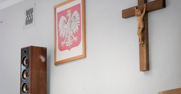

Episkopat oburzony nowymi zasadami organizacji lekcji religii. „To dyskryminujące”
Kościelnym oficjelom nie podoba się zasada łączenia osób z różnych klas w jedną grupę, która będzie uczęszczać na lekcję religii.Marcel Wandas (OKO.press)
Olga Matná-Schrödingerová lubi to.
Olga Matná-Schrödingerováudostępnił to.
OpenStreetMap is a map of the world, created by people like you and free to use under an open license.
#Kolej #TransportPubliczny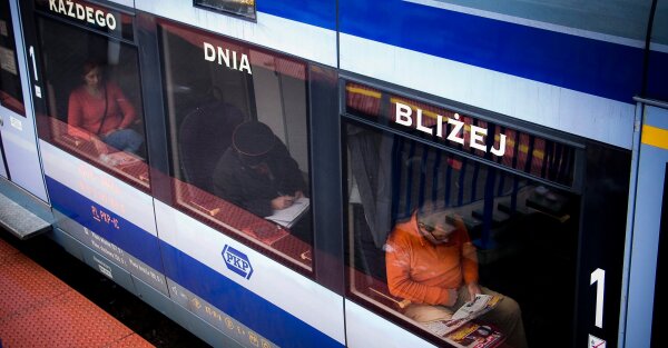

Co trzeba zrobić, by Europejczycy przesiedli się do pociągów? Podpowiadamy von der Leyen
Samo kupno biletu kolejowego za granicę to męka, ceny bywają zaporowe, a podróże – skomplikowane. Komisja Europejska będzie próbowała coś z tym zrobić. Podpowiadamy, w jakim kierunku powinny iść zmianyMarcel Wandas (OKO.press)
2 ludzi lubi to
2 użytkowników udostępniło to dalej
can’t find a suitable type of point for this - anyone have any advice please
many thanks, mark
OpenStreetMap is a map of the world, created by people like you and free to use under an open license.
many thanks, mark
OpenStreetMap is a map of the world, created by people like you and free to use under an open license.
How is it going and what am I up to now?
Introduction
I know I put in a entry in the diary not to long ago but I want to let you know what I am up to now. I am putting the finishing touches on my eruv map with I hope looks good. I am getting help with it and thank you to the gentleman that is helping.
What’s next?
I am currently spending a lot of time on StreetComplete and MapComplete. They are really good for me. I am helping my local community by validating roads, building, hours of operation, what sidewalks are made of, if the road is asphalt or what ever. I am really having a lot of fun doing it and its a good feeling that hey I have no clue if this helps anyone but it helps knowing I am helping.
I am also interested in adding things to OSM. I am fascinated by what I have seen from others. It would be good to start with one thing like roads, building, etc. Still learning the types of things OSM maps. Then build from that point once I get relatively comfortable with whatever this is.
Eventually I would love to get down to one or two things and really get good mapping those. I do not know the full capabilities of OSM, its a lot I am sure. Just hope I can be more specific and get very comfortable doing that one or things.
I am super interested in sustainability and resiliency. I would love to start to map and get involved in this area at some point. I also want to find out if OSM has something like Esri Story Maps. I want to see if I can tell stories of people for resilience. Cultures and peoples have has a long history of successful resiliency initiatives. That is the Story Map type thing came from.
Conclusion
I am super happy I found OSM and you all are very kind and generous and always happy to answer question. Just want to say thank you!
OSM is a tremendously powerful tool that I would love to see how it is used day-to-day by different organizations.
Till next time!
JJSchmerer's Diary | The OSM Journey Continues
OpenStreetMap is a map of the world, created by people like you and free to use under an open license.OpenStreetMap
OpenStreetMap is a map of the world, created by people like you and free to use under an open license.
Historische Banngrenze zwischen dem Nassau-Saarbrücker Ort Völklingen und dem zum Kloster Wadgassen gehörenden Nassau-Saarbrücker Ort Bous von 1771

TBesse's Diary | Historische Banngrenze zwischen dem Nassau-Saarbrücker Ort Völklingen und dem zum Kloster Wadgassen gehörenden Nassau-Saarbrücker Ort Bous von 1771
OpenStreetMap is a map of the world, created by people like you and free to use under an open license.OpenStreetMap
OpenStreetMap is a map of the world, created by people like you and free to use under an open license.
OpenStreetMap is a map of the world, created by people like you and free to use under an open license.
OpenStreetMap is a map of the world, created by people like you and free to use under an open license.
NorthCrab's Diary | OpenStreetMap NextGen Development Diary #16
This is a diary about a recent drone mapping initiative that I participated in. I would like to give credits to the Open Mapping Hub - West and North Africa, OpenStreetMap Sierra Leone, Pete Masters and Ivan Gayton for all the support and knowledge given during the course of this initiative. I hope to learn more as we continue collaborating.
The use of satellite imagery from multiple sources has been a pivotal aspect of open mapping campaigns across the world. However, satellite imageries have some limitations, such as low resolutions and delayed visitation time. This affects the quality of the digitization of physical features that are to be mapped. In order to address these limitations in open mapping campaigns, the use of Unmanned Aircraft Systems such as drones have been employed to capture images with high resolutions within desired timeframe.
With support from the West and North Africa Hub through the Mwalai microgrant, OpenStreetMap Sierra Leone embarked on the collection and processing of drone imageries in three slums across Freetown as part of the Know Your City initiative. The imageries would be used to map buildings and critical infrastructure, test the fAIr model and Field Mapping Tasking Manager.
In order to have high resolution imagery, the team used a DJI Mavic 2 Zoom drone for the flights and Open Drone Map for the image processing. A smartphone-based flight planning and control application was used to conduct flights with specific elevation, overlap, and angle settings, allowing the operators to ensure consistent resolution, quality, and coverage across the areas of interest.
Flights were conducted above slums with dense buildings, therefore, flight settings with paths and gimbal angles that captured the top and sides of buildings and other infrastructure. The team used the following flight settings. 70% Frontal Overlap 80% Side Overlap -75 degrees Gimbal Angle
After collecting the images, we use WebODM, Open Drone Map web version to stitch the images and create orthophotos and other data products. We use the following processing settings and outputs in the WebODM interface: Auto-boundary: yes dsm: yes dtm: yes pc-quality: high
The processed imageries were uploaded to the HOT Tasking manager as basemap for various tasks to map buildings. The Tile Mill Server (TMS) links to the imagery sets were added to the task instructions for mappers to use to help them distinguish the boundaries of building footprints.
At the end of the campaign, (number of buildings) were mapped across 3 slums and the buildings were used as trials for the Field Mapping Campaign through the Field Mapping Tasking Manager to conduct household surveys.
Purpose
The use of satellite imagery from multiple sources has been a pivotal aspect of open mapping campaigns across the world. However, satellite imageries have some limitations, such as low resolutions and delayed visitation time. This affects the quality of the digitization of physical features that are to be mapped. In order to address these limitations in open mapping campaigns, the use of Unmanned Aircraft Systems such as drones have been employed to capture images with high resolutions within desired timeframe.
Scope
With support from the West and North Africa Hub through the Mwalai microgrant, OpenStreetMap Sierra Leone embarked on the collection and processing of drone imageries in three slums across Freetown as part of the Know Your City initiative. The imageries would be used to map buildings and critical infrastructure, test the fAIr model and Field Mapping Tasking Manager.
Technical Specifications/Parameters
In order to have high resolution imagery, the team used a DJI Mavic 2 Zoom drone for the flights and Open Drone Map for the image processing. A smartphone-based flight planning and control application was used to conduct flights with specific elevation, overlap, and angle settings, allowing the operators to ensure consistent resolution, quality, and coverage across the areas of interest.
Flights were conducted above slums with dense buildings, therefore, flight settings with paths and gimbal angles that captured the top and sides of buildings and other infrastructure. The team used the following flight settings. 70% Frontal Overlap 80% Side Overlap -75 degrees Gimbal Angle
Processing
After collecting the images, we use WebODM, Open Drone Map web version to stitch the images and create orthophotos and other data products. We use the following processing settings and outputs in the WebODM interface: Auto-boundary: yes dsm: yes dtm: yes pc-quality: high
Tasking Manager
The processed imageries were uploaded to the HOT Tasking manager as basemap for various tasks to map buildings. The Tile Mill Server (TMS) links to the imagery sets were added to the task instructions for mappers to use to help them distinguish the boundaries of building footprints.
Buildings Mapped
At the end of the campaign, (number of buildings) were mapped across 3 slums and the buildings were used as trials for the Field Mapping Campaign through the Field Mapping Tasking Manager to conduct household surveys.

Tommy G D Charles's Diary | Drone mapping in Freetown, Sierra Leone.
OpenStreetMap is a map of the world, created by people like you and free to use under an open license.OpenStreetMap
Today I woke, cold and alone me. This day unlike any almost except I’m still alone, but today was different. Tonight I mean as 4 :55 ish in the morn , it was as if I had given birth to yesterdays sorrows and as if I’m lying in bed waiting for them to begin walking from a crawl as a toddler does when it first uses it’s feet to wind it’s legs up and run away. Today is now a new day as yesterdays sorrows have become real with their own love deform so it can take its sadness that makes it sorrow and simply , with its own life form simply walk away. Now the dark, like belt, place inside called sorrow simply became and ran away, so now only I have to face today and the sorrow is now lol Niger feeding of my light or life and today is Jacqueline still that it’s mine “just for today”.

Ella92282's Diary | In my room
OpenStreetMap is a map of the world, created by people like you and free to use under an open license.OpenStreetMap
OpenStreetMap is a map of the world, created by people like you and free to use under an open license.





Niech Żyją!
•Bezładnik
•MiKlo:~/citizen4.eu$💙💛 lubi to.
Niech Żyją!
•Najwyraźniej w ostatniej chwili zmieniono plany rządowe. Kto na nie wpłynął - możemy się tylko spodziewać. Przydział funkcyjny może też w każdej chwili ulec zmianie, innym zarządzeniem.