OpenStreetMap is a map of the world, created by people like you and free to use under an open license.

Auf den ersten Blick sieht es im Oktober 2022 so aus, als wäre das Gebiet Vorholz zwischen Alzey und Kirchheimbolanden eine 1a Wandergegend. Wenn man sich dann die Relationen der Wege ansah bekam man Zweifel: Viele Lücken. Und daraus folgend auch Sackgassen, da freut sich der Wanderer.
Ich habe in der VG Alzey-Land angerufen und von einer sehr kompetenten Mitarbeiterin erfahren, dass sich bei der Gemeinde schon der Förster gemeldet hatte, weil er verzweifelte Wanderer im Wald sah, die sich nicht zurechtfanden. Prima. Und dann sagte sie, dass eigentlich alle Wege abgekündigt seien, evtl. könnten einige der NW-Wege bestehen bleiben, die R-Wege und der Kneipp-Napoleon würden eingestellt.
Gerade um den letzteren (K-N) ist es schade, denn der hat schöne Schilder, ist aufwändig gemacht. Er ist fast der Hauptweg im Gebiet. Aber er hat auch viele Sackgassen in der Relation.
Was tut nun der OSM-Mapper? Ich habe für die NW-Wege die Relationen repariert, da war noch eine Karte des Soll-Zustands zu finden. Die R-Wege bekamen das Präfix “Disused”, der K-N wurde etwa zur Hälfte gelassen. Damit ist keine Arbeit endgültig weg, aber die Karten werden von Karteileichen befreit.
Warum keine Reparatur der Relation für R und K-N? Es sind keine Soll-Zustände mehr zu finden, damit müsste die Reparatur die Sackgassen komplett löschen. Damit wird aber eine echte Reparatur immer schwieriger. Oder aber man muss im Feld suchen, wo man noch vollständige Beschilderungen findet, dann geht es. (Letzte Änderung am 14.1.23, die Änderungen an der OSM sind jetzt drin)
Ich habe in der VG Alzey-Land angerufen und von einer sehr kompetenten Mitarbeiterin erfahren, dass sich bei der Gemeinde schon der Förster gemeldet hatte, weil er verzweifelte Wanderer im Wald sah, die sich nicht zurechtfanden. Prima. Und dann sagte sie, dass eigentlich alle Wege abgekündigt seien, evtl. könnten einige der NW-Wege bestehen bleiben, die R-Wege und der Kneipp-Napoleon würden eingestellt.
Gerade um den letzteren (K-N) ist es schade, denn der hat schöne Schilder, ist aufwändig gemacht. Er ist fast der Hauptweg im Gebiet. Aber er hat auch viele Sackgassen in der Relation.
Was tut nun der OSM-Mapper? Ich habe für die NW-Wege die Relationen repariert, da war noch eine Karte des Soll-Zustands zu finden. Die R-Wege bekamen das Präfix “Disused”, der K-N wurde etwa zur Hälfte gelassen. Damit ist keine Arbeit endgültig weg, aber die Karten werden von Karteileichen befreit.
Warum keine Reparatur der Relation für R und K-N? Es sind keine Soll-Zustände mehr zu finden, damit müsste die Reparatur die Sackgassen komplett löschen. Damit wird aber eine echte Reparatur immer schwieriger. Oder aber man muss im Feld suchen, wo man noch vollständige Beschilderungen findet, dann geht es. (Letzte Änderung am 14.1.23, die Änderungen an der OSM sind jetzt drin)
renminbo's Diary | Wege im Vorholz und in Rheinhessen - sind die real? | OpenStreetMap
OpenStreetMap is a map of the world, created by people like you and free to use under an open license.OpenStreetMap
OpenStreetMap is a map of the world, created by people like you and free to use under an open license.
Mein Sohn Linus ist inzwischen sieben und ich schaue mal wieder hier rein…
Ich bin inzwischen ständig mit OSM unterwegs. OSMAnd hat alle früheren Navis abgelöst, auch für die Fahrt in den Urlaub.
Okay, keine Verkehrsinfos und Langzeitbaustellen stehen auch oft nicht in der Karte. Aber seit ich die Funktion zum temporären Sperren einer Straße in OSMAnd gefunden habe, macht mir das auch keine Kopfschmerzen mehr.
Nun muss ihc nicht mehr “gegen” OSMAnd fahren, wenn ich einer Baustelle ausweiche.
Streetcomplete ist ebenfalls sehr oft an. Ich liefere im Moment Tageszeitungen in Beckum aus, und wo es die Zeit zulässt, aktualisiere ich auf dem Weg Kartendaten. Straßenoberflächen, Geschosszahlen von Gebäuden, Hilfen für Blinde an Übergängen, etc. etc.
Es gibt noch so viel zu tun … Geil!
Ich bin inzwischen ständig mit OSM unterwegs. OSMAnd hat alle früheren Navis abgelöst, auch für die Fahrt in den Urlaub.
Okay, keine Verkehrsinfos und Langzeitbaustellen stehen auch oft nicht in der Karte. Aber seit ich die Funktion zum temporären Sperren einer Straße in OSMAnd gefunden habe, macht mir das auch keine Kopfschmerzen mehr.
Nun muss ihc nicht mehr “gegen” OSMAnd fahren, wenn ich einer Baustelle ausweiche.
Streetcomplete ist ebenfalls sehr oft an. Ich liefere im Moment Tageszeitungen in Beckum aus, und wo es die Zeit zulässt, aktualisiere ich auf dem Weg Kartendaten. Straßenoberflächen, Geschosszahlen von Gebäuden, Hilfen für Blinde an Übergängen, etc. etc.
Es gibt noch so viel zu tun … Geil!
Krokofant's Diary | Einige Jahre sind vergangen.. | OpenStreetMap
OpenStreetMap is a map of the world, created by people like you and free to use under an open license.OpenStreetMap
OpenStreetMap is a map of the world, created by people like you and free to use under an open license.
OpenStreetMap is a map of the world, created by people like you and free to use under an open license.
Hallo ich hatte seit November 2019 in meinem Landkreis alle Orte systematisch überprüft und fehlende Gebäude, Straßen, … ergänzt. Die Daten wurden mit den Karten des Landesvermessungsamtes überprüft. Im Mai 2020 war der nördliche WAK komplett abgearbeitet. Da inzwischen eine überschaubare Zahl von Neubauten zur Ergänzung ansteht, habe ich geplant, das in den nächsten Tagen zu bewältigen. Und musste feststellen, das nette Zeitgenossen das Projekt sabotieren. - Beim Hauptort Behringen der Gemeinde 99820 Hörselberg-Hainich sind fast alle Hausdaten gelöscht worden. In verschiedenen Straßen von Eisenach zum Bsp. Okenstraße, Friedrich-Ebert-Straße ebenso. Wie kann man das rückgängig machen,
November2019's Diary | Systematische Sabotage - komplette Siedlungen/Straßen mit Entfernung der Hausadresseinträge | OpenStreetMap
OpenStreetMap is a map of the world, created by people like you and free to use under an open license.OpenStreetMap
Magic Earth möchte dass man im Kreisverkehr Richtung Wien GERADEAUS fährt. Übersichtlicher wäre HALTEN SIE SICH LINKS oder FAHREN SIE AUF DIE LINKE SPUR oder dergleichen. Fährt man geradeaus kommt man, wer die Strecke nicht kennt, eventuell auf die Autobahn Richtung Salzburg
Gerd1963's Diary | Autobahnauffahrt Kreisverkehr Regau | OpenStreetMap
OpenStreetMap is a map of the world, created by people like you and free to use under an open license.OpenStreetMap
Magic Earth sagt man soll von der Jedleseerstrasse HALBRECHTS abbiegen um auf die Floridsdorfer Hauptstrasse und in weiterer Folge auf die A22 zu gelangen. Die Ansage sollte meiner Meinung nach heissen BIEGEN SIE RECHTS AB. Biegt man halbrechts ab fährt mancher Richtung AN DER OBEREN ALTEN DONAU
Gerd1963's Diary | Jedleseerstrasse/Floridsdorfer Hauptstrasse | OpenStreetMap
OpenStreetMap is a map of the world, created by people like you and free to use under an open license.OpenStreetMap
OpenStreetMap is a map of the world, created by people like you and free to use under an open license.
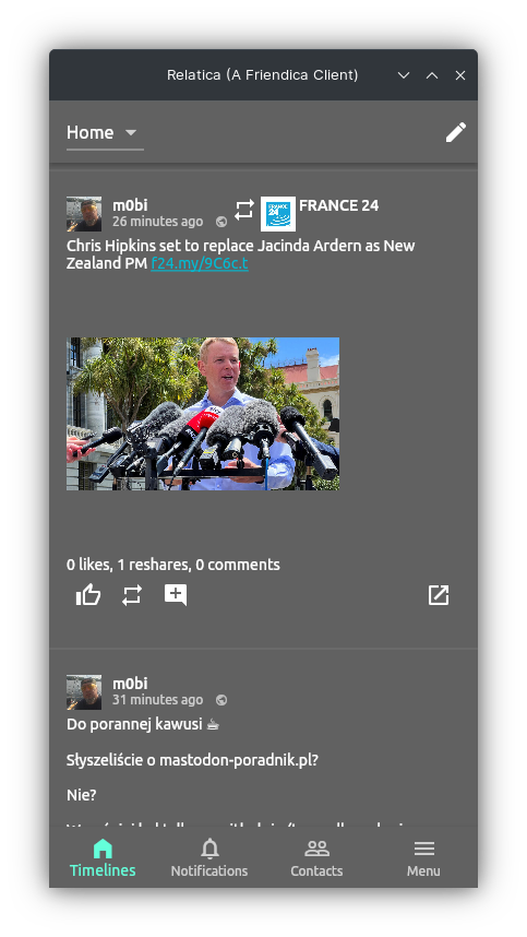
Pierwszy post ze świeżo zbudowanej na Linuksie nowej apki dla Friendica o nazwie Relatica :)
First post from a freshly built new app for Friendica on Linux called Relatica :)
Źródła/Source:
https://gitlab.com/mysocialportal/relatica
cc @Hank G ☑️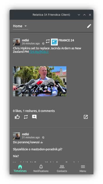
First post from a freshly built new app for Friendica on Linux called Relatica :)
Źródła/Source:
https://gitlab.com/mysocialportal/relatica
cc @Hank G ☑️
7 ludzi lubi to
7 użytkowników udostępniło to dalej
OpenStreetMap is a map of the world, created by people like you and free to use under an open license.

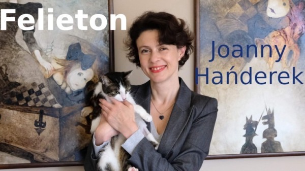
Dzisiaj felieton o liście hańby PiS-u naznaczonej ludzkimi dramatami, o długim wykazie zaniedbań i zniszczeń dokonywanych przez osoby myślące tylko o sobie i swoich partyjnych interesach. Będzie to opowieść o straconej przyszłości. Nie chodzi bowiem jedynie o kłopoty Rafako, ale o problem wszystkich dużych i małych przedsiębiorców, którzy znikają z mapy życia ekonomicznego w Polsce.
Fabryka porcelany Krzysztof w Wałbrzychu działała od 1831 roku. Przed pandemią pracowało w niej 320 osób. Co roku wysyłano stamtąd na cały świat około dziesięciu milionów sztuk porcelany. Rafako, firma znana w Polsce i za granicą, od siedemdziesięciu lat produkuje kotły, które trafiają m.in. do Europy, Turcji, Chin i Indii. Stadnina arabów w Janowie Podlaskim przyciągała miłośników tych szlachetnych zwierząt z całego świata. Licytacje na aukcji Pride of Poland należą już dzisiaj do legendy.
Co łączy fabrykę porcelany, producenta kotłów i stadninę koni? Lista hańby rządów PiS-u. Hańba ta zawiera się w prostych danych statystycznych, które można znaleźć w Krajowym Rejestrze Zadłużonych. Do 31 grudnia KRZ odnotował rozpoczęcie 84 624 postępowań upadłościowych. Czasy pandemii i rządy PiS-u każą nam się zastanawiać, co bardziej niszczy Polskę i jej gospodarkę: wirus o biologicznym podłożu czy może wirus polityczny. Niekompetencja rządzących to jedno, ale to ciągłe, obsesyjne wręcz zatrudnianie biernych, ale wiernych, oraz zagarnianie wszystkiego dla siebie prowadzą już do degeneracji ekonomicznej kraju.
Kłopoty zakładu z Wałbrzycha, stadniny w Janowie Podlaskim i spółki Rafako – gorący temat omawiany ostatnio we wszystkich mediach – obrazują katastrofalne zderzenie tradycji z PiS-owską władzą. Fabryka Krzysztof pracowała nieprzerwanie przez dwieście lat. Przetrwała niejedną burzę. PiS okazało się kataklizmem nie do pokonania, niezwykle skutecznym w zamrażaniu możliwości ekonomicznych, blokowaniu inicjatyw, utrącaniu szans, jakie daje współczesny świat. Obojętność rządzących wobec zniszczeń, jakie co dzień możemy obserwować w polskiej gospodarce, przerażają skalą marnotrawienia naszego narodowego potencjału.
Rządy PiS powinny zostać rozliczone za odbieranie nam przyszłości. Nie chodzi tylko o dotacje z Unii Europejskiej, ale o niszczenie pracowitości, talentów i kreatywności ludzi, którzy przez całe pokolenia tworzyli polskie marki rozpoznawalne na całym świecie. To brak szacunku zarówno dla tych osób, jak i dla ich dziedzictwa. Odsłania się tu sama natura rządzących dzisiaj Polską: tak bardzo zajętych własnymi interesami, że nie zwracających uwagi na nic innego.
Upadające przedsiębiorstwa, fabryki i spółki oznaczają zwiększenie bezrobocia, osłabienie gospodarki, a dla wielu niebezpieczeństwo ubóstwa czy nawet bezdomności. Powoli staczamy się w coraz większe zagrożenie, pokazując światu, że nie potrafimy żyć bez wewnętrznych sporów, a politycy rozkradający nasz kraj nadal mogą czuć się nad Wisłą bezpiecznie.
Właśnie zaczyna się rok wyborczy, a PiS nie robi sobie nic z kłopotów, jakie ściąga na cały naród, nie widzi problemu w krzywdzie poszczególnych robotników/czek, pracowników/czek bankrutujących przedsiębiorstw. To rozkradanie Polski wyznaczają dwa bieguny: biegun buty i niekompetencji Misiewicza oraz biegun arogancji i cynizmu Obajtka. Pomiędzy nimi stado wiecznie nienażartych PiS-owskich prominentów myśli jedynie o sobie samych. I to jest nasza codzienność, coraz okrutniejsza zwłaszcza dla tych, którzy mieli pecha znaleźć się w przestrzeni zniszczeń PiS-u.
Kłopoty w Janowie Podlaskim to zabijanie dumy, jaką dawały nam zdolności polskich hodowców koni. Konflikt Rafako z Tauronem to wyraz obłudy i zakłamania. Upadłość fabryki w Wałbrzychu to nonszalancja wobec tradycji i czerpanych z niej możliwości. Trzy różne dziedziny ekonomicznego i społecznego życia, jedna przyczyna ich upadku: fatalny rząd, i ten sam skutek: utrata – być może bezpowrotnie – naszych szans rozwoju. W takich warunkach słowa polityków i polityczek PiS-u o patriotyzmie zakrawają na absurdalny żart.
Felieton jest wyrazem opinii autorki. Nie prezentuje stanowiska ZR Małopolskie.
MiKlo:~/citizen4.eu$💙💛udostępnił to.
OpenStreetMap is a map of the world, created by people like you and free to use under an open license.

OpenStreetMap is a map of the world, created by people like you and free to use under an open license.

OpenStreetMap is a map of the world, created by people like you and free to use under an open license.

OpenStreetMap is a map of the world, created by people like you and free to use under an open license.

Today,Imma map till I drop.. let’s get some!!
OpenStreetMap is a map of the world, created by people like you and free to use under an open license.
OpenStreetMap is a map of the world, created by people like you and free to use under an open license.

OpenStreetMap is a map of the world, created by people like you and free to use under an open license.
OpenStreetMap is a map of the world, created by people like you and free to use under an open license.
OpenStreetMap is a map of the world, created by people like you and free to use under an open license.
OpenStreetMap is a map of the world, created by people like you and free to use under an open license.
OpenStreetMap is a map of the world, created by people like you and free to use under an open license.
OpenStreetMap is a map of the world, created by people like you and free to use under an open license.
OpenStreetMap is a map of the world, created by people like you and free to use under an open license.
OpenStreetMap is a map of the world, created by people like you and free to use under an open license.
OpenStreetMap is a map of the world, created by people like you and free to use under an open license.
OpenStreetMap is a map of the world, created by people like you and free to use under an open license.
OpenStreetMap is a map of the world, created by people like you and free to use under an open license.
OpenStreetMap is a map of the world, created by people like you and free to use under an open license.
OpenStreetMap is a map of the world, created by people like you and free to use under an open license.
OpenStreetMap is a map of the world, created by people like you and free to use under an open license.
OpenStreetMap is a map of the world, created by people like you and free to use under an open license.
OpenStreetMap is a map of the world, created by people like you and free to use under an open license.
OpenStreetMap is a map of the world, created by people like you and free to use under an open license.
OpenStreetMap is a map of the world, created by people like you and free to use under an open license.
OpenStreetMap is a map of the world, created by people like you and free to use under an open license.
Zawsze warto mieć zasady. Dla przypomnienia.
Dekalog edytora.
- Projekt OSM to zbiór danych z których korzysta wiele osób i instytucji, między innymi na terenie Polski z sieci drogowej korzysta Straż Pożarna podczas działań ratowniczych. Uważaj więc na swoje działania. Edytowanie mapy nie jest zabawą!
- Każdy obiekt istniejący w OSM ma swojego autora, szanuj cudzą pracę zastanów się zanim coś poprawisz lub usuniesz. Nigdy nie kasuj czegoś czego przeznaczenia nie jesteś pewien.
- Jeśli zauważysz problem, a nie umiesz go rozwiązać skorzystaj z możliwości dodawania uwag, poproś o pomoc na forum, lub zapytaj na Discordzie.
- Korzystaj z wiki.openstreetmap.org dodając tagi - nie zgaduj.
- Edytuj wyłącznie na podstawie zweryfikowanych źródeł, które pozwalają na wprowadzenie ich danych do bazy na licencji ODbL (Listę najważniejszych znajdziesz w tym podręczniku,)
- Do zmian jakie wysyłasz na serwer dodawaj komentarze oraz źródło z jakiego korzystasz podczas dokonywania edycji. Jeśli dokonujesz zmiany na terenie Polski komentarz może być po po polsku. Jeśli zmieniasz poza granicami lepiej pisać po angielsku.
- Bądź dokładny! Wszyscy staramy się, by dane OSM były jak najwyższej jakości.
- Każdy może popełnić błąd! Każdą zmianę można wycofać, jeśli coś zepsułeś daj znać pomożemy naprawić.
- Zawsze korzystaj z Narzędzia poprawności (Walidatora) staraj się usuwać błędy i sam ich unikaj (Wyjątkiem są Relacje - tych nie dotykaj, jeśli dokładnie nie wiesz co robisz, najlepiej przed edycją to z kimś skonsultować)
- Dopilnuj by twój adres e-mail na stronie openstreetmap.org był zawsze aktualny. Dzięki temu inni będą mogli się z Tobą skontaktować.
Editor’s Decalogue.
- OSM project is a database used by many people and institutions, among others on the territory of Poland the Fire Brigade uses the road network during rescue operations. So be careful with your actions. Editing the map is not a game!
- Every object existing in OSM has its author, respect other people’s work, think before you correct or delete something. Never delete something which of purpose you are not sure.
- If you notice an issue and can’t solve it use the comment feature, ask for help in the forum, or ask on Discord.
- Use wiki.openstreetmap.org to add tags - don’t guess.
- Edit based on only veryfied sources, which allow their data to be entered into the database under the ODbL license (For a list of the most important ones, see this manual,)
- To changes which you send to the server, add comments and a source, which you use during making edits. If you are making changes in Poland comment can be in Polish. If you make changes outside the borders it”s better to write in English.
- Be accurate! We all strive to make OSM data as high quality as possible.
- Anyone can make a mistake. Every change can be undone. if you messed something up let us know we can help fix it.
- Always use the Validation Tool, try to remove errors and avoid them yourself (Exceptions are Relations - do not touch them if you do not know exactly what you are doing, best to consult it with someone before editing).
- Make sure your email address on openstreetmap.org is always up to date. This will allow others to contact you.
Cristoffs's Diary | Dekalog edytora | OpenStreetMap
OpenStreetMap is a map of the world, created by people like you and free to use under an open license.OpenStreetMap
Zachód przywyka do wojny. Ofiarowuje pomoc, ale procesy decyzyjne trwają bez końca. My też trochę żyjemy w takim stanie podświadomości. Wojna jest, ale nie u nas. Pomagać trzeba, jednak i nam niełatwo.
MiKlo:~/citizen4.eu$💙💛udostępnił to.
OpenStreetMap is a map of the world, created by people like you and free to use under an open license.
m0bi
•m0bi
m0bi
Distributor ID: Neon
Description: KDE neon 5.26
Release: 22.04
Codename: jammy
I have never built a Flatpack/Snap before. This could be an interesting challenge :)
MiKlo:~/citizen4.eu$💙💛
Dla kogoś kto chce pisać dłuższe teksty w rodzaju bloga a jednocześnie mieć pełna interację w dwie strony z resztą fediverse to jest dobry kompromis.
Albo np rozdzielić publikację różnych tematów na kilka identities - to są de facto osobne konta ale zarządzane z jednego loginu.
2 ludzi lubi to
didleth 🇵🇱 🌈 🇺🇦 🇪🇺 ⚡ i m0bi lubię to.
MiKlo:~/citizen4.eu$💙💛
2 ludzi lubi to
m0bi i didleth 🇵🇱 🌈 🇺🇦 🇪🇺 ⚡ lubię to.
m0bi
> Albo zrobić konto bota-agregatora treści
Odbiłem się od tego, nie potrafię bota osobnego ;)
Interfejs jest dla mnie niezrozumiały w polskim tłumaczeniu.
Pewnie jak bym posiedział dłużej, to bym metodą prób i błędów rozwiązał, ale odłożyłem na "kiedy będzie czas" i tak wisi w #ToDo
Btw, własnie wszedłem w TestFlight Relatica na iPhone. Działa jak na Linuksie :)
MiKlo:~/citizen4.eu$💙💛
Bez tego kawałka doc'a jak też się odbiłem za pierwszym razem https://wiki.friendi.ca/docs/bot
m0bi lubi to.