When it comes to mapping, I think a large part of the struggle for it is my obsessive compulsive disorder. I’m writing this post because I think it’s unique and I haven’t stumbled across any other posts like this.
For starters, obsessive compulsive disorder is “a common, chronic, and long-lasting disorder in which a person has uncontrollable, reoccurring thoughts (“obsessions”) and/or behaviors (“compulsions”) that he or she feels the urge to repeat over and over”.
For me, that could mean asking questions like these when doing mapping:
“Do I need to put the city, post code, and state for each address I put in, regardless of whether I know the full address or not?”
“Do I always need to mark if the place is vegan, vegetarian, air conditioned, smoke free, etc.”?
“Do I need to perfectly realign the buildings using JOSM?”
The way things are right now, everybody has their own mapping style. For instance, some people may put a place’s post code and city, even if they don’t know the house number. Some people may put if a place is air conditioned or not.
The reality of the situation is that OSM is not used extensively in the US. So every time a POI is added to the map, it may not be extensively detailed. And even if it is, chances are unless there are some really dedicated mappers out there, that info will become obsolete within a few years because nobody will update the data.
When it comes to OSM, I started to work on the project because I felt it had potential. A potential to become something high quality and really detailed. The sad thing is, I focused so much on that level of detail (mainly with POIs), that I burned myself out on mapping. So I guess the question is, how much is too much detail?
For starters, obsessive compulsive disorder is “a common, chronic, and long-lasting disorder in which a person has uncontrollable, reoccurring thoughts (“obsessions”) and/or behaviors (“compulsions”) that he or she feels the urge to repeat over and over”.
For me, that could mean asking questions like these when doing mapping:
“Do I need to put the city, post code, and state for each address I put in, regardless of whether I know the full address or not?”
“Do I always need to mark if the place is vegan, vegetarian, air conditioned, smoke free, etc.”?
“Do I need to perfectly realign the buildings using JOSM?”
The way things are right now, everybody has their own mapping style. For instance, some people may put a place’s post code and city, even if they don’t know the house number. Some people may put if a place is air conditioned or not.
The reality of the situation is that OSM is not used extensively in the US. So every time a POI is added to the map, it may not be extensively detailed. And even if it is, chances are unless there are some really dedicated mappers out there, that info will become obsolete within a few years because nobody will update the data.
When it comes to OSM, I started to work on the project because I felt it had potential. A potential to become something high quality and really detailed. The sad thing is, I focused so much on that level of detail (mainly with POIs), that I burned myself out on mapping. So I guess the question is, how much is too much detail?
TheAdventurer64's Diary | OCD and Mapping | OpenStreetMap
OpenStreetMap is a map of the world, created by people like you and free to use under an open license.OpenStreetMap

OpenStreetMap is a map of the world, created by people like you and free to use under an open license.
Die AP 7 ist komplett Mautfrei
OpenStreetMap is a map of the world, created by people like you and free to use under an open license.
OpenStreetMap is a map of the world, created by people like you and free to use under an open license.
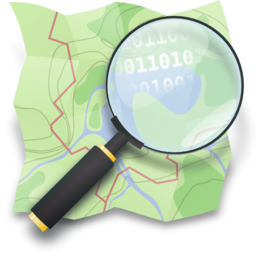
Podobnie jak w greckiej tragedii nieubłagane fatum czeka na głównego bohatera u kresu jego drogi, tak na polityków niezależnie od barw politycznych czekają na końcu kampanii nierozwiązane i narastające problemy. Oglądając przemówienia i szlaki, którymi podróżują dwa orszaki panów w garniturach, mam wrażenie, że niezależnie, czy to PiS czy Platforma Obywatelska (lub jakakolwiek inna partia), kobiety i tak zostaną pominięte. Tyle że one teraz są w Sejmie, kolejny raz przyjechały ze swoimi dziećmi, również tymi dorosłymi. Są tam marginalizowane i niedoceniane przez wielką politykę ludzkiej obojętności.
Okres przedwyborczy tuż, tuż. Więc w Polskę idziemy, w Polskę, panowie i panie – dwa szlaki, dwie ekipy, z jednej strony duma z Polski, białoczerwone flagi, godność prawdziwego Polaka (niekoniecznie Polki), a z drugiej Polska w Europie, Polska praworządna, w której prawo i konstytucja na nowo zajmą swoje miejsce. Morawiecki z błyskawicznie wydłużającym się nosem narodowego Pinokia wskazuje jak zawsze na Tuska, że to jego i tylko jego wina. Według obecnego premiera rozwijamy się ekonomicznie, poziom życia się podnosi, a świadczenia i programy wsparcia dla osób najuboższych i w wieku senioralnym oszałamiają samego Morawieckiego, nie wspominając już o jego klakierach. Tusk natomiast obiecuje powrót do praworządności, normalizację sytuacji ekonomicznej i politycznej. Słuchając tych dwóch panów, ma się wrażenie, że oto zbliża się wojna światów, ponowne starcie sił zła i dobra.
A tymczasem w Sejmie rodzice osób z niepełnosprawnością protestują po raz kolejny. Jedna z mam powiedziała, że za pieniądze przeznaczane przez państwo na wsparcie takich osób oraz ich rodzin nie da się przeżyć ani umrzeć. Żyjemy w kraju, w którym praktycznie nie ma możliwości dokonania aborcji, nawet jeżeli płód jest z uszkodzeniami letalnymi, a poród zagraża samej matce. Kobieta ma urodzić – nieważne kogo, nieważne jakim kosztem, nieważne, co się potem stanie z nią i jej dzieckiem. A gdy urodzi dziecko z niepełnosprawnością, pozostaje sama z jego chorobą, problemami z codziennością, z urzędami, pielęgnacją, terapią, rehabilitacją. Wsparcie rodziny czy kochającego partnera (w idealnej sytuacji – niestety, statystyczna większość małżeństw rozpada się po narodzinach chorego dziecka) nie wystarcza, zwłaszcza że pobierając świadczenie opiekuńcze, kobieta nie może podjąć pracy, bo straciłaby dofinansowanie na dziecko. Kwoty przeznaczane przez państwo na opiekę nad dzieckiem czy osobą dorosłą wymagającą opieki są głodowe. Moja znajoma obliczyła kiedyś, że stać ją na rehabilitację tylko przez dwa dni w miesiącu, bo musi też wykupić lekarstwa, bez których by nie przeżyła, a te kosztują coraz więcej. Leki dawniej refundowane są dzisiaj na ogół albo nie refundowane wcale albo w minimalnym stopniu. Do tego sprzęt specjalistyczny potrzebny w domu, wózek, buty ortopedyczne, specjalne krzesła czy wyposażenie łazienki, kuchni, sypialni…
Matki osób z niepełnosprawnością, osób, które nierzadko potrzebują wsparcia i opieki przez całą dobę, musiały znowu przyjechać do Warszawy i zamieszkać na korytarzu polskiego parlamentu. Jak zawsze zdeterminowane, pewne swojego celu, zmęczone. Kobiety siedzące z dziećmi w Sejmie to świadectwo nie tylko rządów PiS, ale przede wszystkim świadectwo polskiej polityki od lat 90. Sytuacja, w jakiej znajdują się opiekunowie i opiekunki osób z niepełnosprawnością, pokazuje siłę wykluczenia. Kobieta ma urodzić, ale co potem, to już jej problem. Dzieci traktowane są jak obowiązek. Nieustannie wmawia się młodym ludziom, że macierzyństwo i tacierzyństwo to najpiękniejsze i najważniejsze zadanie, nikt jednak nie mówi o konsekwencjach urodzenia dziecka z niepełnosprawnością. W Polsce wsparcie opiekunów takich osób, zwłaszcza osób dorosłych, które wypadają z systemu świadczeń, praktycznie nie istnieje. Trzeba jak w dzikim świecie toczyć walkę z urzędnikami o przyznanie dotacji czy z sąsiadami, którym nie podoba się podjazd budowany przed ich blokiem. A potem lata rosnącej goryczy, pytania, co stanie się z dzieckiem, gdy opiekunki zabraknie. Panowie w garniturach, w dobrych samochodach, zadbani, obsłużeni, opowiadają nam w swoim objazdowym show, jak to dbają albo będą dbać o Polskę. Ludzie potrzebujący wsparcia nie siedzą jednak w Sejmie po raz pierwszy. Nie jest to pierwszy protest zdeterminowanych kobiet, których codzienną troską jest to, by ich dziecko przeżyło kolejny dzień.
Dwa orszaki królewskie ruszyły w Polskę: Morawiecki kontra Tusk, jak w starym, dobrze znanym rozdaniu. PiS kontra Platforma, siły ciemności i zła kontra siły dobra. Deklaracje, przemowy, obietnice, analizy. Tymczasem w Sejmie kobiety siedzą na podłodze, kolejny raz przyjechały ze swoimi dziećmi, już dorosłymi, ale potrzebującymi nieustannej pomocy. Były tu już wcześniej. Rozmawiały z niejednym premierem i premierką, z niejednym przedstawicielem/ką partii rządzących i opozycyjnych. Zmieniły się rządy, zmieniły się narracje polityczne, starzy wrogowie raz jeszcze zaczęli ze sobą walczyć o wejście do parlamentu i przejęcie władzy, a kobiety z dziećmi z niepełnosprawnością nadal nie doczekały się niczego. Siedzą zmęczone i zdeterminowane, z bolesną świadomością, że cokolwiek się dzieje, ktokolwiek rządzi, one są zdane na siebie.
Powtarzające się protesty opiekunów i opiekunek dzieci i dorosłych osób z niepełnosprawnością to tak naprawdę świadectwo naszej klasy politycznej. Przed wyborami wszyscy są zainteresowani, gotowi pomóc, wysłuchać, dostrzec problem, a zwłaszcza gotowi mówić, dużo mówić. Ale w praktyce dwa objazdowe orszaki po Polsce nic nie wiedzą o życiu, nic nie rozumieją z dramatu, jakim jest ta nieustanna walka o przetrwanie.
Czy polityka się zmieni? Do czego zmierzamy? Może panowie w garniturach, zamiast jeździć po Polsce, wróciliby do Warszawy, porozmawiali z tymi, które czekają na nich na korytarzu parlamentu, może by wreszcie usłyszeli, co się do nich mówi…
Felieton jest wyrazem opinii autorki. Nie prezentuje stanowiska ZR Małopolskie.
OpenStreetMap is a map of the world, created by people like you and free to use under an open license.
The Operations Working Group is looking at what it take to deprecate HTTP Basic Auth and OAuth 1.0a in favour of OAuth 2.0 on the main API in order to improve security and reduce code maintenance.
Some of the libraries that the software powering the API relies on for OAuth 1.0a are unmaintained, there is currently a need to maintain two parallel OAuth interfaces, and HTTP Basic Auth requires bad password management practices. OAuth 2.0 libraries should be available for every major language.
We do not yet have a timeline for this, but do not expect to shut off either this year. Before action is taken, we will send out more notifications. Deprecation may be incremental, e.g., we may shut off creation of new applications as an earlier step.
If you are developing new software that interacts with the OSM API, use OAuth 2.0 from the start. Non-editing software can require authentication support, e.g. software that checks if you have an OSM login.
If you maintain existing software, then look into OAuth 2.0 libraries that can replace your OAuth 1.0a ones. We do not recommend implementing support for either protocol version “by hand”, as libraries are readily available and history has shown that implementing your own support is prone to errors.
If you do not develop software that interacts with the OSM API, this change will not directly impact you. You may need to update software you use at some point.
Some of the libraries that the software powering the API relies on for OAuth 1.0a are unmaintained, there is currently a need to maintain two parallel OAuth interfaces, and HTTP Basic Auth requires bad password management practices. OAuth 2.0 libraries should be available for every major language.
We do not yet have a timeline for this, but do not expect to shut off either this year. Before action is taken, we will send out more notifications. Deprecation may be incremental, e.g., we may shut off creation of new applications as an earlier step.
What can you do to help?
If you are developing new software that interacts with the OSM API, use OAuth 2.0 from the start. Non-editing software can require authentication support, e.g. software that checks if you have an OSM login.
If you maintain existing software, then look into OAuth 2.0 libraries that can replace your OAuth 1.0a ones. We do not recommend implementing support for either protocol version “by hand”, as libraries are readily available and history has shown that implementing your own support is prone to errors.
If you do not develop software that interacts with the OSM API, this change will not directly impact you. You may need to update software you use at some point.
pnorman's Diary | Future deprecation of HTTP Basic Auth and OAuth 1.0a | OpenStreetMap
OpenStreetMap is a map of the world, created by people like you and free to use under an open license.OpenStreetMap
OpenStreetMap is a map of the world, created by people like you and free to use under an open license.
OpenStreetMap is a map of the world, created by people like you and free to use under an open license.
Waymo
I used the driverless ride-share from Waymo to go from the Phoenix airport to downtown. The airport pickup location was a bit out of the way, so I added a taxi stand point on OSM.
Many neighborhoods had building footprints added in Phoenix in just the past 2 years. I was able to add some details to trails or new construction.
Wisconsin and the U.P.
I’m planning a summer bicycle trip from Duluth, east through Wisconsin and Michigan’s Upper Peninsula. There are gravel trails along highways (likely old rail lines) which are commonly used by ATVs and snowmobiles. OSM coverage of these is good. What surprised me on Google Maps is that huge swathes of this area have one low-res StreetView from 2008-09? This might be an entry point for Mapillary and others. I’d like to use this and/or tagging to find bike racks.
Durbin Feeling Language Center
I recently listened to a talk by Chris Skillern (New Leaves: The Cherokee Syllabary in the 21st Century). The Cherokee Nation opened this new language center building in Nov. ‘22, but none of the stories gave its address, and it wasn’t a point on Google Maps. Looking up older news articles from when the building was selected, I found it nearby. Then I saw that the Bing imagery included new construction which was not present on Maxar. Typically I had thought Bing was older? But maybe that’s getting a refresh.
mapmeld's Diary | Mapping Early 2023 | OpenStreetMap
OpenStreetMap is a map of the world, created by people like you and free to use under an open license.OpenStreetMap
OpenStreetMap is a map of the world, created by people like you and free to use under an open license.
OpenStreetMap is a map of the world, created by people like you and free to use under an open license.
Hello, I am Brazil Singh, a computer science undergraduate from Eastern University Bangladesh. I’m a an Wordpress webdeveloper. I am also an Editior of Youthmappers at Eastern University. Today I edited the osm. Location was Eastern University building’s Tea Stall. Seriously I enjoyed a lot by contribuiting here.
Brazil Singh's Diary | New experience as a New User | OpenStreetMap
OpenStreetMap is a map of the world, created by people like you and free to use under an open license.OpenStreetMap
OpenStreetMap is a map of the world, created by people like you and free to use under an open license.
OpenStreetMap is a map of the world, created by people like you and free to use under an open license.
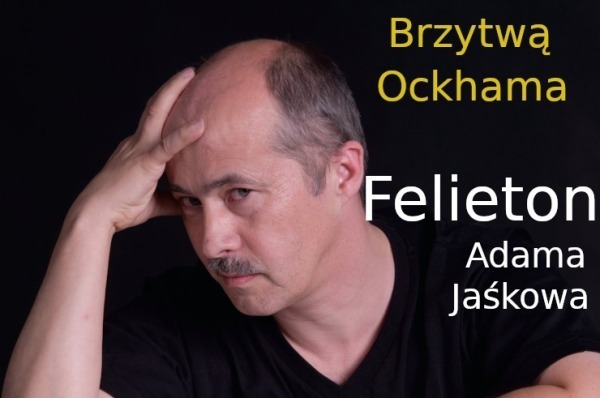
Sen Żeromskiego z Przedwiośnia nie zdążył się zrealizować w czasach PRL-u. Czy ma szansę w niedalekiej przyszłości, to w dużej mierze zależy od dokonywanych wyborów. Od tego, co i kogo Polacy wybiorą w tym roku i w następnych latach.
Unique Mappers Team, Nigeria organized a training session to commemorate the International Women’s Day. Attendees of the program were trained on Digital skills. I was privileged to deliver a lecture on Search Engine Optimisation and Search Engine Marketing as tools of Digital Marketing. The program was enlightening and motivating, as women were reminded that their dreams are valid, and we could be anything we’ve set our hearts to be.
Abigail Itorho's Diary | *Let's DigitAll for Women: #IWD2023 | OpenStreetMap
OpenStreetMap is a map of the world, created by people like you and free to use under an open license.OpenStreetMap
OpenStreetMap is a map of the world, created by people like you and free to use under an open license.
We had a meeting with Mr. Victor Sunday. On the establishment of mapathon centres.
OpenStreetMap is a map of the world, created by people like you and free to use under an open license.
OpenStreetMap is a map of the world, created by people like you and free to use under an open license.
It was a privilege to be one of the Panelists of the IWD hosted by the HOT, North and West Africa Hub. Theme: “Safe Spaces for Women”. It was insightful. English and French were used as a mode of communication and I like that. Teg-Wende and Carter agreed that the submission is being taken note of and that women and girls will be given more attention.
prispe's Diary | International Women's Day | OpenStreetMap
OpenStreetMap is a map of the world, created by people like you and free to use under an open license.OpenStreetMap
Introduction
Hello, I am Aarya Ahjolia, a computer science undergraduate from Nirma University, Gujarat, India. I’m a passionate developer who loves solving problems.
GSoC’23 Project: Improving Valhalla’s Web App (ReactJS)
Since I’m proficient in ReactJS and have the knowledge of the code base of Valhalla Web app, I love this project to share my time with for Summer’23.
I’ll be updating my entire journey of GSoC’23 and give weekly updates in upcoming diaries.
Thanks for reading!
Aarya_Ahjolia's Diary | Starting Open source with OSM | OpenStreetMap
OpenStreetMap is a map of the world, created by people like you and free to use under an open license.OpenStreetMap
OpenStreetMap is a map of the world, created by people like you and free to use under an open license.
OpenStreetMap is a map of the world, created by people like you and free to use under an open license.
Als ich meine Karriere als Kranführer begann, hatte ich wenig Interesse an meinem Beruf. Ich dachte, es sei nur ein Job, bei dem man ein paar Knöpfe drückt und schwere Lasten von einem Ort zum anderen bewegt. Doch als ich meine Arbeit auf der Baustelle aufnahm, wurde mir schnell klar, dass ich mich anstrengen musste, um erfolgreich zu sein.
Ich hatte das Glück, dass ich in einem Unternehmen arbeitete, das erfahrene Kranführer beschäftigte, die mich bei meinem Wachstum unterstützten. Ich erkannte, dass das Kranfahren eine Kunstform ist, die eine Menge Konzentration und Präzision erfordert. Ich begann, mehr Zeit in meine Arbeit zu investieren und mich auf meine Fähigkeiten zu konzentrieren.
Heute, Jahre später, bin ich ein erfahrener Kranführer mit einer Leidenschaft für mein Handwerk. Ich liebe es, die Kontrolle über den Kran zu haben und schwere Lasten sicher und effizient zu bewegen. Ich weiß, dass es nur durch harte Arbeit und Anstrengung möglich ist, diese Fähigkeiten zu perfektionieren. Ich bin dankbar für die Erfahrungen, die ich gemacht habe, und stolz darauf, dass ich meine Karriere als Kranführer mit Ehrgeiz und Engagement aufgebaut habe.
Wenn ich einem jungen Kranführer einen Rat geben könnte, wäre es, dass er sich bemühen sollte, seine Fähigkeiten zu perfektionieren und sich in seine Arbeit zu verlieben. Das Kranfahren ist eine lohnende Karriere, aber es erfordert Anstrengung, Geduld und Hingabe. Wenn man diese Eigenschaften mitbringt, kann man ein erfolgreicher Kranführer werden und sich über eine erfüllende Karriere freuen.
Ich hatte das Glück, dass ich in einem Unternehmen arbeitete, das erfahrene Kranführer beschäftigte, die mich bei meinem Wachstum unterstützten. Ich erkannte, dass das Kranfahren eine Kunstform ist, die eine Menge Konzentration und Präzision erfordert. Ich begann, mehr Zeit in meine Arbeit zu investieren und mich auf meine Fähigkeiten zu konzentrieren.
Heute, Jahre später, bin ich ein erfahrener Kranführer mit einer Leidenschaft für mein Handwerk. Ich liebe es, die Kontrolle über den Kran zu haben und schwere Lasten sicher und effizient zu bewegen. Ich weiß, dass es nur durch harte Arbeit und Anstrengung möglich ist, diese Fähigkeiten zu perfektionieren. Ich bin dankbar für die Erfahrungen, die ich gemacht habe, und stolz darauf, dass ich meine Karriere als Kranführer mit Ehrgeiz und Engagement aufgebaut habe.
Wenn ich einem jungen Kranführer einen Rat geben könnte, wäre es, dass er sich bemühen sollte, seine Fähigkeiten zu perfektionieren und sich in seine Arbeit zu verlieben. Das Kranfahren ist eine lohnende Karriere, aber es erfordert Anstrengung, Geduld und Hingabe. Wenn man diese Eigenschaften mitbringt, kann man ein erfolgreicher Kranführer werden und sich über eine erfüllende Karriere freuen.
MeierFabian212's Diary | Kranführer Blog | OpenStreetMap
OpenStreetMap is a map of the world, created by people like you and free to use under an open license.OpenStreetMap
Als ich damals in der Lehre war, hatte ich wenig Interesse an dem, was ich tat. Ich sah das Handwerk des Schreiners eher als einen Job an, den ich für mein Geld erledigen musste. Aber als ich im Arbeitsleben ankam, wurde mir schnell klar, dass ich mich anstrengen musste, um erfolgreich zu sein.
Ich hatte das Glück, dass ich in einem Betrieb arbeitete, in dem es viele erfahrene Handwerker gab, die mir bei meinem Wachstum halfen. Ich erkannte, dass das Handwerk des Schreiners nicht nur ein Job ist, sondern eine Kunstform, die Zeit, Energie und Hingabe erfordert. Ich begann, mehr Zeit in meine Arbeit zu investieren und mich auf meine Fähigkeiten zu konzentrieren.
Heute, Jahre später, bin ich ein erfahrener Schreiner mit einer Leidenschaft für mein Handwerk. Ich liebe es, ein Stück Holz in etwas Schönes zu verwandeln und ich weiß, dass es nur durch harte Arbeit und Anstrengung möglich ist. Ich bin dankbar für die Erfahrungen, die ich gemacht habe, und stolz darauf, dass ich meine Karriere als Schreiner mit Ehrgeiz und Engagement aufgebaut habe.
Wenn ich einen Rat an junge Lehrlinge geben könnte, wäre es, dass sie sich bemühen sollten, ihr Handwerk zu perfektionieren und sich in ihre Arbeit zu verlieben. Die Handwerkskunst des Schreiners ist eine lohnende Karriere, aber es erfordert Anstrengung, Geduld und Hingabe. Wenn man diese Eigenschaften mitbringt, kann man ein erfolgreicher Schreiner werden und sich über eine erfüllende Karriere freuen.
Ich hatte das Glück, dass ich in einem Betrieb arbeitete, in dem es viele erfahrene Handwerker gab, die mir bei meinem Wachstum halfen. Ich erkannte, dass das Handwerk des Schreiners nicht nur ein Job ist, sondern eine Kunstform, die Zeit, Energie und Hingabe erfordert. Ich begann, mehr Zeit in meine Arbeit zu investieren und mich auf meine Fähigkeiten zu konzentrieren.
Heute, Jahre später, bin ich ein erfahrener Schreiner mit einer Leidenschaft für mein Handwerk. Ich liebe es, ein Stück Holz in etwas Schönes zu verwandeln und ich weiß, dass es nur durch harte Arbeit und Anstrengung möglich ist. Ich bin dankbar für die Erfahrungen, die ich gemacht habe, und stolz darauf, dass ich meine Karriere als Schreiner mit Ehrgeiz und Engagement aufgebaut habe.
Wenn ich einen Rat an junge Lehrlinge geben könnte, wäre es, dass sie sich bemühen sollten, ihr Handwerk zu perfektionieren und sich in ihre Arbeit zu verlieben. Die Handwerkskunst des Schreiners ist eine lohnende Karriere, aber es erfordert Anstrengung, Geduld und Hingabe. Wenn man diese Eigenschaften mitbringt, kann man ein erfolgreicher Schreiner werden und sich über eine erfüllende Karriere freuen.
PC1995's Diary | Meine Erfahrung als Schreiner in jungen Jahren | OpenStreetMap
OpenStreetMap is a map of the world, created by people like you and free to use under an open license.OpenStreetMap
OpenStreetMap is a map of the world, created by people like you and free to use under an open license.
OpenStreetMap is a map of the world, created by people like you and free to use under an open license.
BRASIL - PARINTINS - AMAZONAS - ÁREAS NÃO MAPEADA NO TERRITORIO DA CIDADE DE PARINTINS. BRAZIL - PARINTINS - AMAZONAS - UNMAPPED AREAS IN THE TERRITORY OF THE CITY OF PARINTINS.
umbraosmbr's Diary | BRASIL - PARINTINS - AMAZONAS - ÁREAS NÃO MAPEADA NO TERRITORIO DA CIDADE DE PARINTINS. BRAZIL - PARINTINS - AMAZONAS - UNMAPPED AREAS IN THE TERRITORY OF THE CITY OF PARINTINS. | OpenStreetMap
OpenStreetMap is a map of the world, created by people like you and free to use under an open license.OpenStreetMap
OpenStreetMap is a map of the world, created by people like you and free to use under an open license.
Nohej
Zakładam to konto w ramach rozpoznawczo-edukacyjnych. Główna aktywność na Mastodonie: @Adam Kaliszewski 🌱
MiKlo:~/citizen4.eu$💙💛udostępnił to.
OpenStreetMap is a map of the world, created by people like you and free to use under an open license.
Unique Mappers Team (UMT) organized a meeting for the Keynote speakers, Panelists, Trainers and School Outreach Volunteers on Mar 6, 2023 ,12:30pm to 1:00pm (GMT+01:00) West Africa Standard Time, via the virtual platform -Zoom. The purpose of the meeting was to conclude and finalize on the plans which have being put in place for the International Women’s Day event, which will hold from 8th March - 22nd March, 2023. It was a great avenue to discuss with people of like minds.
Abigail Itorho's Diary | Meeting with Unique Mappers Team for IWD2023 | OpenStreetMap
OpenStreetMap is a map of the world, created by people like you and free to use under an open license.OpenStreetMap
Really excited to have joined the meeting where updates were given by the Local Organizing Committee (LOC) as regards the forthcoming 2023 State of The Map Africa Conference, which is designated to hold in Cameroon. I look forward to the successful accomplishment of the plans in motion and how beautifully the conference would turn out.
Abigail Itorho's Diary | OSM AFRICA COORDINATION MEETING FOR STATE OF THE MAP AFRICA, 2023. | OpenStreetMap
OpenStreetMap is a map of the world, created by people like you and free to use under an open license.OpenStreetMap
Well, I finally got around to trying to undelete the bit of trail in Redwood National Park between Tall Trees and Emerald Ridge, which didn’t take long because I’d already done the hard bit of finding which way that was by finding the deletion changeset. Unfortunately, there’s a lot of things in this area that nag at me. For instance, while I was (not) discovering if there was any reason the trail was deleted, I sorted out the nag about getting the seasonal bridges correctly tags for that attribute. Maybe. It could be “seasonal=summer/autumn” (used on the bridges) or “seasonal=dry_season” used on the trail. Does dry season start when the rains end or when the creek starts to get low too? Because that creek stays high into the dry, making summer/autumn possibly more accurate. Dry/wet season also can require some lookup. If I saw something was “wet_season” in the southwest US deserts, a few years ago I’d expect that means winter, but now I know it might actually mean July and August, when the monsoonal moisture comes through, but when the southwest US coast I grew up on has average monthly rainfall of 0.04 inches.
Most generous with the naggings are the “Orick Horse Trails”, a stacked set of loops built for horseback riding on the west side of Redwood Creek. They are built from good gravel service roads still in use by the park and old tracks decaying back to trail and a bit of trail too. Mostly it’s roads the public can’t drive. Before getting on with the subject of this entry, I had to deal with some really boneheaded stuff I’d done when getting them mapped at all some 2 years ago. Some of it is so boneheaded, it probably needs a content warning if any mappers are actually reading this. In one instance I apparently added in tiger: tags. Sure, if you don’t understand a tag, don’t delete it. But adding it in could be bad too! But there’s a wiki entry for these and you can delete them if the information is already included (or found inaccurate anyway). Apparently I set some “not:name” values that really should have been “old_name” as, while they are not currently what the trails are called, they are seen on the signs. It’s not wrong, just old. Then there’s the apex bad boneheaded what of setting those service roads to “designated” for vehicles. This was probably meant to convey that designated people could drive them, but that’s not what it means. It means those roads are meant for driving, which is very much wrong! So I had to do some fixing of the boneheaded.
Once I’d cleaned up the stupid I’d done before, and some random tagging of some of the service roads back to track roads plus one path into a track road by a random Amazon employee, I could get back to what was actually bothering me about this trail system constructed of roads. Whose point of view should the map reflect? I have this pie-in-the-sky idea it should be all things to all people. You tag it well with all the things and the land manager can come along and render it one way and get a map showing their roads that only they may use. The public can come along and use a standard renderer and be told there’s these trails you can circle around on. I’m pretty sure that’s not entirely wrong an impression, either. Answer: you don’t have to chose. Everyone gets their viewpoint.
How I get there, it seems at first glance, is to say it’s a road if I see a road. When it’s good gravel I would drive in my Scion if I had the key, it’s a road. These service roads are not all good, but most are. Land manager sees road including being able to drive it. I see road, which is a different experience to hike, but I can’t drive it. So I concluded mark it as a road. They need to be distinguished for the actual track roads in the area, some of which have been removed, some are removing themselves without help. That’s easy, because they’re service roads. They access bits of the National Park by employees.
But there’s problems with this. It ends up hiding the loops of trail. Those attributes that can be applied to paths certainly are discouraged from application to service roads (or track roads) in iD. And what kind is it? General access Park Service employees, which doesn’t seem to be a sort generally. It’s driveway and emergency services and such. If none of these fit, maybe you should be looking for a better tag, like highway=path, the wiki says, hinting that maybe my point of view should be it’s a trail, not a road.
The mountain bikers, who happen to be excluded from this bit of horse trail although generally allowed on horse trail in the area, certainly like to view this sort of thing as trail. It’s a “two track” as opposed to a “one track”, although they really are good roads and one very wide track. It’s talked about as trail.
It’s not really that rare a situation. The Arcata Community Forest has a collection of service roads and trails that the public’s trails follow. When I hiked in regional parks in the San Francisco Bay area, I’ve even seen signs warning me that (gasp!) the trail I was on was about to get too narrow for emergency vehicles, presumably so I know it’s a bad idea to settle into having a heart attack further along. These places do tend to mark it all as trails (highway=path).
So I’ve let go of my point of view it’s a road because someone can drive it. Diverted the idea that the land manager sees it as a road. I’ve changed things to highway=path so it’s all trails, then marked the road areas as 3 meters wide. And I suppose there’s a certain point of view that the land manager is perfectly capable of driving trails that are wider than the vehicle, so maybe it still preserves that all things to all people once it’s got enough tagging idea.
And it nicely distinguishes the trails from the leftover track roads, which should be treated with suspicion in this area. Although I know one that’s nice and I didn’t notice any “no access” signs on it.
Oh, yeah, and then I applied some lifecycle tags. See above about track roads getting removed and removing themselves. A removed:highway where I was actually looking for the thing to be sure I went the right way and never saw it seems sensible. A disused:highway where the trail leaves maintained road and no one but animals has been on the rest has a bit of logic. However, that seems to leave them unrendered. Whatever for the removed/overgrown one you can’t see, but the disused one is now a very distinct invitation for a wrong turn. I mean, there’s a line of rocks across the road and it gets distinctly dirtier, but there are people who can miss those clues. It would be nice if they knew ahead of time they are coming to a junction. “Will not confuse existing applications.” says the wiki. Um, the fact that it isn’t in prime shape doesn’t mean that track road doesn’t need to be rendered for walkers. If disused:highway means it doesn’t render, that qualifies as confusing existing applications. (Well, from my point of view.)
I also went and tried to improve Elam Camp and mark the trailhead. (I was sure I marked the trailhead when I hiked the levees…) The camp includes a corral. I’ve searched for how to tag these and only got one forum post asking about it. They were actually describing an arena and got answers that might do well for the sort of corral that cows and sheep get rounded up into. It doesn’t seem quite right for the little boxes for keeping stock in temporarily at camps and trailheads like the one at Elam.
Oh, the Redwood Creek levees in Orick… I should mark them as trail too? They are built by Army Corp of Engineers. The county has some responsibilities to them. The park service maintains them for walking, at least that’s what the ranger I talked to claimed. Also, no dogs, no matter what you see people actually doing.
Most generous with the naggings are the “Orick Horse Trails”, a stacked set of loops built for horseback riding on the west side of Redwood Creek. They are built from good gravel service roads still in use by the park and old tracks decaying back to trail and a bit of trail too. Mostly it’s roads the public can’t drive. Before getting on with the subject of this entry, I had to deal with some really boneheaded stuff I’d done when getting them mapped at all some 2 years ago. Some of it is so boneheaded, it probably needs a content warning if any mappers are actually reading this. In one instance I apparently added in tiger: tags. Sure, if you don’t understand a tag, don’t delete it. But adding it in could be bad too! But there’s a wiki entry for these and you can delete them if the information is already included (or found inaccurate anyway). Apparently I set some “not:name” values that really should have been “old_name” as, while they are not currently what the trails are called, they are seen on the signs. It’s not wrong, just old. Then there’s the apex bad boneheaded what of setting those service roads to “designated” for vehicles. This was probably meant to convey that designated people could drive them, but that’s not what it means. It means those roads are meant for driving, which is very much wrong! So I had to do some fixing of the boneheaded.
Once I’d cleaned up the stupid I’d done before, and some random tagging of some of the service roads back to track roads plus one path into a track road by a random Amazon employee, I could get back to what was actually bothering me about this trail system constructed of roads. Whose point of view should the map reflect? I have this pie-in-the-sky idea it should be all things to all people. You tag it well with all the things and the land manager can come along and render it one way and get a map showing their roads that only they may use. The public can come along and use a standard renderer and be told there’s these trails you can circle around on. I’m pretty sure that’s not entirely wrong an impression, either. Answer: you don’t have to chose. Everyone gets their viewpoint.
How I get there, it seems at first glance, is to say it’s a road if I see a road. When it’s good gravel I would drive in my Scion if I had the key, it’s a road. These service roads are not all good, but most are. Land manager sees road including being able to drive it. I see road, which is a different experience to hike, but I can’t drive it. So I concluded mark it as a road. They need to be distinguished for the actual track roads in the area, some of which have been removed, some are removing themselves without help. That’s easy, because they’re service roads. They access bits of the National Park by employees.
But there’s problems with this. It ends up hiding the loops of trail. Those attributes that can be applied to paths certainly are discouraged from application to service roads (or track roads) in iD. And what kind is it? General access Park Service employees, which doesn’t seem to be a sort generally. It’s driveway and emergency services and such. If none of these fit, maybe you should be looking for a better tag, like highway=path, the wiki says, hinting that maybe my point of view should be it’s a trail, not a road.
The mountain bikers, who happen to be excluded from this bit of horse trail although generally allowed on horse trail in the area, certainly like to view this sort of thing as trail. It’s a “two track” as opposed to a “one track”, although they really are good roads and one very wide track. It’s talked about as trail.
It’s not really that rare a situation. The Arcata Community Forest has a collection of service roads and trails that the public’s trails follow. When I hiked in regional parks in the San Francisco Bay area, I’ve even seen signs warning me that (gasp!) the trail I was on was about to get too narrow for emergency vehicles, presumably so I know it’s a bad idea to settle into having a heart attack further along. These places do tend to mark it all as trails (highway=path).
So I’ve let go of my point of view it’s a road because someone can drive it. Diverted the idea that the land manager sees it as a road. I’ve changed things to highway=path so it’s all trails, then marked the road areas as 3 meters wide. And I suppose there’s a certain point of view that the land manager is perfectly capable of driving trails that are wider than the vehicle, so maybe it still preserves that all things to all people once it’s got enough tagging idea.
And it nicely distinguishes the trails from the leftover track roads, which should be treated with suspicion in this area. Although I know one that’s nice and I didn’t notice any “no access” signs on it.
Oh, yeah, and then I applied some lifecycle tags. See above about track roads getting removed and removing themselves. A removed:highway where I was actually looking for the thing to be sure I went the right way and never saw it seems sensible. A disused:highway where the trail leaves maintained road and no one but animals has been on the rest has a bit of logic. However, that seems to leave them unrendered. Whatever for the removed/overgrown one you can’t see, but the disused one is now a very distinct invitation for a wrong turn. I mean, there’s a line of rocks across the road and it gets distinctly dirtier, but there are people who can miss those clues. It would be nice if they knew ahead of time they are coming to a junction. “Will not confuse existing applications.” says the wiki. Um, the fact that it isn’t in prime shape doesn’t mean that track road doesn’t need to be rendered for walkers. If disused:highway means it doesn’t render, that qualifies as confusing existing applications. (Well, from my point of view.)
I also went and tried to improve Elam Camp and mark the trailhead. (I was sure I marked the trailhead when I hiked the levees…) The camp includes a corral. I’ve searched for how to tag these and only got one forum post asking about it. They were actually describing an arena and got answers that might do well for the sort of corral that cows and sheep get rounded up into. It doesn’t seem quite right for the little boxes for keeping stock in temporarily at camps and trailheads like the one at Elam.
Oh, the Redwood Creek levees in Orick… I should mark them as trail too? They are built by Army Corp of Engineers. The county has some responsibilities to them. The park service maintains them for walking, at least that’s what the ranger I talked to claimed. Also, no dogs, no matter what you see people actually doing.
valhikes's Diary | Whose point of view? | OpenStreetMap
OpenStreetMap is a map of the world, created by people like you and free to use under an open license.OpenStreetMap
Dear community,
anyone has an idea where to find shape files from Latam/Peru? Best wishes and hugs, Anne
anyone has an idea where to find shape files from Latam/Peru? Best wishes and hugs, Anne
SJLAnnie's Diary | Happy Monday, everyone! | OpenStreetMap
OpenStreetMap is a map of the world, created by people like you and free to use under an open license.OpenStreetMap
Hej wszystkim! To mój 1 wpis :)
OpenStreetMap is a map of the world, created by people like you and free to use under an open license.
OpenStreetMap is a map of the world, created by people like you and free to use under an open license.
Mateusz lubi to.
OpenStreetMap is a map of the world, created by people like you and free to use under an open license.
Hello community. While I was mapping, I noticed there are not many electrical charging stations yet on OSM. Since the world is fighting to lower the carbon emissions, and electrical vehicles are bought in high demand.
We should not forget to add public electric charging stations on the maps. It can help a lot to be the first all in one service that you not need to install another centralized app for finding your nearest charging station.
We should not forget to add public electric charging stations on the maps. It can help a lot to be the first all in one service that you not need to install another centralized app for finding your nearest charging station.
DaftPunk's Diary | The rise from fueling to charging | OpenStreetMap
OpenStreetMap is a map of the world, created by people like you and free to use under an open license.OpenStreetMap
OpenStreetMap is a map of the world, created by people like you and free to use under an open license.
global power for reginal action
OpenStreetMap is a map of the world, created by people like you and free to use under an open license.
OpenStreetMap is a map of the world, created by people like you and free to use under an open license.
Assessing the quality of electric vehicle charging station data (with a specific focus on the "capacity" tag)
iboates's Diary | Assessing the quality of electric vehicle charging station data (with a specific focus on the "capacity" tag) | OpenStreetMap
OpenStreetMap is a map of the world, created by people like you and free to use under an open license.OpenStreetMap
kwj@hub.hubzilla.de⚪🔵⚪🟡
•