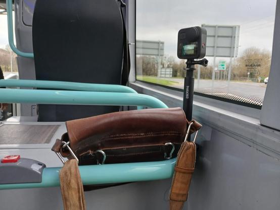
Whenever I use files containing OSM data, Im faced with two major
problems. These problems are inherent in the OSM data model and
inherited by the common file formats (, , ).
problems. These problems are inherent in the OSM data model and
inherited by the common file formats (, , ).
My personal enemy that I take so serious, is someone who edits an area on a map as “under construction” and then it SITS for longer than 6 months in that stage. In some cases people have been living in that neighborhood for 3 years…and it’s been marked as “under construction.” Here I am today fixing areas that are fully developed now, fully established- and the average of the construction edits were made 2 years ago. Here’s hoping doordash, my personal use favorite Strava, or even pokemon go run an update for those poor folks.
This is purely a diary rant about residential areas and their roads not being updated. I almost wish there was a way to make “under construction” just be something for an existing thing being updated/fixed, not something being built. We’re mapping what’s there to be mapped. I’d rather new developments or roads have like a “coming soon” tag of some sorts that wouldn’t block in app access.
We can use strava as an example, i’ll set a route and it’ll make me avoid an entire neighborhood because “Deleted User” 3 years ago marked these 7 streets near the lake trail as “under construction.” Took me a sad amount of time, admittedly, to realize what was happening. Another example is Niantic not having in game spawns (pikmin, pokemon, ingress) if an area is marked “under construction” because the game labels the area as dangerous, so why would they give server room to RNG spawn their in game items there? Reality though is Ash can and SHOULD be able to catch his Pikachu there because he’s been living there for 3 years- Niantic just doesn’t think it’s safe.
So, here’s my little rant about the amount if neighborhoods i fixed today that i have personally been to, biked through, walked my dog through, that have been “under construction” the last 28 months.

Apps that use OSM and their struggles with "construction areas"
My personal enemy that I take so serious, is someone who edits an area on a map as under construction and then it SITS for longer than 6 months in that stage.OpenStreetMap
I finally got back to mapping, after about 6 months of being inactive. I’m really happy!
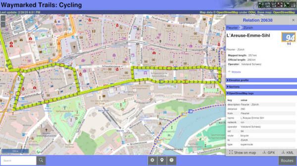
Ive just roled out some updates for waymarkedtrails, the website for browsing route relations. The most notable improvement is that waymarkedtrails is finally able to understand member roles in route relations.
OSM History Viewer and OSM Route Manager are two ancient tools that help visualising and analysing changesets and route relations.
Traili Map - Bike route planner that prioritizes official bike trails
I want better local information so here I am learning and updating Open Street Maps! (4 MAR 2025)
Introduction
This diary entry describes my current insights how best to map and tag pedestrian and bicycle crossings. The many words may make it seem complicated, but the actual tagging is designed for easy and direct tagging what you see on the road, with as little redundancy and required expertise as possible. As follows:
A simple unmarked, uncontrolled crossings is only an intersection nodes without any tags.
A simple zebra can be tagged with highway=crossing + crossing=zebra (or, equivalent highway=crossing + crossing:markings=zebra)
A simple crossing with other markings can be tagged with highway=crossing + crossing:markings=dots/dashes/lines/surface
If traffic lights control the crossing, add crossing:signals=yes
If there are special kerbs, add kerb=lowered/flush/…
If there is tactile paving, add tactile_paving=yes
If there is a crossing island, ad crossing:island=yes
If the crossing path goes uninterrupted over the road it crosses, so the road is interrupted rather than the crossing path, ad crossing:continous=yes
Scope:
- Footway crossing any higher order way, including cycleway and busway, excluding rail.
- Cycleway crossing any higher order way, including busway, excluding rail.
- Mentioned, but excluded: designated horse crossings.
- Mentioned, but excluded for now: how to map a crossing as a way.
- Mentioned, but excluded for now: detailed mapping of the operation of traffic signals.
Basic principles:
- Consider only nodes where a footway, path or cycleway intersects a higher order way, or would intersect if it is actually drawn as a way of its own.
- The intersection of two ways is already a crossing node, even without any tags. It gives the location and the fact that the ways cross, and type and access/designation tags from the crossing way apply to the crossing node.
- only add the highway=crossing tag and additional tags if there are actually attributes to tag, which do not follow (inherit) from the crossing way itself.
- Only tag positive attributes, not missing attributes, unless: a. the applicable default values in your country differ from world-wide defaults; b. the no indicates something generally unexoected, such as crossing=no on a loactoion that cannot be crossed.
- All existing crossing=* schemas are flawed and form a chaotic mix, leaving data users and other mappers to guess what was meant. I use only the additional tags to describe each additional attribute. A crossing= value may still be computed from the separately tagged attributes, for any of the previously used mixed schemes.
- For incremental mapping (start simple and add details later) crossing=zebra is acceptable as a stub for a zebra crossing. All the other crossing types have unclear meanings, because of historical differences in tagging schemes. Note that in some countries even crossing=zebra has been used systematically for non-zebra crossings!
Explanations of the basic principles
Ad 1. If a path, footway or cycleway is not actually drawn in OSM, you can still put a node on the way representing the place where the actual crossing is. In this case, it’s required to tag it highway=crossing., and prefaraby a tag to indicate how people see that it’s a crossing (crossing:markings=zebra/dots/dashes/lines/surface and/or crossing:signals=yes)
Ad 2. The intersection node of a footway with a higher order way is a pedestrian crossing with access foot=designated. If the footway is tagged with bicycle=yes and/or horse=no, the crossing is also foot=designated + bicycle=yes and/or horse=no. Explicit tagging of the node with the same information is redundant, unnecessary, because the information is already there.
Ad 3. Information which warrants explicit tagging of the crossing node is: markings, signal control, tactile_paving, special kerbs, presence of a (safe) crossing island, access or designation not present on the crossing way (or in absence of the crossing way).
Ad 4. Many crossings are tagged as e.g. highway=crossing + crossing=unmarked/uncontrolled + crossing:markings=no + crossing:signals=no + crossing:island=no + tactile_paving=no. The only information there (apart from being an intersection) is that someone some time did not see those attributes. While taht is useful workflow information for a mapathon, OSM generally stores what you can see, not what you can not see, and it’s up to data users to determine what to do if they want information which is not there. We should be clear in what we tag and how, so data users can apply logical defaults. Only if e.g. a national default is clearly differen from the OSM-wide default, it is sometimes wise to tag no, such as foot=yes on Dutch cycleways., because the recommended worldwide default for cycleways is foot=no. Tagging crossing=no on a location where seemingly a crossing is possible: an example is a point where separately mapped cycleways are linked from both sides to the centre line representing the road. This would suggest a crossing, but that is an artefact of using short link sections to make routing possible.
Ad 5. These special tags I often use:
- crossing:markings=zebra/dots/dashes/lines/surface /* road markings showing where to cross
- crossing:signals=yes /* the traffic over the crossing node is normally controlled by traffic lights
- crossing:island=yes /* the crossing has a traffic island, but the road has not been split around it.
- kerb=yes/lowered/flush/… /* The kerb type, important for the impaired pedestrian
- tactile_paving=yes /* presence of tactile paving to guide the visually impaired pedestrian over the crossing.
- crossing:continous=yes /* The crossing path goes uninterrupted over the crossed way; the crossed way is visually interrupted rather than the crossing path.
Tag what’s there, not what you would expect
Only tag positive values, where the expected default is no. However, for footways a kerb is to be expected, so kerb=yes on a foot crossing is redundant and kerb=no is special, to be tagged if it is seen.
bicycle=yes/designated?
In Nederland, bicycle=yes and bicycle=designated have been used a lot. I regard this as unnecessary for a bicycle crossing, because the crossing cycleway already contains that information. Only if a bicycle crossing has been mapped without a crossing way, an explicit bicycle=designated would be warranted; this is because crossings without the crossing way are usually pedestrian crossings.
Crossing node or crossing way?
I think it is acceptable to map both the node(s) and the way as crossing, but preferably tag the details on either the node OR the way, not on both at the same crossing. The exact geometry of a crossing can be mapped using the crossing way, adding way type and access as needed, possiby split into sections such as cycleway=crossing, footway=traffic_island and kerb nodes at the exact spot. My preference is to tag markings and traffic signals on crossing nodes, and to add a crossing node on every intersection node.
Example. Suppose we have a footway crossing a secondary road that has two separate ways for the directions, a traffic island in between, and separately mapped cycleways on both sides; and zebra markings from side to side; and traffic lights for pedestrians to cross the main road, but not the cycleways. There is tactile paving all along, and kerbs are lowered.
I would draw a highway=footway from side to side, crossing a cycleway, two halves of the secondary road, and again a cycleway. I would 1. tag the footway as highway=footway + footway=crossing. 2. tag the four intersection nodes as highway=crossing with crossing:markings=zebra + tactile paving=yes + kerb=lowered. 3. additionally tag the two footway/tertiary intersection nodes with crossing:signals=yes
Now this is intermediate level of detail mapping. Other mappers might just put crossing=zebra on the intersection nodes: low level of detail. High level of detail would be to add nodes for the exact postion of traffic lights and kerbs, splitting the footway into sections for approach, crossing and traffic_island, and e.g. tagging request buttons, sounds and vibrations.
Horse crossings
I don’t know any designated horse crossings in Nederland, although I am sure there are some. Since it would be a bridleway crossing a higher order road, I think the basics are the same as for cycleways and footways. There might be special markings, then we could simply add a value for crossing:markings. Where horses are allowed on footways, paths and cycleways, not even horse-yes would be needed. If they are -by exception- not allowed, add horse=no to the crossing footway/cycleway/path. I know that in several places high placed request buttons are present for horse riders. This is probably best tagged as a detail on the crossing nodes or on the highway=traffic_signals nodes. I don’t know an existing or proposed tag for this.
Blacksburg Square Dance Odd Fellows Lodge #20, 199 Wilson Avenue, Blacksburg, VA Homestead Farm, 5500 Homestead Rd, Riner, VA 24149

Virginia Square and Round Dance Locations
Blacksburg Square Dance Odd Fellows Lodge #20, 199 Wilson Avenue, Blacksburg, VA Homestead Farm, 5500 Homestead Rd, Riner, VA 24149OpenStreetMap
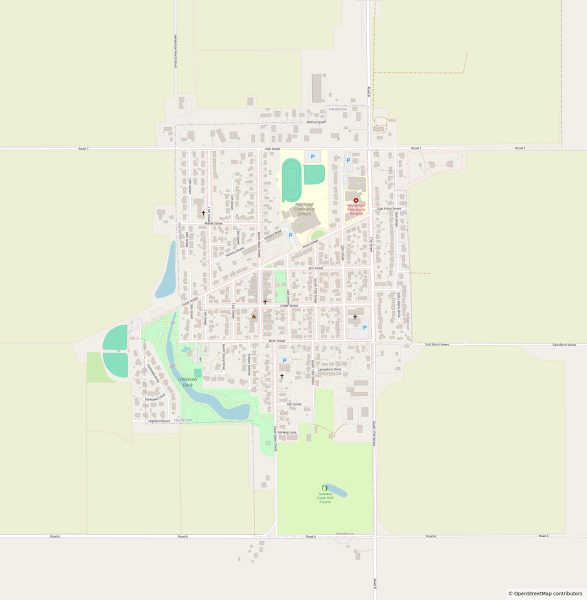
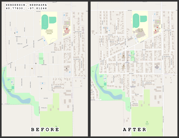
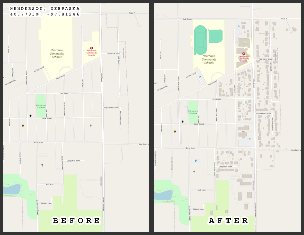
The latest updates from the town of Hernderson Nebraska. I believe i have around 90% of the buildings mapped. Once done, will move on to the sidewalks, parking lots, and other navigation details visible from the sky.
Nachdem ich OSM bisher nur passiv genutzt habe und mich inzwischen mehr ins Fediverse & Open-source einarbeite, möchte ich auch hier etwas beitragen. Erstmal geht es los mit kleinen Ergänzungen, Korrekturen und Infos zu Orten in meiner Nachbarschaft.
VG, c20
VG, c20
12 Fishpond Ter., Barnegat, NJ 08005
Started picking out small towns which have no detail, and started to add some details. This is Henderson, Nebraska. Currently trying to get all the buildings outlined.
I made another small analysis about the reviews made with MapComplete and Mangrove. You can read all about it here:
Added missing house names and numbers. Many similar and/or confusing addresses in Old Conna area.
Some of the readers may have experienced the sinking feeling when they just attempted to upload dozen if not 100s of changes and a network glitch resulted in the editor app failing the upload.
The Year 2021 was my most productive year in OpenStreetMap mapping. It was all downhill from there due to a variety of factors, highlighted by an abrupt career change that I never anticipated (COVID-19 pandemic did a lot of damage to everyone), and d…
View, edit, and create GPX files online with advanced route planning capabilities and file processing tools, beautiful maps and detailed data visualizations.
I used to enjoy making edits on OSM, but now it is so cluttered with every little detail in some areas that you can’t even zoom in to see anything but symbols. I don’t know how to cancel my username. Sorry folks, but I am outta here!
Na 8 bułeczek weźmisz: 250g mąki 7g drożdży pół łyżeczki soli 175g wody Potrzebujesz: miskę stolnice wałek do ciasta patelnie. którą ...
Siła Unii. Felieton Fryderyka Zolla.

Rozmowy między nową administracją USA a Moskwą są sygnałem alarmowym dla Europy. Nie wiadomo, kto zasiadł do stołu w Rijadzie: wrogowie, partnerzy czy sojusznicy. USA rezygnuje z bycia jednym z filarów Zachodu i jego wartości. W to miejsce wchodzi polityka opartą wyłącznie o mocarstwowe interesy. Nie ma tu sensu powtarzać szokujących wypowiedzi Trumpa, Vance’a, Muska czy innych członków amerykańskiej administracji.
Z punktu widzenia UE poważnym zagrożeniem jest fakt, że zarówno Moskwa jak i obecna administracja USA jest zainteresowana osłabieniem i zmarginalizowaniem UE. Trzeba pamiętać, że wojna w 2014 roku zaczęła się od Majdanu, czyli wielkiego europejskiego marzenia. Integracja Ukrainy z UE oznaczałaby w dłuższej perspektywie powstanie wielkiej potęgi. Powstaniem takiej siły – mocnej i zintegrowanej – nie są zainteresowane obecne Stany Zjednoczone i Moskwa. To bardzo niebezpieczna wspólnota interesu.
W egzystencjalnym interesie Polski jest silna Unia, wzmocniona Ukrainą. Konferencja Ambasadorów, Polska organizacja łącząca byłych polskich ambasadorów sformułowała plan wzmocnienia wojskowej integracji Europy jako Unii Obronnej. Integracja Europy i świadomość wspólnoty interesów jest teraz najważniejszym zadaniem Polski i polskiej racji stanu. Nie wolno dopuścić do rozgrywania przez USA i Moskwę poszczególnych państw europejskich przeciwko sobie.
Przychodzi też czas opowiedzenia się. Takie państwa jak Węgry i Słowacja będą musiały się określić. Obecny rozkrok jest na dłuższą metę nie do utrzymania. Musimy także wspierać Ukrainę i przeciwdziałać rodzącemu się w niej poczuciu osamotnienia.
Demokracja znalazła się w niebywałym kryzysie. Jej procedury przestały być odporne na manipulacje i zewnętrzne akty nowego rodzaju agresji. Nacisk USA i Moskwy na konieczność zorganizowania wyborów w Ukrainie wcale nie służy demokracji. Zabezpieczenie prawidłowości procesu wyborczego w Ukrainie jest teraz praktycznie niemożliwe. Tworzą się w ten sposób ryzyka o niekontrolowalnym potencjale, czego doświadczyliśmy w Rumunii i będziemy jeszcze doświadczać w poszczególnych unijnych państwach, w tym w Polsce. W Ukrainie niebezpieczeństwo zewnętrznego wpływu na wybory jest ogromne. To pole, na którym Moskwa ma ogromną przewagę.
Czekają nas trudne czasy. Odpowiedzią jest chuchanie i dmuchanie na Unię Europejską. Tylko mocna (także militarnie) Unia i jasny proces sprawnej integracji Ukrainy z UE dają nadzieję przyszłego bezpieczeństwa. Budując potężną Unię Europejską tworzymy realną gwarancję bezpieczeństwa na nowe czasy. Należy ściśle współpracować z Wielką Brytanią i Kanadą budując autonomiczne struktury bezpieczeństwa. USA pozostanie ważnym filarem Zachodu. Niemniej widać wyraźnie, że architektura bezpieczeństwa nie może spoczywać jedynie na USA. Do tego także dąży USA. Tu akurat mamy wspólnotę interesów. Ale musimy być samodzielnie dostatecznie silni jako Europa aby nikt nie mógł nas rozgrywać. Trzeba pamiętać, że gdyby Ukraina przegrała, Europa z tego się nie podniesie. Bądźmy tego świadomi.
Jakub Urbanowiczudostępnił to.
Imię dla dziewczynki. Felieton Adama Jaśkowa (201)
Nie wiemy jeszcze, jakie kształty miałaby teraz przyjąć deregulacja. Na razie ojciec chrzestny chwali się, że u niego w firmie nie ma związków zawodowych, a żaden kurier nie pracuje na etacie. Ameryka. A przynajmniej Amazon. A propos, swego czasu BBC twierdziła, że warunki pracy w magazynach Amazona przypominają obozy pracy przymusowej.
W Misiu Stanisława Barei najlepszym imieniem dla dziewczynki była Tradycja. Ta kultowa już fraza z filmu stała się przedmiotem wielu okazjonalnych wariacji i parafraz. Żyje życiem memicznym i będzie nim żyła aż do końca Internetu. Chciałbym dołączyć do grona parafrazujących i zaproponować niezwykle aktualne imię: Deregulacja. Brzmi dostojnie, wiele obiecuje. Jest na wielu ustach, znacznie częściej niż inne słowa, takie jak ojczyzna, rozsądek, sprawiedliwość czy dobrobyt. Wiem, że Rozsądek i Dobrobyt w języku polskim byłyby akurat imionami męskimi, no ale też coraz trudniej przypisać je konkretnym mężczyznom.
Wróćmy jednak do dziewczynek, czy raczej do kobiet, bo Deregulacja to zdecydowanie nie jest mała dziewczynka, mimo że zapewne z zapałkami albo nawet z napalmem. Imię to przyszło do Europy znad Zatoki Amerykańskiej, choć znane było nie od wczoraj. Po prostu wraca na nie moda.
Nie pamiętamy – być może nie chcemy pamiętać – że pierwszym polskim ojcem Deregulacji był Jarosław Gowin jako minister w rządzie Donalda T. Oczywiście Tjak Tuska, a nie T jak Trumpa. Minister deregulował zawody, wychodząc z założenia, że wszystkiego można się nauczyć, a rynek, czyli klienci, zweryfikują to, czego zawodowiec sam się nauczył. Czego Gowin nie zdążył zderegulować jako minister w rządzie PO, to starał się dokończyć w rządzie Zjednoczonej Prawicy. Tam przygotował ustawę o szkolnictwie wyższym, która zderegulowała uprawnienia senatów uczelnianych kosztem uprawnień rektora oraz tworu w postaci rady uczelni. Był to mały krok w kierunku prywatyzacji uczelni publicznych. Skorzystał na tym rektor Uniwersytetu Pedagogicznego w Krakowie, który chyba najlepiej odczytał intencje ustawodawcy. Reszta rektorów publicznych została nieco w tyle. Rozwinęły się za to uczelnie prywatne oparte na „humanistycznym” czy może „humanitarnym”, ale merkantylnym podejściu do studentów.
Nie udało się – niektórzy powiedzą, że na szczęście – uregulować statusu psychologa i psychoterapeuty, w związku z czym łatwiej na „psychoterapię” się dostać, ale trudniej z niej wyjść. Za to naczelny deregulator wyszedł z rządu Morawieckiego prosto na terapię.
Aktualnym ojcem chrzestnym polskiej Deregulacji został ojciec paczkomatów. Co ciekawe, narzeka on na konkurencję na tym rynku i dlatego chciałby opatentować i zastrzec sam termin paczkomat. A mógł przecież adoptować.
Nie wiemy jeszcze, jakie kształty miałaby teraz przyjąć deregulacja. Na razie ojciec chrzestny chwali się, że u niego w firmie nie ma związków zawodowych, a żaden kurier nie pracuje na etacie. Ameryka. A przynajmniej Amazon. A propos, swego czasu BBC twierdziła, że warunki pracy w magazynach Amazona przypominają obozy pracy przymusowej. W odpowiedzi Amazon przytoczył opinie ekspertów, że warunki pracy są odpowiednie, a bezpieczeństwo pracowników jest dla firmy najważniejsze. Oczywiście w firmie nie ma związków zawodowych. Gdyby Wiesław Kielar dożył tych czasów, potwierdziłby, że nie takie rzeczy da się przeżyć.
Stany Zjednoczone są liderem deregulacji od czasów Ronalda Reagana. Nie jest to oczywiście deregulacja ciągła, bo zdarzają się administracje jak ta Obamy czy nawet Bidena, które płyną trochę pod prąd.
Europa – Wielka Brytania, Niemcy, Francja, Włochy – też przeszła swoje deregulacje. Jakoś nie widać sukcesów. Wielka Brytania jest w największym kryzysie od czasów II wojny. I nie jest to efekt brexitu, bo brexit był efektem i zarazem największym sukcesem deregulacji. Ziszczonym marzeniem Żelaznej Damy.
Na co zmienić deregulację, o ile to jeszcze jest możliwe? A wydaje się możliwe, bo taka próba została podjęta w Wielkiej Brytanii. Keir Starmer, premier, jak mówią Brytyjczycy, o charyzmie dorsza z frytkami, zaproponował wielki plan inwestycji publicznych, budowę co najmniej 10 tysięcy domów wraz z niezbędną infrastrukturą komunalną. Docelowo do 2030 roku ma powstać 1,5 miliona mieszkań. Po prostu nowy plan pięcioletni. Brytania kontynuuje też budowę elektrowni jądrowych. Aktualnie budowane są dwie, a co pięć lat ma startować budowa kolejnej. Osobiście kibicuję Starmerowi, choć jest nudny jak pudding i ma za uszami brzydkie knucie w celu pozbycia się z partii swojego poprzednika. Mozolnie, nudnie i bez charyzmy Starmer próbuje uczynić Brytanię może nie wielką, ale zdatną do życia dla Brytyjczyków. Na kontynencie nikt dotąd nie myśli iść w jego ślady. Raczej jak zaklęcie przywołuje się imię św. Deregulacji i przymierza się bejsbolówki z napisem Great Again i metką Made in China.
2 użytkowników udostępniło to dalej
OSGEO Hokkaido team and SotM Japan team hosted the FOSS4G Hokkaido and State of the Map Japan 2024 in 15th February in Sapporo, Hokkaido.
Hi
I am a absolute beginner in use the open street map tool.
I want to import publicly available data, postcode, address etc into an open street map. How do I do that?
I am a absolute beginner in use the open street map tool.
I want to import publicly available data, postcode, address etc into an open street map. How do I do that?
This is cross-linked from my blog, posted on 11 July 2023
Discover the Milagrow Advantage: Innovation, Efficiency, and Cutting-Edge Technology for Home & Office
In today’s fast-paced world, where time is precious and convenience is key, having the right technology in your home or office can make all the dif…
In today’s fast-paced world, where time is precious and convenience is key, having the right technology in your home or office can make all the dif…
Some days ago, I searched online for a bus route that was supposed to be newly introduced to go from Kilkenny to New Ross. I didnt find it, but I found another one which pleased me even more which goes from Kilkenny to Fiddown ().
To follow along with this tutorial, please setup and configure a Oracle Cloud instance for mapillary tools. Please refer to this guide for instructions on how to accomplish this.
Install & Configure Oracle Cloud Infrastructure to upload Mapillary images from ARM processors
So I recently started working on adding the features of a local high school into a relations group, but after looking at the docs, I’m not sure I’ve properly understood when or how relations should be used. Could somebody help clarify this?
Well, I’ve just discovered that anybody can edit like it’s wikipedia. So instead of doing homework, I’ve spent several hours fixing little things in my hometown. This is fun.


